
Click on Zoning Map for a detailed zoning Map of Mount Gilead. You can use the link provided to download and print a Zoning Application. Download these ordinances as a PDF here.
Please find the Zoning Ordinances for Mount Gilead, North Carolina below.
ARTICLE 1. AUTHORITY AND PURPOSE
1.1 AUTHORITY.
These regulations are adopted pursuant to the authority vested in the Town of Mount Gilead by its charter, the Session laws, and the General Statutes of North Carolina, particularly Chapter 160D and any special local legislation enacted by the General Assembly for the Town of Mount Gilead.
1.2 PURPOSE.
The purposes of these regulations are to: promote the health, safety, morals, and general welfare of the community; to lessen congestion in the streets; to secure safety from fire, panic and other dangers; to provide adequate light and air; to prevent the overcrowding of land; to avoid undue concentration of population; to facilitate the adequate and economic provision of public facilities and infrastructure; to conserve the value of buildings; and to encourage the most appropriate use of land throughout the corporate area and extraterritorial zoning jurisdiction, in accordance with adopted plans and policies.
1.3 TITLE.
These regulations shall be known as the Zoning Ordinance of Mount Gilead, North Carolina, and may be cited as the “Zoning Ordinance”. The maps referred to herein titled Official Zoning Map, Mount Gilead, North Carolina may be cited as the “Zoning Map”.
1.4 JURSIDICTION.
These regulations govern the development of land and structures within the corporate limits and the extraterritorial zoning jurisdiction (ETJ) of the Town of Mount Gilead.
- For an extension of the ETJ, the Town shall provide mailed notice thirty (30) days prior to the ETJ Hearing. One hearing with a single mailed notice may be used for the ETJ extension and the initial zoning map amendment.
1.5 ZONING MAP.
The Board of Commissioners has adopted a Zoning Map entitled “Official Zoning Map, Town of Mount Gilead, NC” which is retained in the office of the Town Clerk. The Zoning Map sets out and delineates the zoning districts established in Article 4. The Zoning Map and notations thereon are hereby designated, established, and incorporated as a part of these regulations and shall be as much a part of these regulations as if they were fully described herein.
- Prior zoning maps will be kept and maintained for public inspection in either paper or digital formatting.
- Other local, state or federal maps incorporated by reference into the Official Zoning Map will be kept and maintained for public inspection in either paper or digital formatting.
- Copies of the zoning district map may be reproduced by any method of reproduction that gives legible and permanent copies and, when certified by the Town Clerk in accordance with G.S. 160A-79, shall be admissible into evidence and shall have the same force and effect as would the original map.
1.6 SEVERABILITY.
If any section, specific provision, or standard of these regulations, including any zoning district boundary that now exists or may exist in the future, is found by a court of competent jurisdiction to be invalid for any reason, the decision of the court shall not affect the validity of any other section, provision, standard, or district boundary of these regulations except the provision in question. The other portions of these regulations not affected by the decision of the court shall remain in full force and effect.
1.7 RELATION TO OTHER ORDINANCES.
If the provisions of this ordinance conflict with the provisions of any other validly enforceable ordinance(s), the most stringent provisions shall control.
1.8 EFFECTIVE DATE.
These regulations shall become effective upon the date of their adoption by the Board of Commissioners of the Town of Mount Gilead.
ARTICLE 2. APPLICABILITY AND INTERPRETATION OF ORDINANCE
2.1 APPLICABILITY.
No building, structure, or land shall be used, occupied, or altered; nor shall any building, structure, or part thereof be erected, constructed, reconstructed, moved, enlarged, or structurally altered; nor shall any changed use be established for any building, structure, or land, unless in conformity with the general provisions of this ordinance and the specific provisions for the district in which it is located, except as otherwise provided by these regulations.
2.2 VESTED DEVELOPMENT RIGHTS.
- In General. Any amendments, modifications, supplements, repeal or other changes in these regulations or the zoning maps shall not be applicable or enforceable without the consent of the owner with regard to buildings and uses:For which a building permit has been issued prior to the effective date of the ordinance making the change so long as the permit remains valid and unexpired pursuant to G.S. 160D-108(d)(1) and the building permit has not been revoked pursuant to G.S. 160D-1111; orFor which a zoning permit has been issued prior to the effective date of the ordinance making the change so long as the permit remains valid and unexpired pursuant to this article and G.S. 160D-108(d)(2); orFor which a vested right has been established and remains valid and unexpired pursuant to this section.Site-Specific Vesting Plan. A vested right to commence with a use of property according to a site-specific vesting plan shall be established upon approval of a development site plan, special use permit or conditional zoning district by the Town Board. The vested right thus established is subject to the terms and conditions of the site-specific vesting plan. Only those design elements shown on or made a part of the site-specific vesting plan or permit shall be vested.
The site-specific vesting plan shall at a minimum include the following:
- Approximate boundaries of the site;
- Significant topographical and other natural features affecting development of the site;
- The approximate location on the site of the proposed buildings, structures, and other improvements;
- The approximate dimensions, including height, of the proposed buildings and other structures; and
- The approximate location of all existing and proposed infrastructure on the site, including water, sewer, roads, and pedestrian walkways.
What constitutes a site-specific vesting plan shall be defined by the relevant development regulation, and the development approval that triggers vesting shall be so identified at the time of its approval. At a minimum, the regulation shall designate a vesting point earlier than the issuance of a building permit. A variance shall not constitute a site-specific vesting plan and approval of a site- specific vesting plan with the condition that a variance be obtained shall not confer a vested right unless and until the necessary variance is obtained. If a sketch plan or other document fails to describe with reasonable certainty the type and intensity of use for a specified parcel or parcels of property, it may not constitute a site-specific vesting plan.
- Term of a Vested Right. A right, which has been vested by the Town of Mount Gilead, shall remain vested for a period of three (3) years from date of approval. Modifications or amendments to an approved plan do not extend the period of vesting unless specifically so provided by the Town Board when it approves the modification or amendment. A vested right obtained under this sub-section is not a personal right, but shall attach to and run with the subject property. A right which has been vested under the provisions of this sub-section shall terminate at the end of the applicable vesting period with respect to buildings and uses for which no valid building permit has been issued except that:
- When a vested development plan has been at least 50% completed by the end of the vesting period, the project as a whole shall be given two (2) more years to complete development in conformance with the approved plan not to exceed a total vested period of five (5) years; and
- Prior to the vested right terminating at the end of the three (3) year period, the owner of the property may petition the Town Board for a one
(1) time two (2) year extension of the vested right not to exceed a total vested period of five (5) years. In its deliberations regarding the extension request, the Board may consider, among other things: a) the percentage of the project completed; b) a demonstration by the petitioner of good faith efforts made towards project completion; c) the reasons for the delay of project build-out; and d) the compatibility of the planned development with current town plans and the surrounding landscape. The Board may choose to extend the vested right for the entire project or only a portion of the project and may require one (1) or more design features shown on the plan or incorporated in the permit to meet the current code.
- Declaration of a vested right upon voluntary annexation. A petition for annexation filed with the Town under G.S. 160A-31 or G.S. 160A-58.1 shall contain a signed statement declaring whether or not any zoning vested right with respect to the properties subject to the petition has been established. A statement that declares that no development vested right has been established under G.S. 160D-108, or the failure to sign a statement declaring whether or not a development vested right has been established shall be binding on the landowner, and any such zoning vested right which may have existed shall be terminated.
- Multiphase Developments. A multiphase development shall be vested for the entire development with the zoning regulations, subdivision regulations, and other development ordinances in place at the time a site plan approval is granted for the initial phase of the multiphase development. This right shall remain vested for a period of seven (7) years from the time a site plan approval is granted for the initial phase of the multiphase development.
For purposes of this subsection, “multiphase development” means a development containing 100 acres or more that:
- Is submitted for site plan approval for construction to occur in more than one phase; and
- Is subject to a master development plan with committed elements, including a requirement to offer land for public use as a condition of its master development plan approval.
2.3 PERMIT CHOICE.
If an application made in accordance with this ordinance is submitted for a development approval required pursuant to this G.S. 160D and a development regulation changes between the time the application was submitted and a decision is made, the applicant may choose which version of the development regulation will apply to the application. If the development permit applicant chooses the version of the rule or ordinance applicable at the time of the permit application, the development permit applicant shall not be required to await the outcome of the amendment to the rule, map, or ordinance prior to acting on the development permit. This section applies to all development approvals issued by the Town. The duration of vested rights created by development approvals is as set forth in 2.2(C).
2.4 RULES OF CONSTRUCTION.
For the purposes of these regulations, the following rules of construction apply:
- Interpretations shall be guided by statements of intent.
- The term this ordinance shall refer to the Town of Mount Gilead Zoning Ordinance.
- The words shall, must, and will are mandatory, implying an obligation or duty to comply with the particular provision.
- The word may is permissive, except when the context of the particular use is negative, then it is mandatory (e.g., may not.).
- The word should, whether used in the positive or the negative, is a suggested guideline.
- References to days will always be construed to be business days, excluding weekends and holidays, unless the context of the language clearly indicates otherwise.
- For purposes of interpreting this ordinance, certain words, concepts, and ideas are defined in Appendix A except as defined herein, all other words used in this ordinance shall have their everyday dictionary definition.
- Words used in the present tense include the future tense, and words used in the future tense include the present tense.
- Words used in the singular number include the plural, and words used in the plural number include the singular.
- The word person includes a firm, association, organization, partnership, corporation, trust, and company, as well as an individual.
- The word lot includes the words plot, parcel or tract.
- The word building includes the words structure, and the word structure includes the word building.
- The words used or occupied as applied to any land or building shall be construed to include the words intended, arranged, or designed to be used or occupied.
- Words used in the masculine gender include the feminine gender.
- The word street includes the words road, avenue, place, way, drive, lane, boulevard, highway, and any other facility principally designed for motor vehicle traffic, except an alley or an easement solely for utilities or pedestrians.
- The term town board shall mean the Board of Commissioners of the Town of Mount Gilead, North Carolina.
- The term planning board shall mean the Planning and Zoning Board of the Town of Mount Gilead, North Carolina.
- The term zoning administrator shall mean the Zoning Administrator of the Town of Mount Gilead, North Carolina.
- The term subdivision administrator shall mean the Subdivision Administrator of the Town of Mount Gilead, North Carolina.
- The term mayor shall mean the Mayor of the Town of Mount Gilead, North Carolina.
- The term board of adjustment shall mean the Board of Adjustment of the Town of Mount Gilead, North Carolina.
- The term state shall mean the State of North Carolina.
- Any reference to an article shall mean an article of the Town of Mount Gilead Zoning Ordinance, unless otherwise specified.
2.4 INTERPRETATION.
- Zoning Boundaries. Where uncertainty exists as to the boundaries of any district shown on the official zoning map, the Zoning Administrator shall employ the following rules of interpretation.
- Where the zoning map shows a boundary line located within a street right-of-way, railroad or utility line right-of-way, easement or waterway, it shall be considered to be in the center of the right-of-way, easement or waterway. If the actual location of such right-of-way, easement or waterway varies slightly from the location as shown on the zoning map, then the actual location shall control.
- Where the zoning map shows a district boundary to approximately coincide with a property line or city, town or county border, the property line or border shall be considered to be the district boundary, unless otherwise indicated on.
- Where the zoning map shows a district boundary to not coincide or approximately coincide with any street, alley, railroad, waterway or property line, and no dimensions are shown, the location of the boundary shall be determined by use of the scale appearing on the zoning map.
- If, because of error or omission in the zoning map, any property within the jurisdiction of this ordinance is not shown as currently being in a zoning district, such property will be classified as R-15, until changed by amendment.
- Where district boundaries appear to be parallel to the centerline of streets, easements or rights-of-way, such district boundaries shall be construed to be parallel thereto and at such a distance therefrom as is indicated on the zoning map.
- The Zoning Administrator shall decide the exact location of zoning district boundary lines when a question arises concerning boundary lines shown on the zoning maps. This decision may be appealed to the zoning board of adjustment.
- Split tracts and fractional requirements. The Zoning Administrator shall employ the following rules with respect to split tracts and fractional requirements:
- Where a district boundary line divides a lot or tract in single ownership, the district requirements for the least restricted portion of such lot or tract shall be extended to apply to the whole, provided such extensions shall not include any part of a lot or tract more than thirty-five feet beyond the district boundary line. The term least restrictive shall refer to all zoning restrictions except lot or tract size.
- When any requirement of this ordinance results in a fraction of a dwelling unit or other measurement, that fraction will be disregarded and the nearest lower whole number shall apply.
- Where the zoning map shows a boundary line located within a street right-of-way, railroad or utility line right-of-way, easement or waterway, it shall be considered to be in the center of the right-of-way, easement or waterway. If the actual location of such right-of-way, easement or waterway varies slightly from the location as shown on the zoning map, then the actual location shall control.
- Whenever a density calculation for a legal lot of record results in less than one dwelling unit being permitted, one dwelling unit will be permitted subject to the remaining provisions of this ordinance.
(C) General rules of conflict.
- In the event of a conflict between the text of this article and any caption, figure, illustration, or table included herein, the text of this article shall control.
- In the event there is a conflict in limitations, requirements or standards applying to any individual use or structure, the more stringent or restrictive provision shall apply.
(D) Distance measurements.
Distance separations are required for many uses in this article. Unless otherwise specified, the following rules shall apply in determining such measurements:
- Where lot separation is required, measurements shall be made from lot line to lot line using the shortest straight-line distance between lots.
- Where separation between a building, structure, parking area, buffer, driveway or similar feature on a development site and any other feature on the same or abutting site is required or is part of a regulation contained herein, such separation shall be measured between the closest points on the feature using the shortest straight line distance between the two.
- Where separation between a building, structure, parking area, buffer, driveway or similar feature on a development site and any other feature on the same or abutting site is required or is part of a regulation contained herein, such separation shall be measured between the closest points on the feature using the shortest straight line distance between the two.
ARTICLE 3 NONCONFORMITIES.
- PURPOSE AND APPLICABILITY. The purpose of this article is to regulate and limit the continued existence of uses and structures that were established prior to the effective date of these regulations and that do not conform to these regulations. Any nonconformity created by a change in the text of these regulations or by the reclassification of property shall be regulated by the provisions of this chapter. The “effective date” referenced below shall be the date the text of these regulations or the zoning map is amended to render a particular use, structure, or lot nonconforming. Many nonconformities may continue, but the provisions of this article are designed to curtail substantial investment in nonconformities, and to bring about their eventual improvement or elimination.
3.2 NONCONFORMING USES.
- Nonconforming uses of land or structures may continue only in accordance with the provisions of this section.
- A nonconforming use shall not be expanded.
- A nonconforming use shall not be changed to any other use unless the new use conforms to the standards of the zoning district in which it is located. Once a nonconforming use is changed to a conforming use, a nonconforming use shall not be re-established.
- Where a nonconforming use is abandoned for a period of 180 days, then the use shall not be reestablished or resumed and any subsequent use of the land or structure shall conform to the requirements of these regulations.
- No structural changes shall be made in any structure occupied by a nonconforming use except as follows:
- Those structural changes ordered by an authorized official in order to insure the safety of the structure shall be permitted.
- Maintenance and repairs to keep a structure in sound condition shall be permitted.
- Structural changes necessary to convert the nonconforming use to a conforming use shall be permitted.
- An existing nonconforming residential structure may be enlarged or altered provided that no additional dwelling units result therefrom. Any such enlargement or alterations shall be in compliance with all yard requirements of the district and/or use.
- The structure and its accompanying use may be moved to another location on the lot so long as the structure meets all applicable requirements of the district.
3.3 NONCONFORMING STRUCTURES.
- A nonconforming structure, devoted to a use permitted in the zoning district in which it is located, may continue only in accordance with the provisions of this section.
- Normal repair and maintenance may be performed to allow the continuation of a nonconforming structure.
- Any nonconforming structure may be enlarged if the expansion does not increase the nonconformity.
- A nonconforming structure shall not be moved unless it thereafter conforms to the standards of the zoning district in which it is located.
- A nonconforming structure, destroyed or damaged so that more than 25% of the value of such structure remains, may be repaired or restored if a building permit for the repair or restoration is issued within six (6) months of the date of the damage. A nonconforming structure destroyed or damaged so that no more than 25% of its value remains, may be repaired or restored only if the structure conforms to the standards of these regulations for the zoning district in which it is located. The extent of damage or destruction shall be determined by comparing the estimated cost of repair or restoration with the current assessed tax value.
- A nonconforming structure shall not be replaced with another nonconforming structure regardless of the degree of nonconformity.
3.4 NONCONFORMING VACANT LOTS.
- Except as provided in section (B) below, a nonconforming vacant lot may be used for any of the uses permitted by these regulations in the zoning district in which it is located, provided that the use meets all yard, parking, and landscape requirements of this ordinance for the zoning district in which it is located.
- If two (2) or more adjacent, nonconforming, unimproved lots are held in single ownership, such lots shall be considered to be a single building lot for the purposes of this article. If the combination results in the creation of a building lot that is more than one and one-half (1-1/2) times the width and area required in the zoning district, then the two (2) lots may be legally re-subdivided into two (2) lots of equal width and area, both of which may be developed under the authority of section (A) above.
3.5 ADDITIONAL REQUIREMENTS FOR NONCONFORMING ACCESSORY USES AND STRUCTURES.
No nonconforming accessory use or accessory structure shall continue after the principal use or structure is terminated by abandonment, damage or destruction unless such accessory use or accessory structure thereafter is made to conform to the standards for the zoning district in which it is located.
3.6 NONCONFORMITIES ASSOCIATED WITH MANUFACTURED HOME PARKS.
- Nonconforming manufactured home parks may not be expanded or increased in size. Expansion shall include adding additional manufactured home spaces, additional manufactured housing units, additional land area, or additional support structures/amenities. Expansion shall not include any modification or expansion to utility systems to address public health or safety issues including notices of violation or correction issued by appropriate State agencies.
Expansion shall only be permitted with the park being brought into compliance with applicable standards, and issuance of all required permits required under, this Ordinance.
- Replacement of One Manufactured Home with Another Manufactured Home in an Established Manufactured Housing Park. Such replacement shall be permitted provided that:
- New dimensional nonconformities are not created in accordance with Section 9.50 of this Ordinance,
- The replacement manufactured home is constructed to the United States Department of Housing and Urban Development (HUD) standards,
- The replacement home is placed in the same location as the original home, and
- Such replacement occurs within 365 days of the removal of the original manufactured home. In all other situations, replacement shall be prohibited.
- Replacement of One Manufactured Home with Another Manufactured Home in Areas Other Than a Lawfully Established Manufactured Housing Park. Such replacement shall be permitted provided that:
- New dimensional nonconformities are not created,
- The replacement manufactured home is constructed to the United States Department of Housing and Urban Development (HUD) standards,
- The replacement home is placed in the same general location as the original home,
- The replacement home conforms to the development standards listed in Section 9.48 of this Ordinance, and
- Such replacement occurs within 365 days of the last day of occupancy of the original manufactured home. In instances where a replacement home exceeds the external dimensions of the original home, the external dimensions of the replacement home shall not be considered a non-conformity provided the home does not encroach into any required minimum yard other than such area of encroachment existing under the original home. In all other situations, replacement shall be prohibited.
- Temporary Use of Manufactured Housing. Nothing within this section shall be construed as regulating or restricting the temporary use of manufactured housing as defined within this Ordinance or regulated in accordance with the provisions of Section 9.49 of the Ordinance.
- New dimensional nonconformities are not created in accordance with Section 9.50 of this Ordinance,
- CHANGES OF TENANCY AND/OR OWNERSHIP. There may be a change in tenancy or ownership of an existing nonconforming use or structure, provided there is no change in the nature or character of such nonconforming use or structure except as provided herein and all other applicable requirements of this article are met (e.g., parking, screening, landscaping, etc.).
ARTICLE 4. ZONING DISTRICTS.
4.1 ZONING DISTRICTS ESTABLISHED.
- Types of Zoning Districts. All areas within the zoning jurisdiction of the Town of Mount Gilead are hereby divided into zoning districts within which the use of land and water areas; the location, height, bulk, appearance and use of structures; the provision of parking and loading areas; and the provision of buffers and screening areas are regulated as herein provided. Zoning districts within the Town of Mount Gilead fall within one of the following categories.
- General Use Zoning Districts. Each general use district category serves a different purpose and imposes its own set of requirements and restrictions on the use of land in addition to the general requirements and restrictions imposed on all land or uses within the zoning jurisdiction. A general use district may be layered with an overlay district, which is a special type of general use district.
(2) Conditional Zoning Districts.
- Most conditional districts are established as parallel or counterpart districts to a general use district. In such cases, references in the zoning ordinance to the general use district shall be construed to also include the counterpart conditional district. In addition, there are several districts which exist only as conditional districts and do not have counterpart general use districts.
- Each conditional district with a counterpart general use district is intended to accomplish the purposes of the counterpart district through the development of identified uses at a specific location in accordance with this article. All regulations and uses which apply to a general use district also apply to the counterpart conditional district, and no use shall be allowed in the conditional district that is not allowed in its counterpart general use district.
- Additional conditions which may be placed upon the development by the petitioner as part of the rezoning process shall be binding upon property within a conditional district in perpetuity or until the property is rezoned by the Town Board. Such conditions may include increased buffers, architectural features, access, parking, hours of operation, or any other feature of the development that is integral to meeting the spirit and intent of this ordinance or that serves to mitigate the impacts of the development on adjacent property or the community at large. Such conditions must be enforceable by the Town, presented by the petitioner during the hearing as part of the re-zoning petition, and agreed to by the Town Board during the re-zoning process.
- This is a voluntary procedure which is intended for firm development proposals. It is not intended or suited for securing early zoning for tentative or speculative proposals which may not be undertaken for some time.
- Overlay Districts. Overlay districts are established to provide for certain additional requirements, to permit uses not otherwise permitted in the underlying district, to prohibit uses allowed in the underlying district, or to establish special development requirements for uses permitted. Thus, where overlay districts exist and there is a conflict between the requirements and/or uses specified between the overlay and the underlying district, the standards of the overlay district shall prevail. Otherwise, the standards of the underlying district shall also be in effect for any area additionally zoned for an overlay district. A zoning map change either establishing or changing any overlay district shall be subject to the same procedures and requirements as any other zoning map change. In certain areas, two or more overlay districts may apply.
- Districts Named.
R-A & R-A-CD Residential Agricultural District
R-15 & R-15-CD Low/Moderate Density Single-Family Residential District
R-15M & R-15M-CD Low/Moderate Density Single-Family Residential District Manufactured Housing
R-8 & R-8-CD Medium Density Residential District
R-6 & R-6-CD High Density Residential District
OI & OI-CD Office Institutional District
CB & CK-CD Central Business District
GB & GB-CD General Business District
NB & NB-CD Neighborhood Business District
I & I-CD Industrial District
LD-CD Lakeside Development Conditional District
(C) Zoning District Boundary Interpretation.
- Where district boundaries are shown within a street right-of-way, railroad or utility line right-of-way, recorded easement, or navigable or non-navigable waterway, such boundaries shall be construed to be in the center of the right-of-way, easement, or waterway.
- Where district boundaries are so indicated that they approximately follow lot lines, or town, city, or county borders, such lines shall be construed to be said district boundaries, unless otherwise indicated.
- Where district boundaries are so indicated that they are approximately parallel to the centerlines of streets, highways, or railroads, or rights-of- way of same, such district boundaries shall be construed as being parallel thereto and at such distance therefrom as indicated on the zoning map. If no distance is shown, such distance shall be determined by use of the scale shown on the official Zoning Map.
- Where a district boundary line divides a single lot, each part of the lot shall be used in conformity with the standards established by these regulations for the district in which that part is located.
- If, because of error or omission in the official Zoning Map, any property within the jurisdiction of this ordinance is not shown as being in a zoning district, such property will be classified as R-15 – Low Density Single- Family Residential until changed by amendment.
- When a zoning case file contains detailed, verifiable information regarding the boundary, that information will be used as the correct boundary location.
4.2 GENERAL DISTRICTS.
- Permitted Uses. Uses permitted by right, uses with conditions, and uses permitted upon the issuance of a special use permit are listed in the TABLE OF PERMITTED USES in Section 4.5. This applies to all zoning districts unless otherwise noted.
(B) Dimensional Requirements and Supplemental Standards.
- All lots shall meet the minimum dimensional requirements shown in Section 4.4.
- Development density, amount and location of open space, arrangement of streets and lots, yard dimensions, and access to existing roads shall be controlled by the most recently approved subdivision plan (sketch, preliminary, or final). Any modifications to an approved subdivision plan shall maintain the density of the original plan.
(C) RESIDENTIAL AGRICULTURAL DISTRICT (R-A and R-A-CD)
The R-A Residential Agriculture District is intended to provide land for low density single-family residential and agricultural uses. The regulations of this district are intended to protect the agricultural sections of the community from an influx of uses likely to render them undesirable for farms and future development, and to ensure that residential developments dependent upon private wells and septic tank systems for sewage disposal will occur at sufficiently low densities to insure a healthful environment.
(D) LOW/MODERATE DENSITY SINGLE-FAMILY RESIDENTIAL DISTRICT (R-15 and R-15-CD)
The R-15 Low/Moderate Density Single-Family Residential District is primarily intended to provide land for low to moderate density single-family detached dwellings with an overall maximum density between two (2) and three (3) dwelling units per acre. Public facilities, including public water and sewer and public roads are generally available. Residential developments dependent upon septic tank systems for sewage disposal will occur at sufficiently low densities to insure a healthful environment.
- LOW/MODERATE DENSITY SINGLE-FAMILY RESIDENTIAL
MANUFACTURED HOUSING DISTRICT (R-15M and R-15M-CD)
The R-15M district is a comparable parallel district allowing for the development of Manufactured Housing units at established densities noted above. Allowable land uses, which include the aforementioned Manufactured Housing units, dimensional requirements, and development standards are consistent with all other standards associated with the general R-15 general use zoning district as established within this Ordinance.
(F) MEDIUM DENSITY RESIDENTIAL DISTRICT (R-8 and R-8-CD)
The R-8 Medium Density Residential District is intended to accommodate medium density residential development at a maximum density of five (5) dwelling units per acre. Types of residential development accommodated in the R-8 District may include single-family attached and detached dwellings in addition to multi-family structures. Public water and sewer, public roads, parks and other governmental support services are available. Uses which would negatively impact the residential nature of the district are discouraged.
(G) HIGH DENSITY RESIDENTIAL ZONING DISTRICT (R-6 and R-6-CD)
The R-6 High Density Residential Zoning District is primarily intended to accommodate residential uses such as single-family dwellings, two-family dwellings, multi-family residential buildings, and manufactured homes located within manufactured home parks at a maximum density of seven (7) dwelling units per acre. Public facilities, including public water and sewer, public roads, parks, and other governmental support services are available. Uses that would interfere with the residential nature of the district are strongly discouraged.
(H) OFFICE INSTITUTIONAL DISTRICT (O-I and O-I-CD)
The O-I Office and Institutional Districts established primarily for office and institutional uses which have only limited contact with the general public and which have no offensive noises, odors, smoke, fumes, or other objectionable conditions. As residences are permitted in this zone and as this zone is usually adjacent to residential districts, provisions are made for yards, off-street parking and off-street loading areas.
(I) CENTRAL BUSINESS DISTRICT (CB and CB-CD)
The CB Central Business District is intended to encourage high density, compact, urban development. The district is intended to accommodate a wide range of uses, including office, retail, service, and institutional development in a pedestrian-oriented setting. The district also accommodates high-density residential development. These uses may be mixed on the same tract of land or within the same structure.
(J) GENERAL BUSINESS DISTRICT (G-B and G-B-CD)
The GB General Business District is established to provide locations for retail, service and distributive establishments which require high visibility and good road access, or which cater primarily to passing motorists. Because these zones are generally located adjacent to main thoroughfares where they are subject to public view, they should provide an appropriate appearance, ample parking, and suitable landscaping.
(K) NEIGHBORHOOD BUSINESS DISTRICT (N-B and N-B-CD)
The NB Neighborhood Business District is established as a zone in which the principal use of land is for commercial and service uses to serve the surrounding residential zones and in which traffic and parking congestion can be reduced to a minimum in order to preserve the residential character of the surrounding residential zones. Residential, heavy commercial and industrial uses of land and other uses of land which would substantially interfere with the development or continuation of the commercial uses in the zone are prohibited. Uses, which due to their character or size, would interfere with the use of land in the district as a shopping and service center for the surrounding residential zones are discouraged.
(L) INDUSTRIAL DISTRICT (I and I-CD)
The I Industrial District’s purpose is to promote and protect both the existing industrial activities and potential sites where urban services are available and which are considered suitable for continued or future industrial use. Uses of land which would substantially interfere with the continuation of industrial uses permitted in the district are prohibited. The operation of well-planned and well- maintained industrial facilities which can be operated in a relatively clean and quiet manner and which will not be obnoxious or have significant negative effects to adjacent residential or business properties is promoted.
(M) LAKESIDE DEVELOPMENT CONDITIONAL DISTRICT (LD-CD)
The LD-CD Lakeside Development Conditional District is intended to provide an appropriate location for a mixture of lake-oriented businesses, public and semi- public recreational opportunities and residential uses. Properties appropriate for rezoning to LD-CD shall be located within 2,000 feet of Lake Tillery. Uses may be mixed on the same tract of land or within the same structure and shall be designed to complement surrounding land uses through appropriate screening, buffers, and landscaping.
(1) Permitted Uses.
Uses permitted shall be those listed on the applicant’s rezoning application for Lakeside Development and approved by the Town Board and shall be selected from the uses listed in the TABLE OF PERMITTED USES in Section 4.5.
4.3 OVERLAY DISTRICTS.
- HISTORIC OVERLAY DISTRICT (H-O)
(1) Intent.
The purpose of the H-O Historic Overlay District is to protect the social, cultural, and historical character of the districts and the property and buildings located therein by providing policies, procedures, and standards that govern the alteration, restoration, and demolition of buildings located in the district.
(2) Permitted Uses.
Uses permitted by right, uses with conditions, and uses permitted upon the issuance of a special use permit are the same as those listed in the TABLE OF PERMITTED USES in Section 4.5 for the underlying or base zoning district.
(3) Dimensional Requirements and Supplemental Standards.
- All new development activities and subdivisions of land shall meet the provisions of this article and the procedures for review and approval outlined in Article 12 – Historic District Regulations when located in the Historic Overlay district.
- The Historic Overlay district regulations shall apply to land use activities within the Historic Overlay District as shown on the Zoning Map.
4.4 DIMENSIONAL REQUIREMENTS.
Table 1. General Requirements for Residential Development
| Districts | Minimum Lot Area in square feet | Required Additional Lot Area per additional dwelling unit (in sq. ft.) | Minimum Lot Width (in ft.) | Required Front Setback (in ft.) | Required Side Setback (in ft.) | Required Rear Setback (in ft.) | Maximum Building Height (in ft.) |
| R-A | 40,0003 | 4 | 1001 | 40 | 15² | 30 | 35 |
| R-15 and R-15M | 15,000/20,0003 | 4 | 1001 | 35 | 12² | 30 | 35 |
| R-8 | 8,000/20,0003 | 5 | 801 | 35 | 12² | 12 | 35 |
| R-6 | 6,000/20,0003 | 5 | 601 | 25 | 12² | 25 | 35 |
| OI | 6,000/20,0003 | 5 | 60 | 25 | 102 | 25 | 35 |
| CB | 6,000 | 5 | 25 | – | – | – | – |
| GB | – | – | – | – | – | – | – |
| NB | – | – | – | – | – | – | – |
| I | – | – | – | – | – | – | – |
| LD-CD | 20,000 | – | 6 | 6 | 6 | 6 | 6 |
1 Additional 15 feet of lot width required for each additional dwelling unit in the principal structure.
2 An additional 10 feet is required if the property is located on a corner.
3 All minimum square footage requirements may be increased as necessary by the Montgomery County Health Department
4 Primary residences with accessory dwelling units shall be required to have 150 percent of the minimum lot area required for one (1) dwelling unit.
5 Lots containing accessory dwelling units shall have an additional 2,000 square feet of lot area in excess of the minimum lot area required for one dwelling unit. Lots with multi-family dwelling units shall provide an additional 3,000 square feet of lot area for each unit above one (1).
6 To be determined through conditional zoning process.
Table 2. General Requirements for Non-Residential Development
¹ 10 foot side yard is required if property is located adjacent to a residential zoning district. ² An additional 10 feet is required if the lot is located on a corner.
³ Maximum building height may be increased above that specified, provided that one (1) additional foot of required front, side and rear setback is supplied for each two (2) feet or fraction thereof above the specified maximum height.
4 All minimum square footage requirements may be increased as necessary by the Montgomery County Health Department.
5 When a lot abuts a residentially zoned lot, the abutting side or rear yard shall be at least 15 feet measured from the corresponding property line.
6 When a lot abuts a residentially zoned lot the abutting rear yard shall be at least 25 feet measured from the rear property line.
7 Off street parking is not permitted in this area.
8 Lots abutting a residentially zoned lot shall have at least a 25 foot side yard measured from the side property line.
9 Developed area (Areas with buildings, paving, gravel or other impervious surfaces) shall not exceed 30% of total lot area.
10 To be determined through conditional zoning process.
4.5 TABLE OF PERMITTED USES.
The following table lists uses permitted in each zoning district by 1) issuance of a zoning permit from the Zoning Administrator with or without conditions, and 2) issuance of a special use permit (abbreviated SUP in the legend at the top of the table) from the Board of Commissioners. The table also denotes which districts certain uses are not permitted and where the uses permitted within an overlay district are determined by the uses permitted in the underlying district. For the purposes of interpreting the table, the zoning districts are abbreviated as listed in 4.1 (B) and are repeated as follows:
R-A & R-A-CD Residential Agricultural District
R-15 & R-15-CD Low/Moderate Density Single-Family Residential District
R-15M & R-15M-CD Low/Moderate Density Single-Family Residential District
Manufactured Housing
R-8 & R-8-CD Medium Density Residential District
R-6 & R-6-CD High Density Residential District
OI & OI-CD Office Institutional District
CB & CB-CD Central Business District
GB & GB-CD General Business District
NB & NB-CD Neighborhood Business District
I & I-CD Industrial District
LD-CD Lakeside Development Conditional District
Interpreting Permitted Uses. If a use is not specifically listed in any of the districts listed in this Ordinance, then the Town Zoning Administrator shall have the authority to interpret in which district, if any, the use shall be permitted. In determining if a use is permitted, the Zoning Administrator shall consider which category of expressed uses most closely matches the use proposed and apply the regulations pertaining to that category to the proposed use. In determining the use which most closely matches the proposed use, the Zoning Administrator shall consider the density and intensity of the use, and anticipated traffic, noise, light, and odor on adjacent properties. If requested, the applicant shall submit evidence to the Zoning Administrator of the anticipated traffic, noise, light, or odor of the proposed use. Reports prepared by the applicable professional trade may be required (i.e. transportation engineer, environmental scientist, etc.).
Such interpretation shall be provided in writing to the property owner and subject to appeal by the Board of Adjustment.
ARTICLE 5 GENERAL REGULATIONS
5.1 CONFORMITY REQUIRED.
No person may occupy, or sell any land, structure, or building or authorize or allow the use, occupancy, or sale of any land, structure, or building under his control except in accordance with all of the applicable provisions of this article. For the purposes of this section, the use or occupancy of structures and buildings shall relate to anything and everything that is done to, on, or in the land, structures, or buildings.
5.2 STREET FRONTAGE REQUIRED.
Any lot on which any building (or buildings) is to be erected or used is to be established shall abut a public street with the following exceptions:
- Any lot for which a residential use has been legally established prior to the effective date of this ordinance in accordance with provisions permitting establishment of use on a lot served by a private and exclusive recorded easement of at least 15 feet in width connecting said lot to a public street, may be used as if it abutted a public street, provided that it is served by a driveway located on said easement.
- Any lot for which a non-residential use has been legally established prior to the effective date of this ordinance in accordance with provisions permitting establishment of use on a lot served by a private and exclusive recorded easement of at least 15 feet in width connecting said lot to a public street, may be used in the same manner as a lot abutting a public street, provided that it is served by a driveway built to appropriate standards located on the permanent, recorded easement.
- A development site consisting of one or more legal lots of record which is developed under a coordinated, approved site specific plan and which is accessed solely by driveways shall only be required to abut a public street along some portion of the development site the minimum distance of which shall be determined by the Town to be adequate for public and emergency vehicle access but which shall not be less than 35 feet.
- A multi-family, townhouse, condominium, or industrial development site consisting of one or more legal lots of record which is developed under a coordinated, approved site specific plan may be permitted, on a case by case basis, to be served by a private street network with streets designed and built to NC Department of Transportation standards and specifications and shall only be required to abut a public street along some portion of the development site the minimum distance of which shall be determined by the Town to be adequate for public and emergency vehicle access but which shall not be less than 35 feet.
- Flag lots and zero frontage lots shall be permitted in the R-A and I districts provided all the design standards of Section 6.3 (A) (Lot Size and Configuration) are met.
5.3 ONE PRINCIPAL BUILDING PER LOT; EXCEPTIONS.
Only one (1) principal building and its customary accessory building(s) may be erected on any lot, except that multiple buildings may be erected on a single lot as permitted by use and district regulations.
5.4 LOT SIZE.
No building lot (development site), even though it may consist of one (1) or more adjacent lots of record, shall be reduced in size such that the requirements for building and lot type cannot be met, or the performance standards for spacing of structures, building mass and scale, and street frontage relationships cannot be respected. This prohibition shall not be construed to prevent the purchase, dedication, or condemnation of narrow strips of land for public utilities or street or sidewalk right-of-way purposes.
5.5 YARD DESIGNATION.
- On lots which abut more than one (1) street, the front of the lot shall be parallel to the more prominent street. Exceptions may be made to this rule by the Zoning Administrator based upon the arrangement of existing and proposed streets and drives and the orientation of buildings on adjoining lots. Where neither street is more prominent than the other, the Zoning Administrator shall decide which street shall be the front based upon these same criteria.
- Where multiple buildings are permitted on a single lot of record, each building shall generally front upon a street, either external or internal to the development; side and rear yard designations shall be determined on the basis of building orientation.
- On irregularly shaped lots, the location of required front, side, and rear yards will be determined by the Zoning Administrator. The determination will be based on the spirit and intent of this ordinance to achieve an appropriate spacing of buildings and orientation to the street(s).
5.6 MEASURING SETBACKS ON REGULAR LOTS.
- Setbacks Adjacent to Streets, however termed (front, side or rear), shall be measured as follows: a straight line shall be drawn between the two points at which lot lines for the portion of the lot involved intersect street lines. Where property corners are rounded, such points shall be plotted by projecting the lot lines to the point where they would have met without rounding. Depth of required setbacks adjacent to public streets shall be measured perpendicular to such straight lines, and the inner line of such required setbacks shall be parallel to the outer line.
- Front Setbacks on Regular Lots are open spaces extending across the frontage of the lot between side lot lines. Depth of required front setbacks shall be measured as indicated under setbacks adjacent to streets, above.
- Interior Setbacks on Regular Lots are all setbacks other than those adjacent to streets.
- Rear Setbacks on Regular Lots are open spaces extending across the full width of the lots at the rear, between side lot lines. Corner and through lots will have no rear setbacks, but only front and side setbacks. For most lots, depth of a rear setback shall be measured perpendicular to the lot line, so that the required setback is a trip of the minimum depth prescribed by district regulations. However, in the case of lots whose rear lines intersect in the general form of an angle pointing away from the street, the required rear setback shall be construed as running between the apex of the angle and a line parallel to the rear line of the required front setback, and at the distance prescribed for a rear setback from the apex of the angle. Adjacent to the remainder of such lot lines, side setback requirements shall apply.
- Side Setbacks on Regular Lots are setbacks running from the rear line of the front setback to the front line of the rear setback. Depth of side setbacks shall be measured perpendicular to the side lot line, so that the required setback is a strip of the minimum depth prescribed by district regulations.
5.7 THROUGH LOTS.
If both the front and rear yards of a lot abut public streets, then the rear building line shall respect the alignment of buildings on the back street while the front building line shall respect the alignment of buildings on the fronting street.
5.8 MINIMUM LOT WIDTH REQUIREMENT.
The minimum lot width shall be measured at the required building setback (front yard setback) line. The building setback line is established for each zoning district as shown in Section 4.4, except that the building setback line for cul-de-sac lots may be set back an additional 20 feet for the purposes of meeting minimum lot width requirements.
5.9 HEIGHT LIMITATION EXCEPTIONS.
- The height limitations of this section shall not apply to steeples, flagpoles, chimneys, water tanks, public utility poles and lines, skylights, roof structures for elevators, stairways, tanks, heating, ventilation and air conditioning equipment, or similar equipment for the operation and maintenance of a building, and any device used to screen such structures and equipment.
- Telecommunications towers, where permitted, may exceed the height limit for structures when erected in accordance with this Ordinance.
- When adjacent to a lot or lots located in a residential district, any part of a non- residential structure that extends above the height limit shall, at a minimum, be separated from adjacent residential lots by a distance equal to its height measured from the ground.
5.10 STRUCTURES AND USES LIMITED IN YARDS.
- No principal building or structure shall be located within any required setback or yard.
- No principal building or structure shall be located within any required buffer or required planting yard.
- Architectural Features. Certain architectural features such as cornices, eaves and gutters may project three (3) feet into the required front yard, five (5) feet into the required rear yard and two (2) feet into the required side yard.
- Balconies, Porches, Fire Escapes, Awnings. An unenclosed balcony or porch, fire escape or metal awning may project into the required front yard or required rear yard for a distance not to exceed ten (10) feet, or into the required side yard for a distance not to exceed three (3) feet; however, a porch which is screen or glass enclosed shall be considered an enclosed porch. An enclosed vestibule, containing not more than 40 square feet, may project into the required front open yard for a distance not to exceed four (4) feet.
- Permitted fences and walls, security gates, paths, walkways, mailboxes, utility poles, lighting fixtures, patios at grade, and similar features may be located in a required yard, so long as the sight triangle on corner lots is protected.
- Permitted signs may be located in an established front or side yard abutting a public street.
5.11 ACCESSORY STRUCTURES AND USES.
Minor uses or structures which are necessary to the operation or enjoyment of a permitted principal use, and are appropriate, incidental and subordinate to any such uses, shall be permitted in all districts with certain exceptions as described herein as an accessory use, subject to the following:
- In no event shall “accessory use” or “accessory structure” be construed to authorize a use or structure not otherwise permitted in the district in which the principal use is located.
- Accessory uses or structures and well houses shall be located no closer than 15 feet to any side or rear lot line. Well houses shall be allowed in any yard. Detached garages may be located in any non-required side or rear yard and must comply with all setback requirements of principal structures for that district.
- In any residential district or on any lot containing a principal residential use, no accessory use or structure shall be permitted that involves or requires any construction features, which are not residential in nature or character. Accessory uses shall be located on the same lot as the principal use.
- Accessory structures shall not exceed the height of the principal building.
- An accessory building shall not exceed seventy-five (75%) of the gross floor area of the principal building.
- Roofed accessory structures physically attached or connected to the principal building shall be considered a part of the principal building and shall be subject to the setback requirements for the principal building.
- The following activities are specifically regarded as accessory to residential principal uses so long as they satisfy the general criteria set forth above:
- Offices or studios within an enclosed building and used by an occupant of a residence located on the same lot as such building to carry on administrative or artistic activities of a commercial nature, so long as such activities do not fall within the definition of a home occupation.
- Hobbies or recreational activities of a non-commercial nature.
- Yard sales or garage sales, so long as such sales are not conducted on the same lot for more than three days (whether consecutive or not) during any 90-day period.
- Without limiting the generality of the foregoing, the sale of agricultural products (either in a “roadside stand” or on a “pick your own” basis) from property where such products were grown or from land that is all part of the same farm or farming operation as the land where such products were grown shall be regarded as accessory to an agricultural operation.
- Petroleum storage, accessory to a permitted principal use or building is permitted.
5.12 VISIBILITY AT INTERSECTIONS IN RESIDENTIAL DISTRICTS.
On a corner lot in any residential zoning district, nothing shall be erected, placed, planted or allowed to grow in such a manner as to impede materially vision between a height of three (3) and ten (10) feet above the center-line grades of the intersecting streets in the area bounded by the street lines of such corner lots and a line joining points along said street lines, 35 feet from the point of the intersection of the street lines.
5.13 BUILDING SEPARATION.
All detached principal structures in all districts shall preserve a minimum building separation of ten (10) feet. The requirement of the district or the existing pattern of building spacing along a street may require a greater separation or the provision of specified side yards.
5.14 NOISE.
Every use of land must be conducted in such a manner that regularly recurring noises are not disturbing or loud and do not cause injury, detriment, or nuisance to any person of ordinary sensitivities, as measured at the property line.
5.15 VIBRATION.
No equipment in any district shall operate in such a fashion that any inherent or recurring ground vibrations can be felt or detected at the property line without the use of instruments.
5.16 RESTORING UNSAFE BUILDINGS.
Nothing in these regulations shall prevent the strengthening or restoring to a safe condition of any part of any building or structure declared unsafe by lawful order.
5.17 SWIMMING POOLS.
Swimming pools located on any site, including single-family residential sites, shall be:
- Located in a side or rear yard only.
- Located a minimum of 20 feet from any property line.
- Completely enclosed by a fence or wall no less than four (4) feet and no more than eight (8) feet in height above grade as measured on the side of the fence or wall which faces away from the swimming pool. This fence or wall shall enclose the pool itself and may include any other additional portions of the lot. All fence or wall openings into the pool area shall be equipped with a gate that opens outward away from the pool and be self-closing and have a self-latching device.
ARTICLE 6 DESIGN STANDARDS
6.1 PURPOSE AND APPLICABILITY.
This section is intended to insure that new development, renovations, and reconstructions are designed, sized, and sited to complement the area in which they are located and the character of the town in general; and to minimize traffic hazards and situations which endanger public safety; and to protect existing development and property values through the promotion of high standards of design and compatibility; and to provide for a high quality of life for our citizens.
- DESIGN STANDARDS FOR BUILDINGS.
| A. Building Presentation. | DISTRICTS | ||||||||||
| In order to have buildings that successfully address public streets and public places, the following standards shall apply to all buildings, unless otherwise noted | R-A | R-15/R15M | R-8 | R-6 | O-I | CB | GB | NB | I | LD-CD | |
| “X” means the standard is required. “-“ means the standard is not required. “U” means that standards in the underlying district prevail. | |||||||||||
| (1) | Building facades shall be substantially parallel to the front property line except that: Corner buildings may be oriented to address the corner, andBuildings interior to a development site may be arranged to front a common courtyard, parking area, driveway, or private street. | X | X | X | X | X | X | X | X | – | X |
| (2) | All development sites shall front public streets. | – | – | – | – | – | – | – | – | – | X |
| (3) | Any side of a non-residential building that is not intended to serve the public shall be screened from public view and the view of adjacent properties to the extent that all loading, storage, solid waste, maintenance equipment (brooms, mops, buckets, etc.) and similar items are not visible to the public. | – | – | – | – | X | – | X | X | – | X |
| (4) | Any side of a building that faces an arterial or collector street shall be treated as a building façade. | – | – | – | – | X | X | X | X | – | X |
- DESIGN STANDARDS FOR LOTS
| A. Lot Size and Configuration. | DISTRICTS | ||||||||||
| The following standards shall apply to all lots, unless otherwise noted. | R-A | R-15/R15M | R-8 | R-6 | O-I | CB | GB | NB | I | LD-CD | |
| “X” means the standard is required. “-“ means the standard is not required. “U” means that standards in the underlying district prevail. | |||||||||||
| (1) | Flag lots and zero frontage lots shall be permitted within single family subdivisions and industrial parks, including all phases, serving not more than two lots where a shared driveway or private street provides access as long as: The building numbers served by the driveway/street are posted next to the public street and again where access to individual lots intersects the shared driveway/street, andA legally binding shared driveway an/or private street use and maintenance agreement is filed at the Register of Deeds of Montgomery County, andThe shared driveway or private road is shown, along with all appropriate and necessary easements, on a recorded plat and a note is attached thereto stipulating the use of the driveway and referencing any recorded agreements. | X | – | – | – | – | – | – | – | X | – |
| (2) | Flag lots and zero frontage lots shall be permitted to serve above ground utility sites. | X | X | X | X | X | X | X | X | X | X |
| (3) | All new lots shall meet the dimensional requirements listed in section 4.4 | X | X | X | X | X | X | X | X | X | X |
| B. Access. | DISTRICTS | ||||||||||
| The intent of these standards is to promote safe, convenient, and sufficient access to all properties by vehicles, pedestrians, and bicyclists. The following standards shall apply to all uses, unless otherwise noted | R-A | R-15/R15M | R-8 | R-6 | O-I | CB | GB | NB | I | LD-CD | |
| “X” means the standard is required. “-“ means the standard is not required. “U” means that standards in the underlying district prevail. | |||||||||||
| (1) | All vehicular access to a development containing multiple destinations (e.g. strip shopping centers, multiple building developments, etc.) shall be provided by means of a shared driveway, side street, or frontage road. (This standard shall not apply to industrial buildings in the I district.) | – | – | – | – | X | X | X | X | – | X |
| (2) | The approaches to loading and unloading areas in business districts and commercial uses in the industrial districts shall be designed to minimize conflict with onsite vehicular, pedestrian, and bicycle traffic and with adjacent residential uses. | – | – | – | – | X | X | X | X | – | – |
| (3) | Buildings with uses requiring public access shall provide the primary pedestrian access from the street front. | – | – | – | – | X | X | X | X | – | X |
| (4) | At least one (1) driveway or other vehicular link shall be provided between adjacent mixed use and commercial properties, such as shops and offices that require public access. | – | – | – | – | X | – | X | X | – | – |
| “X” means the standard is required. “-“ means the standard is not required. “U” means that standards in the underlying district prevail. | R-A | R-15/R15M | R-8 | R-6 | O-I | CB | GB | NB | I | LD-CD | |
| (5) | Whenever practicable, driveways shall be aligned with driveways on the opposite side of the public street. | – | – | – | – | X | – | X | X | X | X |
| (6) | Shared driveways are strongly encouraged and shall be used when practicable. | – | – | – | – | X | – | X | X | X | X |
| (7) | A multi-family, townhouse, commercial, or industrial development site consisting of one (1) or more legal lots of record which is developed under a coordinated, approved site specific plan may be permitted, on a case by case basis, to be served by a private street network and shall only be required to abut a public street along some portion of the development site the minimum distance of which shall be determined by the town to be adequate for public and emergency vehicle access but which shall not be less than 35 feet. | X | X | X | X | – | – | X | – | X | X |
- DESIGN STANDARDS FOR PARKING AND LOADING AND UNLOADING AREAS.
In order to have safe, well-designed parking areas that successfully accommodate the pedestrian and are subordinate in design and appearance to adjacent buildings, the following standards apply to all accessory and principle use parking lots in all districts unless otherwise noted.
| A. General. | DISTRICTS | ||||||||||
| R-A | R-15/R15M | R-8 | R-6 | O-I | CB | GB | NB | I | LD-CD | ||
| “X” means the standard is required. “-“ means the standard is not required. “U” means that standards in the underlying district prevail. | |||||||||||
| (1) | Off-street parking spaces shall be increased when a change of use of either a structure or of land requires additional parking spaces in compliance with this section. Parking spaces may be decreased when a change of use in either a structure or of land requires fewer spaces than provided for the replaced use. | X | X | X | X | X | X | X | X | X | – |
| (2) | A certificate of occupancy will not be issued for any use until all-street parking and loading requirements in accordance with this ordinance have been met and are in place and ready for use. | X | X | X | X | X | – | X | X | X | – |
| (3) | A one-time enlargement of a structure or increase in the amount of land used may be made for existing uses deficient in off-street parking, provided that the enlargement or increase does not represent a requirement in excess of five (5) off-street parking spaces. In the event that such increase represents a requirement in excess of five (5) off- street parking spaces, such increase shall require complete compliance with the provisions of this section for the entire use. | X | X | X | X | X | – | X | X | X | – |
| B. Location. | DISTRICTS | ||||||||||
| “X” means the standard is required. “-“ means the standard is not required. “U” means that standards in the underlying district prevail. | R-A | R-15/R15M | R-8 | R-6 | O-I | CB | GB | NB | I | LD-CD | |
| (1) | Off-street parking spaces shall be provided on the same lot as the principal use except as noted in (2) below. Driveways shall be considered as providing off-street parking spaces for all single-family dwellings. | X | X | X | X | X | – | X | X | X | X |
| (2) | Cooperative provisions for off-street parking may be made by contract between owners of adjacent property, and any such contract shall be filed with the Zoning Administrator. The parking area provided on any one lot may be reduced to not less than one-half (1/2) the parking spaces required for the use occupying such lot. The total number of spaces provided under such a cooperative parking scheme shall not be less than the total number of spaces required for each use individually. | X | X | X | X | X | – | X | X | X | X |
| (3) | No parking area shall be located over an active septic tank field. | X | X | X | X | X | X | X | X | X | X |
| (4) | In residential areas, the temporary parking or storage of manufactured homes shall be prohibited. Boats, motor homes and camping trailers may, however, be stored or temporarily parked in residential districts; consistent with any more restrictive subdivision covenants. No more than one (1) inoperative, unlicensed and unregistered motor vehicle per dwelling unit may be stored outdoors, and shall be parked behind the residence, and screened from the public right-of-way and shall also satisfy any more restrictive covenants that may exist. | X | X | X | X | – | – | – | – | – | – |
| C. Connectivity. | DISTRICTS | ||||||||||
| “X” means the standard is required. “-“ means the standard is not required. “U” means that standards in the underlying district prevail. | R-A | R-15/R15M | R-8 | R-6 | O-I | CB | GB | NB | I | LD-CD | |
| (1) | New parking areas on adjacent non-residential and non-industrial lots shall be connected unless the town determines that topography or other natural features prevents it. | – | – | – | – | X | X | X | X | – | X |
| (2) | All off-street parking shall be served by interior circulation drives. No private off-street parking spaces shall directly connect to public streets. | X | X | X | X | X | X | X | X | X | X |
| D. Paving. | DISTRICTS | ||||||||||
| “X” means the standard is required. “-“ means the standard is not required. “U” means that standards in the underlying district prevail. | R-A | R-15/R15M | R-8 | R-6 | O-I | CB | GB | NB | I | LD-CD | |
| (1) | All driveway and parking areas shall be paved with asphalt, concrete, brick pavers, or crushed rock, stone, gravel or similar material except for areas used for overflow, special events, and peak parking. | X | X | X | X | X | X | X | X | X | X |
| (2) | Any non-paved surface used for overflow, special events and peak parking that cannot be maintained with healthy living turf grass or similar ground cover shall be paved with asphalt, concrete, pervious pavement, brick pavers, crushed rock, stone, gravel or similar material. (This standard does not apply to single-family detached residential lots.) | – | – | – | – | X | X | X | X | X | X |
| D. Paving (cont.) | DISTRICTS | ||||||||||
| “X” means the standard is required. “-“ means the standard is not required. “U” means that standards in the underlying district prevail. | R-A | R-15/R15M | R-8 | R-6 | O-I | CB | GB | NB | I | LD-CD | |
| (3) | Any non-paved surface used for parking or driveways on industrial sites shall be maintained with crushed rock, stone, gravel, or similar material. | – | – | – | – | – | – | – | – | X | – |
| E. Aisles. | DISTRICTS | ||||||||||
| “X” means the standard is required. “-“ means the standard is not required. “U” means that standards in the underlying district prevail. | R-A | R-15/R15M | R-8 | R-6 | O-I | CB | GB | NB | I | LD-CD | |
| (1) | Aisles shall be a minimum of 24 feet in width if serving two-way traffic and a minimum of 12 feet in width if serving one-way traffic. | X | X | X | X | X | X | X | X | X | X |
| (2) | No parking aisle serving the general public that contains more than ten (10) parking spaces shall deadend. Any parking aisle that deadends shall provide a suitable turnaround. | X | X | X | X | X | X | X | X | X | X |
| F. Spaces and loading/unloading areas. | DISTRICTS | ||||||||||
| “X” means the standard is required. “-“ means the standard is not required. “U” means that standards in the underlying district prevail. | R-A | R-15/R15M | R-8 | R-6 | O-I | CB | GB | NB | I | LD-CD | |
| (1) | Parking spaces shall be clearly marked on the ground for all uses except single-family detached residential. | X | X | X | X | X | X | X | X | X | X |
| (2) | Wheel stops, curbs, or other devices shall be provided in such locations as to prevent any vehicle from encroaching either on a public right-of- way, required planting yard, or an adjacent property. No parking space shall measure less than nine (9) feet in width and 18 feet in length. | X | X | X | X | X | X | X | X | X | X |
| (3) | Parking shall be provided at the rate of one (1) space per 500 square feet of gross floor area except for the following: Office uses shall have at least one (1) space per 300 square feet of building area.Warehouse uses shall have at least one (1) space per each employee on the shift with highest employment plus one (1) space per each vehicle in business use.Schools shall have at least one (1) space per employee, one (1) space per five (5) students, and one (1) space per each school bus kept on site.Shopping Centers shall have at least three (3) spaces per 1,000 square feet of gross floor area.Industrial uses shall have at least one (1) space per 1,000 square feet of gross floor area.Single-family and duplex units shall have at least two (2) spaces per unit.Multi-family residential units shall have at least one and one-half (1½) spaces per unit.Civic, social and fraternal organizations shall have at least one (1) space per 250 square feet of gross floor area.Auditoriums and places of public assembly shall have at least one (1) space per six (6) seats or one (1) space per 50 square feet of gross floor area if no seats are provided. | X | X | X | X | X | X | X | X | X | X |
| “X” means the standard is required. “-“ means the standard is not required. “U” means that standards in the underlying district prevail. | R-A | R-15/R15M | R-8 | R-6 | O-I | CB | GB | NB | I | LD-CD | |
| (4) | In addition to required parking spaces, drive-thru facilities shall provide a minimum of five (5) stacking spaces per drive-thru facility, window, or bay, except for the following: Fast food restaurants shall have an additional five (5) stacking spaces. A minimum of five (5) of the total stacking spaces shall be located at or prior to the ordering station.Non-automated car washes shall only be required to have a minimum of two (2) stacking spaces per bay, one (1) of which is located for use as a dry down area.Automated car washes shall be required to have an additional two (2) stacking spaces per bay. | – | – | – | – | – | – | X | X | X | – |
| (5) | Stacking spaces shall be located entirely outside of a required driveway or parking aisle needed to access required parking spaces. | – | – | – | – | – | – | X | X | X | – |
| (6) | Adequate onsite turnaround area shall be provided for all parking spaces. | X | X | X | X | X | X | X | X | X | X |
| (7) | Adequate onsite turnaround area shall be provided for all loading and unloading areas. | X | X | X | X | X | X | X | X | X | X |
6.5 DESIGN STANDARDS FOR SERVICES AND UTILITIES.
In order to subordinate the appearance of services and utilities on individual sites and throughout the town’s jurisdiction, the following standards shall apply to all services and utilities in all districts unless otherwise noted.
| A. Utility Lines and Equipment. | DISTRICTS | ||||||||||
| “X” means the standard is required. “-“ means the standard is not required. “U” means that standards in the underlying district prevail. | R-A | R-15/R15M | R-8 | R-6 | O-I | CB | GB | NB | I | LD-CD | |
| (1) | All utility equipment (including meters, boxes, valves, etc. but does not include overhead power lines, light poles, and similar equipment) shall be designed and located to be as inconspicuous as possible and shall not be located on the street-side of a principal structure, except industrial buildings located in the I district. | X | X | X | X | X | X | X | X | – | X |
| (2) | All utility lines serving new development or subdivisions shall be placed underground whenever practicable. | X | X | X | X | X | X | X | X | X | X |
| B. Trash, Garbage, and Recycling. | DISTRICTS | ||||||||||
| “X” means the standard is required. “-“ means the standard is not required. “U” means that standards in the underlying district prevail. | R-A | R-15/R15M | R-8 | R-6 | O-I | CB | GB | NB | I | LD-CD | |
| (1) | All trash, recycling receptacles and storage areas (except single-family residences) shall be located away from public streets and screened from public view. | X | X | X | X | X | X | X | X | X | X |
| (2) | All non-vegetative screening used to block public view of trash and recycling receptacles and storage areas shall be made of materials compatible in color and type to the principle structure(s) on the property. | X | X | X | X | X | X | X | X | X | X |
| C. Drive-thru Windows and Similar Accessories. | DISTRICTS | ||||||||||
| “X” means the standard is required. “-“ means the standard is not required. “U” means that standards in the underlying district prevail. | R-A | R-15/R15M | R-8 | R-6 | O-I | CB | GB | NB | I | LD-CD | |
| (1) | Drive-thru windows, freestanding ATM’s, fuel pumps and similar devices shall only be placed in areas that will not interfere with the safe movement of pedestrians and vehicles in parking and driveway areas. | – | – | – | – | X | X | X | X | X | X |
6.6 DESIGN STANDARDS FOR NATURAL RESOURCE AREAS.
In order to protect our natural resources while continuing to support healthy economic growth, the following standards shall apply to all natural resource areas and features in all zoning districts unless otherwise noted.
| DISTRICTS | |||||||||||
| “X” means the standard is required. “-“ means the standard is not required. “U” means that standards in the underlying district prevail. | R-A | R-15/R15M | R-8 | R-6 | O-I | CB | GB | NB | I | LD-CD | |
| (1) | Piping or channeling creeks and streams shall be avoided whenever practicable. | X | X | X | X | X | X | X | X | X | X |
| (2) | Natural landscapes and areas of mature trees, especially near creeks, streams, and lakes shall be protected during development. | X | X | X | X | X | X | X | X | X | X |
| (3) | Naturalized stream banks shall be maintained whenever practicable. Rip-rap and similar devices shall be avoided. | X | X | X | X | X | X | X | X | X | X |
| (4) | Stream crossings by streets and trails shall be avoided unless necessary to provide or maintain connectivity. | X | X | X | X | X | X | X | X | X | X |
| (5) | Open space systems shall be designed to incorporate and protect significant natural features whenever practicable. | X | X | X | X | X | X | X | X | X | X |
6.7 ![]()
![]() DESIGN STANDARDS FOR FENCES AND WALLS
DESIGN STANDARDS FOR FENCES AND WALLS
| A. General. | DISTRICTS | |||||||||||
| “X” means the standard is required. “-“ means the standard is not required. “U” means that standards in the underlying district prevail. | R-A | R-15/R15M | R-8 | R-6 | O-I | CB | GB | NB | I | LD- CD | ||
| (1) | Fences and walls shall be maintained in good order. | X | X | X | X | X | X | X | X | X | X | |
| (2) | Fences shall not contain advertising, signs, logos or other lettering unless expressly permitted by the Zoning Administrator. | X | X | X | X | X | X | X | X | X | X | |
| (3) | Where a fence or wall is used as part of the required screening, all required vegetation shall be planted on the exterior side of the fence or wall (exterior to the lot). | X | X | X | X | X | X | X | X | X | X | |
| (4) | Fences and walls shall be installed and maintained so as not to interfere with the sight distance requirements of this ordinance or the sight distance needs of drivers in parking areas and at entrance and exit locations. | X | X | X | X | X | X | X | X | X | X | |
- DESIGN STANDARDS FOR STREETS.
In order to have a safe, efficient, well-connected street network and to promote a safe, efficient, integrated system of pedestrian facilities throughout the town’s jurisdiction, the following standards shall apply to all streets in all zoning districts unless otherwise noted.
ARTICLE 7 SIGNAGE
7.1 PURPOSE AND SCOPE.
This section is intended to regulate and control signs and their placement throughout the Town of Mount Gilead for the following purposes:
- To provide a pleasing overall environmental setting and good community appearance, which is deemed vital to the continued economic attractiveness of the town;
- To create a more productive, enterprising, professional business atmosphere;
- To allow signs appropriate to the planned character and development of each zoning district;
- To ensure that permitted signs do not become a hazard or nuisance;
- To promote traffic safety;
- To prevent business and advertising signs from conflicting with public safety signs; and
- To protect and enhance the value of properties.
7.2 APPLICABILITY.
- It shall be unlawful to construct, enlarge, modify, move or replace any sign or cause the same to be done, without first obtaining a zoning permit for such sign from the town or its designee.
- Not withstanding the above, changing or replacing the permanent copy on an existing lawful sign shall not require a permit, provided the copy change does not change the nature of the sign so as to render it in violation of this ordinance.
7.3 GENERAL PROVISIONS.
The following regulations shall apply to all signs.
(A) Construction Standards.
- All signs shall be constructed and installed in accordance with the applicable provisions of the North Carolina State Building Code.
- All temporary signs shall be constructed of materials and printed on by inks capable of withstanding normal weather conditions.
- All signs, except for banners, flags, temporary signs, and window signs conforming in all respects with the requirements of this ordinance shall be constructed of permanent materials and shall be permanently attached to the ground, a building, or another structure by direct attachment to a rigid wall, frame, or structure.
- Electrical Standards. All illuminated signs shall be installed in accordance with the applicable provisions of the North Carolina State Electrical Code and all detached signs shall be illuminated by an underground electrical source.
- Maintenance and Removal of Signs. All signs shall be maintained in good structural and aesthetic condition. Deficiencies such as chipped paint, broken plastic, missing letters and exposed light bulbs shall be evidence of a lack of maintenance.
Within six (6) months after the termination of business at a particular location, the owner of the property shall remove or eliminate all signage related to the terminated or relocated business. If the property owner fails to remove the signage within the specified time, the Zoning Enforcement Officer may order whatever actions are necessary (at the owner’s expense) to eliminate the signage.
- Obstructions Prohibited. No sign shall be placed so as to obstruct the clear sight triangle at a street intersection nor shall any sign obstruct the view of motorists entering or leaving an off-street parking area.
(E) Relation to Other Building Elements.
- Signs shall relate in their placement and size to other building elements without obscuring building elements such as windows, cornices, or decorative details, except that signs may be placed on the inside of windows.
- Sign material, style and color shall complement the building façade in terms of design, scale, color, and materials.
- Individual shop signs in a single storefront shall relate to each other in terms of design, size, color, placement on the building, and lettering style.
- Signs placed on the inside of the window areas shall conceal no more than twenty-five percent (25%) of the area of the window on which the signs are located.
(F) Sign Lighting.
- Neon, argon and similar lighting fixtures shall not be used anywhere on the exterior of a building outside of the CB, GB, and I zoning districts; however, such signs if non-flashing and non-moving may be mounted on the inside of store windows.
- Signs shall be lighted with indirect light sources (e.g. backlighting); knockout signs are encouraged. Ground mounted floodlights may also be used if the light is directed only on the sign and not onto adjacent properties or roadways and the light fixtures are fully shielded from view through the use of landscaping.
- Sign Height Computation. Sign shall be computed as the lower of: 1) existing grade prior to construction, or 2) the newly established grade after construction, exclusive of any filling, berming, mounding, or excavating solely for the purpose of locating the sign. The calculation of the height of any sign placed upon a berm or mound shall include the height of the berm or mound.
- Sign Area Computation. The area of a sign face (which is also the sign area of a wall sign or other sign with only one face) shall be computed by means of the smallest square, circle, rectangle, triangle, or combination thereof that will encompass the extreme limits
of the writing, representation, emblem, or other display, together with any material or color forming an integral part of the background of the display or used to differentiate the sign from the backdrop or structure against which it is placed, but not including any supporting framework, bracing, or decorative fence or wall when such fence or wall otherwise meets zoning ordinance regulations and is clearly incidental to the display itself.
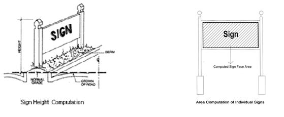
- Sign Area Computation for Multi-Faced Signs. The sign area for a sign with multiple faces shall be computed by adding together the area of all sign faces visible from any one
(1) point. When a sign is composed of two (2) or more sign faces, only one (1) of which can be viewed from any one (1) point, and when such sign faces are part of the same structure, the sign area shall be computed by the measurement of one (1) of the faces.
- Forfeiture of Illegal Signs Placed On or Over Public Property. Any sign installed or placed on or over public property, except in conformance with the requirements of this section, shall be forfeited to the public and be subject to confiscation and disposal. In addition to other remedies provided by this section and the Town Code of Ordinances, the Town shall have the right to recover from the sign owner and/or installer the full costs of removal and disposal of such sign.
7.4 SIGN PLACEMENT.
The following provisions shall apply to the placement of all signs in all districts.
(A) In General.
- Signs must be located entirely on private property, unless otherwise permitted by this section.
- No sign may be located so that it blocks the sight triangle at any driveway or public street intersection.
- Wall Signs. Wall mounted signs shall not extend above the eave or parapet of any building.
- Suspended Signs. Suspended signs must provide a minimum of eight (8) feet of clearance between the bottom of the sign and the sidewalk.
(D) Freestanding and Monument Signs.
- All parts of freestanding and monument signs shall be set back a minimum of 12 feet from the street right-of-way line. No freestanding or monument sign shall be located in a required side yard or within ten (10) feet of the side property line.
- No freestanding or monument sign shall be located closer than 15 feet from another structure on the same zoning lot.
(E) Outdoor Advertising Signs.
- Outdoor advertising signs shall not be located within 100 feet of any residential district.
- Outdoor advertising signs shall meet all setback requirements of the district in which it is located.
- Outdoor advertising signs shall not be permitted within 1000 feet of an existing outdoor advertising sign or structure.
- Display lighting of outdoor adverting signs shall be shielded so as to prevent the direction of such light into any structure used primarily for residential purposes.
- No rotating, revolving, changeable message, or intermittent lighting devices shall be attached to, or made a part of, any outdoor advertising sign.
(F) Temporary Signs.
- Temporary signs shall be located on private property unless expressly permitted by this section to be posted on public property.
- All temporary signs shall be anchored, attached, or otherwise affixed to a structure or support so that the sign cannot be easily dislodged by strong winds or heavy rains.
(G) Portable Signs, Sandwich or Menu Board.
- Portable, sandwich or menu board signs shall be placed on the sidewalk directly in front of the associated use and within four (4) feet of the curb.
- No portable sandwich or menu board signs shall be located on a sidewalk where the sidewalk is less than nine (9) feet in width.
- Portable, sandwich or menu board signs shall be at least ten (10) feet from any intersection and at least five (5) feet from any crosswalk or fire hydrant.
- Portable, sandwich or menu board signs shall be displayed only during operational hours of the business being advertised, removed each day at the close of business, and shall not be lighted.
- Portable, sandwich or menu board signs shall be constructed of materials that present a finished appearance. Rough cut plywood is not acceptable. The sign lettering shall be professionally painted or applied. Chalkboard signs shall be permitted. The written message of the sign shall be kept to the minimum necessary to communicate the name of a business or a special message of the business.
- Any person erecting a portable, sandwich or menu board sign shall indemnify and hold harmless the Town and its officers, agents, and employees from any claim arising out of the presence of the sign on Town property or rights-of-way. The person erecting a portable, sandwich or menu board sign shall sign an indemnification agreement, approved by the Town Attorney, prior to the issuance of a sign permit. The indemnification agreement shall be accompanied by evidence of insurance covering the liability assumed in this subsection and the agreement.
- Any person erecting a portable, sandwich or menu board sign shall indemnify and hold harmless the Town and its officers, agents, and employees from any claim arising out of the presence of the sign on Town property or rights-of-way. The person erecting a portable, sandwich or menu board sign shall sign an indemnification agreement, approved by the Town Attorney, prior to the issuance of a sign permit. The indemnification agreement shall be accompanied by evidence of insurance covering the liability assumed in this subsection and the agreement.
7.5 PERMANENT SIGNS BY ZONING DISTRICT.
Signs shall be permitted and prohibited within certain zoning districts as follows:
Permanent Signs by Sign Type and Zoning District
| SIGN TYPE | R-A | R-15/R15M | R-8 | R-6 | O-I | CB | GB | NB | I | LD-CD |
| Canopy/Awning | – | – | – | – | Z | Z | Z | Z | Z | Z |
| Directional/Incidental | P | P | P | P | P | P | P | P | P | P |
| Directory | – | – | – | – | Z | – | Z | Z | Z | Z |
| Flag | P | P | P | P | P | P | P | P | P | P |
| Freestanding (Pole) | – | – | – | – | Z | – | Z | Z | Z | – |
| Marquee | – | – | – | – | – | Z | – | – | – | – |
| Monument (Ground) | Z | Z | Z | Z | Z | Z | Z | Z | Z | Z |
| Outdoor Advertising (Billboard) | – | – | – | – | – | – | – | – | S | – |
| Planned Development (Shopping Center) | – | – | – | – | – | – | Z | Z | Z | – |
| Portable | – | – | – | – | – | – | – | – | – | – |
| Portable, Sandwich or Menu Board | – | – | – | – | – | P | – | P | – | P |
| Projecting | – | – | – | – | Z | Z | – | Z | – | – |
| Suspended | – | – | – | – | Z | Z | Z | Z | – | Z |
| Wall | Z | Z | Z | Z | Z | Z | Z | Z | Z | Z |
| Window | – | – | – | – | Z | Z | Z | Z | Z | Z |
P = permitted without a permit
Z = permitted only upon issuance of a valid zoning permit S = permitted only upon issuance of a special use permit “- “= not permitted
Important Note: Sign types not specifically listed in this table are not permitted
7.6 SIGN HEIGHT.
The following provisions shall apply to the height of all signs.
- Supporting elements of freestanding signs shall not extend above the sign face and shall be included in the measurement of sign height.
- Maximum sign height shall be limited by the type of sign and the zoning district in which it is located, as follows:
Maximum Sign Height by Sign Type (in feet)
| SIGN TYPE | R-A | R-15/R-15M | R-8 | R-6 | O-I | CB | GB | NB | I | LD-CD |
| Canopy/Awning | – | – | – | – | n/a | n/a | n/a | n/a | n/a | n/a |
| Directional/Incidental | 4 | 4 | 4 | 4 | 4 | 4 | 4 | 4 | 4 | 4 |
| Directory | – | – | – | – | 6 | – | 6 | 6 | 6 | 6 |
| Flag | * | * | * | * | * | * | * | * | * | * |
| Freestanding (Pole) | – | – | – | – | 5 | – | 5 | 3 | 15 | – |
| Marquee | – | – | – | – | – | n/a | – | – | – | – |
| Monument (Ground) | 5 | 3 | 3 | 3 | 5 | 5 | 5 | 3 | 5 | 5 |
| Outdoor Advertising (Billboard) | – | – | – | – | – | – | – | – | 20 | – |
| Planned Development (Shopping Center) | – | – | – | – | – | – | 12 | 8 | 8 | – |
| Portable | – | – | — | – | – | – | – | – | – | – |
| Portable, Sandwich or Menu Board | – | – | – | – | – | 4 | – | 4 | – | 4 |
| Projecting | – | – | – | – | n/a | n/a | – | n/a | – | – |
| Suspended | – | – | – | – | 1 | 1 | 1 | 1 | – | 1 |
| Wall | n/a | n/a | n/a | n/a | n/a | n/a | n/a | n/a | n/a | n/a |
| Window | – | – | – | – | n/a | n/a | n/a | n/a | n/a | n/a |
* Shall not exceed twice the maximum building height permitted or 40 feet, whichever is less.
1 Suspended signs shall be at least eight feet above sidewalk level.
7.7 NUMBER OF SIGNS PERMITTED.
The number of signs by sign type permitted on an individual zoning lot shall be as follows:
Maximum Number of Signs Per Sign Type Per Zoning Lot
| SIGN TYPE | R-A | R-15/R-15M | R-8 | R-6 | O-I | CB | GB | NB | I | LD- CD |
| Canopy/Awning | – | – | – | – | 11 | 11 | 11 | 11 | 11 | 11 |
| Directional/Incidental | 2 | 2 | 2 | 2 | 24 | 24 | 24 | 24 | 24 | 24 |
| Directory | – | – | – | – | 1 | – | 1 | 1 | 1 | 1 |
| Flag | 4 | 4 | 4 | 4 | 4 | 4 | 4 | 4 | 4 | 4 |
| Freestanding (Pole) (see Note below) | – | – | – | – | 13 | – | 13 | 13 | 13 | – |
| Marquee | – | – | – | – | – | 1 | – | – | – | – |
| Monument (Ground) | 13 | 13 | 13 | 13 | 13 | 13 | 13 | 13 | 13 | 13 |
| Outdoor Advertising (Billboard) | – | – | – | – | – | – | – | – | 1 | – |
| Planned Development (Shopping Center) | – | – | – | – | – | – | 13 | 13 | 13 | – |
| Portable | – | – | – | – | – | – | – | – | – | – |
| Portable, Sandwich or Menu Board | – | – | – | – | – | 1 | – | 1 | – | 1 |
| Projecting | – | – | – | – | 1 | 1 | – | 1 | – | – |
| Suspended | – | – | – | – | 1 | 1 | 1 | 1 | – | – |
| Wall | 13 | 13 | 13 | 13 | 13 | 13 | 13 | 13 | 13 | 13 |
| Window | – | – | – | – | n/a | n/a | n/a | n/a | n/a | n/a |
¹ Per canopy or awning. ² Per storefront.
³ Per street front.
4 Per development entrance.
NOTE: When a freestanding (pole) sign is erected, the maximum number of monument (ground) signs permitted shall be decreased by the number of freestanding (pole) signs erected.
7.8 SIGN AREA BY ZONING DISTRICT.
The amount of sign area permitted for each sign on a zoning lot shall be as follows:
Maximum Sign Area Per Sign Per Zoning Lot (in square feet)
¹ Shall not exceed 75% of the size of the marquee.
² Shall not exceed 25% of the wall area of the façade on which it is located. ³ Shall not exceed 25% of the window area.
4 Shall not exceed 10% of the canopy or awning.
7.9 PERMANENT SIGNS LIMITED.
(A) Notwithstanding Section 7.5 and in addition thereto, the following permanent signs shall be permitted without a zoning permit.
- Historical markers, regulatory signs, public interest signs, and warning signs erected and maintained by the town or state or an agent of such.
- On-premises directional signs not exceeding four (4) feet in height nor two (2) square feet in area.
- Identification signs not exceeding two (2) square feet in area nor two (2) feet in height.
- Incidental signs.
- Flags on permanent poles.
- Any sign not legible or easily noticeable from public property or a public right- of-way and obviously not intended to attract the attention of the public.
- Any public notice or warning required by a valid and applicable federal, state, or local law, regulation, or ordinance.
- Traffic control signs on private property, the face of which meets Department of Transportation standards and which contain no commercial message of any kind.
(B) Notwithstanding Section 7.5 and in addition thereto, the following permanent signs shall be permitted upon the issuance of a valid zoning permit.
- Any sign not expressly listed as permitted without a permit shall require the issuance of a valid zoning permit prior to installation.
7.10 TEMPORARY SIGNS LIMITED.
- Temporary Signs Permitted Without a Permit. The following temporary signs are permitted without a zoning permit in all zoning districts, but shall be in conformance with all other requirements of this ordinance.
- Campaign or election signs shall be permitted provided that:
- Individual signs shall not exceed 16 square feet in area nor four (4) feet in height.
- Signs shall only be displayed from the 30th day before the beginning of “one-stop” early voting and the 10th day after the primary or election day.
- Any party erecting a campaign or election sign shall obtain the permission of the owner of any residence, business, or religious property that fronts the right-of-way where the sign is erected.
- Real estate signs, excluding temporary development signs provided that:
- Signs advertising all residential lots, buildings, units, or spaces for sale or for lease shall not exceed six (6) square feet in area nor four (4) feet in height.
- Signs advertising all non-residential lots, buildings, units, or spaces for sale or for lease shall not exceed a sign face area of 32 square feet or exceed a height of six (6) feet.
- Only one (1) sign per street front of the advertised property shall be erected.
- Signs shall not be illuminated.
- Signs shall be removed within seven (7) days after the sale is closed or rent or lease transaction finalized.
- Construction signs are permitted provided that:
- Signs located on residential lots, excluding multi-family sites, shall not exceed six (6) square feet in area. The maximum height of such signs shall be six (6) feet.
- Signs for all multi-family development sites and nonresidential
- Campaign or election signs shall be permitted provided that:
uses shall not exceed a sign face area of 32 square feet or a height of six
(6) feet.
- Signs are confined to the site of construction.
- Only one (1) sign per street front of the property under construction shall be erected.
- Signs shall not be illuminated.
- Signs shall be removed within seven (7) days after the completion of the project.
- Temporary farm products signs are permitted provided that:
- Signs are located on the premises where the products are sold.
- Signs advertise products produced on-site only.
- Signs shall not exceed 24 square feet in area nor five (5) feet in height.
- Only one (1) sign shall be erected.
- Signs shall be removed within seven (7) days of the termination of sale activities.
- Temporary special event signs or banners for religious, charitable, civic, fraternal, or similar organizations, are permitted provided that:
- Signs shall not exceed 32 square feet in area nor five (5) feet in height.
- Signs shall be erected no sooner than 14 days before and removed seven (7) days after the event.
- Holiday lights and decorations.
- Any sign not legible or easily noticeable from public property or a
public right-of-way and obviously not intended to attract the attention of the public.
- Any public notice or warning required by a valid and applicable federal, state, or local law, regulation, or ordinance.
- Temporary Signs Requiring a Permit. Temporary signs permitted upon issuance of a valid zoning permit shall be limited as follows:
- Temporary banners in commercial districts, provided that:
- Only one (1) banner per establishment shall be allowed at a time.
- All banners shall be attached in total to a building wall or permanent canopy extending from a building.
- No paper banners shall be allowed.
- Temporary banners in commercial districts, provided that:
- Banners shall be erected for a period not to exceed two (2) weeks.
- No more than six (6) such signs per establishment shall be erected within a calendar year.
- No banner shall extend above the second occupiable floor level of a building.
- Temporary off-premise signs or banners for special community events, open to the general public and sponsored by non-commercial civic, charitable, community, or similar organizations, provided that:
- Temporary signs shall be located outside of the public right-of-way or at least 12 feet from the edge of any public street if the right-of-way cannot be determined.
- Every temporary off-premise sign or banner shall be separated by a distance of 100 feet from any other such temporary off-premise sign on the same side of a street, and by a distance of 100 feet from any other sign on the opposite side of a street.
- Nothing in this provision shall be construed to authorize the posting of such signs or banners upon trees, utility poles, traffic control signs, lights or devices in any place or manner prohibited by the provisions herein, nor on private property without written consent of the owner.
- Any temporary sign not expressly permitted without a permit
7.11 PROHIBITED SIGNS.
Notwithstanding Section 7.5 and in addition thereto, the following signs, both permanent and temporary, are prohibited in all zoning districts:
- Signs extending into the public right-of-way other than those expressly permitted by this article or otherwise approved by the Board of Commissioners, if placed along public streets.
- Roof signs.
- Flashing, fluttering, swinging, wind-activated, rotating, animated signs and other digital or electronic message boards, excluding signs incorporating electronic or digital time and/or temperature displays, fuel prices and message boards provided that messages and/or copy do not change more frequently than once every 30 seconds.
- Any sign which obstructs the view of motorists, pedestrians, or cyclists using any street, sidewalk, bike path, or driveway, or which obstructs the approach to any street intersection or railroad crossing, or which interferes with the effectiveness of any traffic sign, device, or signal.
- Illuminated or highly reflective signs which hamper the vision of motorists or cyclists.
- Any sign that resembles traffic signals, traffic signs, or emergency vehicle lights and any other sign not erected by a public authority which may be erroneously construed as governmental signs or emergency warning signs.
- Beacons, pennants, and strings of lights not permanently mounted to a rigid background, except those permitted as temporary signs.
- Any sign that interferes with free passage from or obstructs any fire escape, downspout, window, door, stairway, ladder, or opening intended as a means of ingress or egress or providing light or air except for permitted window signs.
- Any sign placed on any curb, sidewalk, post, pole, hydrant, bridge, tree, or other structure or surface located on, over, or across any public street right-of-way or property unless expressly authorized by this article or the Board of Commissioners.
- Off-premises signs advertising adult establishments.
- Off-premises signs on parcels of land that are zoned residential, used primarily for residential purposes, or which do not include an active permitted use as established by this article.
- Inflatable devices or balloons.
- High intensity searchlights.
- Any object displayed in a manner which is intended to attract attention to a site, product, or event.
- Vehicular signs.
- Any sign listed as not permitted in Section 7.5
- Any sign not expressly permitted by this article.
7.12 ENFORCEMENT OF REGULATIONS.
Any sign, structure, or other form of advertising defined as a sign herein that is erected or placed anywhere in Mount Gilead or in its extra-territorial jurisdiction (ETJ) after adoption of this ordinance that is not in compliance with the provisions of this section shall be subject to the enforcement provisions outlined in Article 10 of the Zoning Ordinance.
ARTICLE 8 LANDSCAPING, SCREENING AND BUFFER AREAS
8.1 PURPOSE AND SCOPE.
The landscaping, screening and buffer regulations, adopted and prescribed in this Ordinance, are found by the Board of Commissioners to be necessary and appropriate to:
- Maintain and enhance Mt. Gilead’s existing tree coverage;
- To promote careful landscaping of outdoor areas;
- To soften and enhance the manmade environment;
- Provide the separation necessary to permit certain land uses to coexist harmoniously which might not do so otherwise;
- Safeguard and enhance property values and protect public and private investment;
- Reduce the negative impact of glare, noise, trash, odors, overcrowding, traffic, lack of privacy, and visual disorder when incompatible land uses adjoin one another.
The following requirements are intended to enhance the appearance and natural beauty of the town and to protect property values through preservation and planting of vegetation, screening, and landscaping material.
8.2 APPLICABILITY.
- Exemptions: These requirements shall not apply to:
- Single family detached dwellings or two-family dwellings on their own lots.
- Multi-family developments containing four (4) or fewer dwelling units in a single zone (building) lot.
- Property lines abutting railroad rights-of-way and utility easements in excess of 60 feet in width.
- Application: These requirements shall apply to the following:
- New Principal Building or Use: Principal buildings or open uses of land constructed or established after the adoption of this Ordinance.
- Expansions or Reconstruction: Expansions which will result in a parking or building square footage increases of more than 3,000 square feet for developments existing on the effective date of this Ordinance. In such cases the landscaping requirements shall apply only to the expansion.
8.3 GENERAL PROVISIONS.
- Planting and Maintenance. Landscaping, trees, and plant material shall be planted in a growing condition according to accepted horticultural practices and they shall be maintained in a healthy growing condition. Any landscaping, trees, and plant material in a condition that does not fulfill the intent of these regulations shall be replaced by the property owner during the next planting season.
- Screening Fences and Walls. A screening fence or wall area shall be maintained by the property owner, in good condition, throughout the period of the use of the lot.
- Protection of Existing Vegetation. To the extent possible, existing trees, vegetation, and unique site features shall be retained and protected. Existing healthy, mature trees, if properly located, shall be fully credited against the requirements of these regulations.
(D) Size and Spacing of Landscape Materials.
- Trees shall be a minimum of six (6) to eight (8) feet in height, with a minimum circumference of three and one half (3 ½) inches, immediately after planting. Trees shall reach an expected height of 25 to 35 feet at maturity.
- Spacing of Trees. Trees shall be planted 25 to 35 feet on center depending on species.
- Evergreen trees shall be a minimum of six (6) feet immediately after planting.
- Shrubs and hedges shall be a minimum of one (1) to two (2) feet in height immediately after planting.
- Ground cover may include any plant material that reaches an average height of not more than 12 inches. Alternative materials may be used in lieu of grass provided they present a finished appearance and provide reasonably complete coverage at the time of planting.
- Plants that restrict sight visibility at intersections of streets or driveways, such as tall shrubs or low branching trees, shall be avoided.
- Alternate Methods of Compliance. Where lot size, shape, topography or existing structures make it not feasible to comply with the provisions of this ordinance, the Zoning Administrator may modify these provisions provided the alternate proposal will afford a degree of landscaping screening and buffering equivalent to or exceeding the requirements of these regulations.
8.4 FRONT LANDSCAPED AREA.
A front landscaped area shall be required for all multi-family developments with more than four
(4) units and all non-residential uses. The required landscaped area shall be contiguous to the front lot line of the property and have an average minimum width of ten (10) feet. The area shall be covered with grass or other ground cover and shall include appropriate trees and shrubs. At a minimum, one (1) tree and ten (10) shrubs shall be planted within the front landscaped area for each 50 feet or fraction thereof of lot frontage. The purpose of the landscaping is to enhance the appearance of the use of the lot but not to negate access or screen the use from view.
8.5 BUFFER AREA.
A buffer area shall be required to separate and screen incompatible land uses from each other. A buffer area shall be required along all boundaries of a two-family, multi-family, or a nonresidential lot abutting a less intensive use. Such buffer shall comply with the following minimum standards.
- A buffer area shall be located within the boundaries of the subject property. The buffer may be located on abutting property, provided the owners of all abutting properties agree
in writing to the proposal. Said agreement must be recorded and run with the land and provide stipulations for maintenance and upkeep, as deemed necessary.
- The minimum width (in linear feet) of the buffer area shall be following the buffer matrix below:
PROPOSED USE
| Single-Family (SF) | – | – | – | – | – | – |
| Two-Family (TF) | 10 | – | – | – | – | – |
| Office (OF) | 10 | 5 | – | – | – | – |
| Commercial (CM) | 15 | 10 | 5 | – | – | – |
| Multi-Family (MF) | 15 | 10 | 5 | – | – | – |
| Industrial (IND) | 25 | 20 | 15 | 10 | 10 | – |
| SF | TF | OF | CM | MF | IND |
ADJACENT USE
- The buffer area shall consist of trees and shrubs of such a type, height, spacing and arrangement to effectively buffer the activity on the lot from the neighboring area. At a minimum, the planting shall consist of five (5) trees and ten (10) shrubs per 100 linear feet for five (5) to ten (10) foot buffers, ten (10) trees and 15 shrubs per 100 linear feet for 15-20 foot buffers, and 20 trees and 20 shrubs per 100 linear feet for 25 foot buffers.
- An earthen berm, fence, or wall of a location, height, design, and material approved by the Zoning Administrator may be substituted for any portion of the
required planting and/or buffer area. Fences and walls, if substituted, shall be constructed of materials congruous with the materials of the main building. Trees and shrubs shall supplement earthen berms, fences, or wall areas.
8.6 LANDSCAPED PARKING AREA.
Parking areas shall comply with the following minimum standards.
- All uses required to have 20 or more off-street parking spaces shall have at least ten (10) square feet of interior landscaping, within the paved portion of the parking area, for each parking space and at least one (1) tree for every ten (10) parking spaces or fraction thereof.
- Each interior landscaped area shall contain a minimum of 200 square feet and shall be planted with shrubs and trees.
- A landscaped area shall be provided along the perimeter of any parking area. The required landscaped area shall have a minimum width of five (5) feet and shall be planted with two (2) trees and ten (10) shrubs per 100 linear feet of perimeter area.
- Interior landscaped areas shall be spaced throughout the lot to reduce the visual impact of long rows of parked cars. At a minimum, landscaped areas shall be distributed approximately once every ten (10) spaces for residential and once every 15 spaces for other developments.
- Landscaped areas shall be provided at the ends of parking aisles and shall be planted with shrubs and/or trees.
- The required number of parking spaces may be reduced by one (1) parking space for each 150 square feet of interior planting area, not exceeding ten percent (10%).
8.7 SCREENING OF OUTDOOR STORAGE AREAS.
Outdoor storage areas shall be screened from view of adjacent streets, and from all residentially zoned land by a double row of evergreen shrubs or trees planted to form a continuous hedge of at least six (6) feet in height within two (2) years of installation.
8.8 SCREENING OF MECHANICAL EQUIPMENT.
All non-residential uses shall screen from view from public places and neighboring properties all mechanical equipment, such as but not limited to, ground or roof mounted air conditioning, air conditioners, or pumps, through the use of features such as berms, fences, false facades or dense landscaping compatible with the site.
8.9 CENTRAL SOLID WASTE STORAGE AREA.
All new buildings and uses, except for single-family and two-family dwellings, shall provide facilities for the central storage of solid waste within the lot. Where such facilities are provided outside of a building they shall be screened from adjacent property by an enclosure constructed of materials congruous with the materials on the exterior wall of the main buildings.
8.10 UNOCCUPIED LOT AREAS.
All areas of a developed lot not occupied by buildings, structures, pedestrian and vehicle circulation ways, off-street parking and outside storage shall be appropriately improved with ground cover, trees, shrubbery or mulch. No exposed soils shall be permitted after issuance of the Certificate of Occupancy, except for agricultural activities or extraction of earth products.
8.11 PLANTING LIST.
The following trees and shrubs by way of example but not by way of limitation are suitable for use in the Mount Gilead area:
Large Trees (mature height 35 feet or greater and 35 feet spacing).
Willow Oak Black Gum
Sugar Maple Littleleaf Linden
Red Maple White Oak
Scarlet Oak Japanese Scholartree
Pin Oak Gingko
Southern Magnolia English Oak
London Plane-tree Japanese Katsuratree
River Birch Shumard Oak
Japanese Zelkova Chinese Elm
Tulip Poplar
Medium Trees (mature height 25 to 35 feet and 30 feet spacing)
Mountain Silverbell Weeping Cherry
Sourwood Kwanzan Cherry
Thornless Honeylocust Yellowood
Eastern Redbud Ironwood
Mountain Ash Pistachio
Yoshino Cherry Redwood Linden
Golden-Rain Tree American Holly Saucer Magnolia
Small Trees (mature height less than 25 feet and 25 feet spacing)
Japanese Maple Crabapple
Japanese Dogwood Amur Maple
Flowering Dogwood Russian Olive
Smoketree Wax Myrtle
Crepe Myrtle Star Magnolia
Shrubs (mature height approximately 36 inches)
Evergreen
Warty Barberry Mugo Pine
Dwarf Burford Holly Juniper
Japanese Holly Euonymous
Azalea Leatherleaf Viburnum
Deciduous
Forsythia Potentilla
Dwarf Burning Bush Ornamental Grass Varieties
Thunberg Spirea Oregonholly Grape
Viburnum Red Chokeberry
Oakleaf Hydrangea Nandina
Japanese Flowering Quince Dwarf Nandina
Screening Plants (installation height 6 feet)
American Holly Hetz Juniper
Burford Holly Arborvities
Nellie Stevens Holly Eastern Red Cedar
Wax Myrtle Japanese Black Pine
ARTICLE 9 ADDITIONAL CONDITIONS FOR CERTAIN USES
Note: These conditions apply only to uses “Permitted with Conditions” or by “Special Use Permit” in the applicable zoning district as listed in Section4.5, Table of Permitted Uses.
9.1 Abattoirs.
- Any structure or loading or unloading area associated with the use shall not be located within 100 feet of any property line which is in a Residential District.
- All animals awaiting processing are to be housed within a fully enclosed structure.
- All inedible offal, meat that is not food, condemned material and refuse of the meat processing shall be refrigerated and stored in the interior of a fully enclosed structure until time of pick up or final disposal.
- All loading and unloading areas for animals shall be screened from adjoining properties.
- Humane bedding shall be provided for animals housed over 24 hours.
- Proper disposal of all bedding materials shall be required.
- All animals that shall remain onsite for up to 12 hours are to be supplied food and water.
- Proper ventilation of all holding areas shall be provided.
9.2 Accessory Communication Antennae.
See applicable conditions for Accessory Communication Antennae listed under 9.88 Telecommunications Towers.
9.3 Accessory Dwelling Unit, Detached.
- The principal use of the lot shall be residential and the principal structure on
the lot shall be a residential building (single-family, duplex, multi-family, or townhouse).
- No more than one (1) accessory dwelling shall be permitted on a single lot of record in conjunction with the principal dwelling unit.
- The accessory dwelling shall be owned by the same person as the principal dwelling.
- The accessory dwelling shall not be served by a driveway separate from that serving the principal dwelling unless the accessory dwelling is accessed from a rear alley and the principal dwelling is accessed from a street.
- The detached accessory dwelling shall be housed in a building not exceeding650 square feet of first floor area (maximum footprint); the structure may be a dwelling only or may combine a dwelling with a garage, workshop, studio, or similar accessory use.
- The detached accessory dwelling shall be located in the side or rear yard.
- The owner of the accessory dwelling shall live on the parcel containing the
accessory dwelling.
9.4 Adult Establishments.
- All windows, doors, openings, entries, etc. for all adult establishments shall be so located, covered, screened or otherwise treated so that views into the interior of the establishment are not possible from any public or semi-public area, street or way.
- No adult establishment shall be established within 1,000feet (determined by a straight line and not street distance) of the closest boundary of any residential zoning district, or of any point on the closest property line of any church, school, day care, public park, residence or playground as measured by a horizontal straight line distance from the closest point on the boundary line of the property occupied by the adult establishment.
- No adult establishment shall be located within 1,000 feet(determined by a straight line and not street distance) of any other adult establishment as measured by a horizontal, straight line distance from the closest point on the closest boundary line of the property occupied by each.
- Screening shall be required around the entire perimeter of any adult use, regardless of adjacent zoning district or existing land uses. The screening shall consist of a naturally wooded area or planted with a mixture of evergreen and deciduous trees and shrubs to simulate a naturally wooded area within three (3) years. This screening shall be located in a 15-foot-wide buffer.
- Supplemental Site Plan Requirements.
- Location of existing structures on property within 1,000 feet of exterior wall(s) of the regulated use.
- Zoning of properties within 750 feet of each property line of the regulated use.
- Other information that may be necessary to judge the probable effect of the proposed activity on neighboring properties, and to carry out the intent of this chapter
- Zoning of properties within 750 feet of each property line of the regulated use.
- Operational Considerations.
- If applicable, all viewing booths shall be open and be visible to manager(s) of the establishment.
- If applicable, there shall be a minimum separation of six (6) feet between patrons and performers.
- Masseuses and servers of food and beverage shall at all times wear a shirt and pants.
- No printed material, slide, video, photograph, written text, live show, or other visual presentation shall be visible to the public or an adjacent property or use, nor shall any live or recorded voices, music, or sounds be heard from outside the walls of the establishment.
- If applicable, there shall be a minimum separation of six (6) feet between patrons and performers.
9.5 Airport.
- A minimum of 50 acres is required for a Basic Utility Stage 1 Airport with a 2,000-foot runway. More area is required for larger airports. Airport size and layout shall conform to current FAA requirements.
- There shall be a minimum 300-foot separation between airport property and the nearest residence.
- Security fencing shall be provided sufficient to control access to runways and taxiways. The fencing shall be a minimum six (6) feet in height.
9.6 Amusements, Commercial Indoor.
- Indoor amusement facilities shall take place entirely within an enclosed facility.
- Music, loud speakers, and similar noise devices shall not be permitted outdoors. Noise emanating from the facility shall not exceed ambient noise levels in the surrounding area at a distance of more than 100 feet from any point of the property containing the use.
- Music, loud speakers, and similar noise devices shall not be permitted outdoors. Noise emanating from the facility shall not exceed ambient noise levels in the surrounding area at a distance of more than 100 feet from any point of the property containing the use.
9.7 Amusements, Commercial Outdoor.
- Outdoor amusement facilities shall be separated by an opaque screen from any abutting property located in a residential district.
- No permanently established amusement facilities, such as miniature golf courses, skateboard courses, or mechanical rides shall be located within 200 feet of the closest point of any abutting property located in a residential district.
- Hours of operation shall be no earlier than 8 am and no later than 12midnight.
9.8 Animal Feeder/ Breeder Operations.
- All structures, buildings, or enclosed areas used for housing of poultry, hogs, cattle or other livestock or animals being bred shall be a minimum of 100 feet from all property lines.
- Any violation of County Health Department regulations concerning the operation of the feeder/breeder shall be considered a violation of this ordinance.
- Mechanical equipment producing noise or sound in excess of 70 decibels shall be located no closer than 100 feet to the nearest residence.
9.9 Arenas.
- The facility shall have direct access to a major arterial roadway.
- All facilities shall be located at least 100 feet from any lot line and 300 linear feet from a residential district.
- All facilities shall be located at least 100 feet from any lot line and 300 linear feet from a residential district.
9.10 Asphalt and Concrete Plant and Contractors.
- Any asphalt or concrete plant, or other industrial operation shall be located at least 50 feet from any property line.
- The asphalt or concrete plant operation shall be enclosed by a non-climbable fence of at least six (6) feet in height.
- Within one (1) year after the cessation of production, all equipment and stockpiles, incidental to such operation, shall be dismantled and removed by and at the expense of the owner.
- The site shall be drained to prevent the accumulation of standing water, and channelization of the drainage shall be designed and controlled so as not to cause erosion or silting of neighboring properties or public drainage way, nor to appreciably increase the turbidity of any natural water course, or to occlude any existing drainage course.
- All unpaved storage areas shall be maintained in a manner so as to limit dust from leaving the storage area.
- Access.
- Access roads leading to any part of the operation shall be constructed with a gravel or asphalt base stone surface and maintained in a dust-free manner.
- No part of such roads shall be located closer than 15 feet to an external property line other than a limited access highway or railroad right-of-way.
- A truck route plan shall be submitted showing routes to and from the site. Such routes shall be designed to minimize impacts on a residential area, schools, or other uses which will be affected by truck traffic.
A truck route plan shall be submitted showing routes to and from the site. Such routes shall be designed to minimize impacts on a residential area, schools, or other uses which will be affected by truck traffic.
9.11 Assembly Halls, Coliseums, Armories, Ballrooms, Reception Halls and Exhibition Buildings.
- The facility shall have direct access to a major arterial roadway.
- All facilities shall be located at least 100 feet from any lot line and 300 linear feet from a residential district.
- All facilities shall be located at least 100 feet from any lot line and 300 linear feet from a residential district.
9.12 Auto Wrecking Yards, Building Material Salvage Yards and Scrap Metal Processing Yards.
- A minimum of two (2) acres for the site shall be provided.
- The site shall be completely enclosed by a solid or opaque fence in conjunction with required landscape materials. The fencing shall extend from the surface of the ground to a uniform minimum height of at least six (6) feet from the ground at any given point. All business activity, including storage of vehicles or other materials, shall be conducted within the fenced area.
- No dismantling, disassembling, salvaging, wrecking, or processing operation on the premises shall be carried on between the hours of 9 pm and 7 am.
- Any gasoline, oil, or other materials spilled or collected on the site shall be contained and disposed of in accordance with state and federal laws.
9.13 Bed and Breakfast Establishments.
- The establishment shall be the permanent residence of the owner or designated property manager of the establishment.
- Employment shall not exceed two (2) full time employees in addition to the owner(s).
- In any residential zoning district, no more than four (4) off-street parking spaces shall be provided in the front yard.
- Off-street parking in the side and rear yards shall be screened in accordance with parking lot landscaping and screening requirements. Parking shall be placed on the lot in a manner designed to have the least physical impact on adjoining residential uses.
9.14 Boarding or Rooming House.
- The house shall be the permanent residence of the owner of the establishment.
- Lodging shall be provided to no more than six (6) paying guests on a weekly or longer basis and the rooms rented neither individually nor collectively shall constitute separate dwelling units.
- In any residential zoning district, no more than two (2) off-street parking spaces shall be provided in the front yard.
- Off-street parking in the side and rear yards shall be screened in accordance with parking lot landscaping and screening requirements. Parking shall be placed on the lot in a manner designed to have the least physical impact on adjoining residential uses.
9.15 Building Contractors, General.
- All building materials, equipment and unlicensed vehicles shall be stored inside an enclosed building or inside a fenced storage yard that is completely enclosed by a solid or opaque fence in conjunction with required landscape materials. The fencing shall extend from the surface of the ground to a uniform minimum height of at least six (6) feet from the ground at any given point.
9.16 Building Contractors, Heavy.
- All outdoor storage of non-passenger vehicles, equipment and building materials shall be kept at least 100 linear feet from any adjacent residential use and shall be located in a side or rear yard only.
- All unpaved storage areas shall be maintained in a manner so as to limit dust from leaving the storage area.
- All unpaved storage areas shall be maintained in a manner so as to limit dust from leaving the storage area.
9.17 Bulk Storage of Petroleum Products.
- Use Separation:
- Storage tanks protected by either an attached extinguishing system approved by the Fire Marshal or an approved floating roof shall not be located closer to an exterior property line than a distance equal to the greatest dimension of either diameter or height of the tank, except that such distance need not exceed 120 feet.
- Storage tanks not equipped as indicated in (1) above, shall not be located any closer to an exterior property line than a distance equal to one and one-half (1½) times the greater dimension of either the diameter or height of the tank, except that such distance need not exceed 175 feet.
- Storage tanks and loading facilities shall be located a minimum of 500feet from any existing residence or residentially zoned property.
- Storage tanks not equipped as indicated in (1) above, shall not be located any closer to an exterior property line than a distance equal to one and one-half (1½) times the greater dimension of either the diameter or height of the tank, except that such distance need not exceed 175 feet.
- Gravel or paved roadways shall be provided to all storage tanks.
- Security fencing, a minimum of six (6) feet in height, shall be provided along the entire boundary of such facilities.
- Dikes:
- Tanks or groups of tanks shall be diked to prevent the spread of liquid onto other property, waterways, or drainage ways. The volumetric capacity of the diked area shall not be less than the capacity of the largest tank within the diked area.
- Dikes or retaining walls shall be of earth, steel, concrete or solid masonry designed and constructed to be liquid tight and to withstand a full hydraulic head. Earthen dikes three (3) feet or more in height shall have a flat section at the top not less than two (2) feet in width. The slope shall be consistent with the angle of repose of the material of which the dikes are constructed. Dikes shall be restricted to an average height of not more than six (6) feet above the exterior grade unless means are available for extinguishing a fire in any tank. Dikes enclosing such tanks shall be provided at the top with a flareback section designed to turn back a boil-over wave. A flareback section shall not be required for dikes and walls enclosing approved floating roof tanks. No loose combustible material, empty or full drums or barrels, shall be permitted within the diked area.
- Where provision is made for draining rainwater from diked areas, such drains shall normally be kept closed and shall be so designed that when in use they will not permit flammable liquids to enter natural watercourses, public sewers, or
- Dikes or retaining walls shall be of earth, steel, concrete or solid masonry designed and constructed to be liquid tight and to withstand a full hydraulic head. Earthen dikes three (3) feet or more in height shall have a flat section at the top not less than two (2) feet in width. The slope shall be consistent with the angle of repose of the material of which the dikes are constructed. Dikes shall be restricted to an average height of not more than six (6) feet above the exterior grade unless means are available for extinguishing a fire in any tank. Dikes enclosing such tanks shall be provided at the top with a flareback section designed to turn back a boil-over wave. A flareback section shall not be required for dikes and walls enclosing approved floating roof tanks. No loose combustible material, empty or full drums or barrels, shall be permitted within the diked area.
public drains. Where pumps control drainage from the diked area, they shall not be self-starting.
- Tank Maintenance:
- All storage tanks shall be maintained in a leak-proof condition with an adequately painted, rust free exterior surface.
- A firm substrate shall be constructed under each storage area to eliminate differential subsidence and to prevent the product from seeping.
- The product shall be sold in the same form as received and shall not be altered, except that two (2) or more products may be blended. Any other alteration of the product shall be deemed a manufacturing use, requiring approval of a special use permit.
- All storage facilities shall comply with the latest edition of the “Flammable and Combustible Liquids Code, NEPA 30” of the National Fire Protection Association.
9.18 Cemetery/Mausoleum.
- A minimum of three (3) contiguous acres shall be required to establish a cemetery not located on the same tract of land as a church or place of worship.
- Tombstones, crypts, monuments and mausoleums must be located at least 25 feet from any street right-of-way line or abutting property. Greater setbacks shall be observed if otherwise required by the zoning district in which it is located. Gravesites shall also be set back at least 20 feet any side or rear lot lines in cemeteries (or cemetery expansions).
- Principal access shall be from a collector street or higher capacity street.
- Sales of crypts shall be allowed as an accessory use on premises (for cemeteries as a principal use only). No building in conjunction with such sales shall be located closer than 20feet from any side lot line abutting a residential district and 40 feet from any such rear lot line.
9.19 Child Care Institution and Day Care Center.
- Outdoor play and/or recreation areas shall be located behind the front building line in the rear yard or side yard only. If located in the side yard, a minimum side yard setback of ten (10) feet shall be observed. On corner or through lots, a minimum 20-foot setback as measured from the abutting street right-of-way line shall be required.
- All outdoor play and recreation areas shall be surrounded by a fence or wall at least four
(4) feet in height.
- Outdoor activities are limited to the fenced area between 8 am and8 pm.
- At least one (1) off-street passenger loading/unloading space separate from required parking shall be provided for each 20 people enrolled. Adequate on-site turnaround area shall be provided for all loading/unloading and parking spaces.
9.20 Civic, Fraternal, Cultural and Community Facilities not otherwise listed
- Such use shall have direct access to an arterial or collector street.
- No active parts of the site (buildings, parking, recreational areas, etc.) are permitted within 50 feet of an adjacent single-family residential use.
- An auditorium or assembly hall is only permitted provided that:
- Such use is permitted as a principal use in the district, or
- Such use is limited to a seating capacity of no more than 150 people.
9.21 Clinics (When located in a residential zoning district).
- The proposed clinic home shall provide a semi-opaque screen utilizing fencing or vegetation materials, where abutting property is located in a residential district or is a residential use in a commercial district.
- Adaptive reuse: The reuse of residential structures for clinics is strongly encouraged.
- Appearance: New principal and accessory structures shall be predominantly designed and constructed with a residential style using features common on residential structures. Residential style features to be considered include roof pitch, façade materials, and size, type and placement of windows and doors.
- Building size: No single building or a combination of buildings on a development site shall exceed 5,000 square feet of heated floor area.
9.22 Club, Private and Club or Lodge, Private Non-Profit.
- Private clubs shall be open to members of the club and their guests only.
- Hours of operation shall be no earlier than 10 am and no later than 11pm when the use abuts a residential use or a residentially zoned lot. This restriction shall not apply where such use is separated from a residential use or a residentially zoned lot by a major arterial street.
- Outdoor seating areas shall not be permitted adjacent to a public street or within 250 feet of a residential use or a residentially zoned lot.
- Outdoor entertainment areas, except areas devoted strictly to seating, shall not be permitted.
- Music, loud speakers, and similar noise devices shall not be permitted outdoors. Noise emanating from the club shall not exceed ambient noise levels in the surrounding area at a distance of more than 100 feet from any point of the property containing the club.
9.23 Cluster Subdivisions.
- All lots within the development shall be accessed solely by interior streets, except that lots used for permitted non-residential uses may have driveway access to adjacent streets if approved by the town.
- No non-residential use in the development shall be permitted within 150 feet of the perimeter of the development site unless the adjacent zoning district permits such use.
- The overall density of the cluster subdivision shall not exceed that of an un-clustered or conventional subdivision. Land saved by clustering shall be dedicated for open space.
9.24 Community Center.
- Any community center having a seating capacity in excess of 250 persons shall have direct access to a major or minor arterial.
9.25 Congregate Care Facility and Nursing Care Institution.
- Any facility which is licensed to have more than 20 residents shall maintain a side setback of at least 20 feet and a rear setback of at least 40 feet when the side or rear yard is in or abuts a residential district.
- Driveway access to accessory structures shall be through the main entrance to the facility.
- Accessory structures shall be arranged to provide for adequate on-site vehicular and pedestrian traffic.
- Any portion of a building, which contains living areas, shall be set back a minimum of 15 feet from internal driveways and parking areas.
- No single building shall be greater than 15,000 square feet if located within 200 feet, as measured in any direction from the closest point, from an adjacent residentially zoned lot.
- Acceptable materials for additions and new construction include wood, brick, stone, stucco, vinyl, and similar materials designed to give the exterior a residential appearance. Under no circumstances shall metal siding, not intended to mimic traditional wood siding used on residential structures, or unfinished concrete block be permitted.
9.26 Correctional Institution.
- The principal structure and any accessory use or structure (excluding property boundary fencing) shall be located at least 500 feet from any property located in a residential district.
- Property boundary fencing shall not employ barbed wire, razor wire, electrical fencing, or similar materials where abutting property located in a residential district.
- Security fencing shall be provided utilizing an opaque screen on the exterior of fencing wherever it is adjacent to a street or property in a residential or mixed use district.
- The use shall be located on a lot of at least ten (10) acres if the facility has beds for more than 100 inmates.
- The use shall be located on a lot of at least five (5) acres if the facility has beds for 100 or fewer inmates.
- Razor wire, barbed wire, and electrical fencing or similar materials shall be permitted along the perimeter of the interior residential facility
9.27 Daycare Center.
- An indoor activity area shall be provided equivalent to at least 25 square feet per attendee.
- An outdoor activity area shall be provided equivalent to at least 75 square feet per attendee and located outside the required front yard setback.
- Outdoor activity area(s) for children shall be enclosed by a security fence at least four (4) feet in height and located outside the required front yard setback. Outdoor activity shall be permitted between the hours of 8 am and 8 pm.
- Centers on a site greater than three (3) acres shall have frontage on a collector or arterial street.
- The construction and operation shall comply with the provisions of the North Carolina General Statutes and any other applicable federal, state, or local standards.
9.28 Day Care Home, Large and Small.
- A day care home must be clearly incidental to the residential use of the dwelling and must not change the essential residential character of the dwelling. All building and lot standards for residential dwellings shall be maintained.
- Outdoor activity area(s) for children shall be enclosed by a security fence at least four (4) feet in height and located outside the required front yard setback. Outdoor activity play shall be permitted between the hours of 8 am and 8 pm and care shall be allowed on a 24- hour basis.
- The facility shall be staffed by persons residing in the dwelling in which the day care is located except that up to one non-resident may report to work at a daycare home.
- The day care shall be located in a structure originally constructed as and designed for a single-family dwelling which shall be the principal structure on the lot. The structure shall not be altered in any manner which diminishes its value as a single-family dwelling or which changes its exterior residential character.
- The owner of the daycare home shall reside on premises.
- The construction and operation shall comply with the provisions of the North Carolina General Statutes and any other applicable federal, state, or local standards.
9.29 Dry Cleaning and Laundry Plants.
- Permitted activities include on-premises washing, drying, dry cleaning, pressing, alterations, shoe repair and tailoring.
- Dry cleaning and laundry plants shall comply with all applicable local, state and federal regulations.
- Chemical substances shall be disposed of properly and off-site when no public sewer is available.
- No outside storage of materials shall be permitted.
9.30 Fairgrounds.
- The site must be located on a major roadway that can handle the anticipated traffic volume when the fairground is in use.
- All buildings, arenas, stadiums, exhibit areas, barns, and similar activity areas, shall be set back from all property lines and street rights-of-way a minimum of 100 feet.
- In addition to requirements of Article 6.4 (Design Standards for Parking and Loading and Unloading Areas) of this Ordinance, parking lots must be set back at least 20 feet from any property line or street right-of-way.
- Outdoor lighting shall be shielded so as to prevent light from directly hitting adjacent property or any public right-of-way.
- Outdoor lighting shall be shielded so as to prevent light from directly hitting adjacent property or any public right-of-way.
9.31 Feed and Flour Mills
- The boundary of the property shall be a minimum of 200 feet from any residential use, hospital, nursing or convalescent home, retirement home, life care community, school, or church. However, the Town Board shall be authorized to increase this setback if the situation warrants, based on the specific substances that are to be manufactured or stored and in what specific quantities.
- All structures (except fences and walls), buildings, storage areas, etc. used in the operation shall be a minimum of 100 feet from all property lines or street rights-of-way.
- Buildings must meet all requirements for Hazardous Occupancy under the NC Building Code.
- Outdoor lighting shall be designed so as to minimize light from directly hitting adjacent property or any public right-of-way.
- A vegetative screen, either planted or natural wooded area, shall be provided along any street right-of-way and any property line within 400 feet of property used or zoned for residential purposes.
- Operational Requirements:
- The site shall be utilized in a manner that shall not pose a hazard off-site.
- All unpaved storage areas shall be maintained in a manner that prevents dust from adversely impacting adjacent properties.
- Buildings must be maintained to meet all requirements for Hazardous Occupancy under NC building Code.
- The County Fire Marshall and local fire department shall be kept notified of the types of materials used, manufactured, or stored on site.
- All unpaved storage areas shall be maintained in a manner that prevents dust from adversely impacting adjacent properties.
9.32 Flea Market, Outdoor.
- A minimum lot area of two (2) acres is required.
- No booths, stalls, display areas or sanitary facilities shall be placed or maintained within any required setback area.
- All items shall be stored indoors when the flea market is not open for business or removed from the site at the close of each business day.
- Sanitary facilities shall be provided on-site with at least one handicapped-accessible facility.
9.33 Fuel Dealer.
- Storage tanks shall not be located any closer to an exterior property line than a distance equal to the greatest dimension, diameter or height of the tank, except that such distances shall not need to exceed 175 feet.
- Tanks or groups of tanks containing flammable liquids, where deemed necessary on account of the proximity to waterways or drainage ways, the character of topography, or nearness to buildings or to dwellings or places of public assembly, shall be diked or the yard shall be provided with a curb or other suitable means to prevent the spread of liquid onto other property or waterways. A diked area shall not be less than the capacity of the largest tank within the diked area. Dike or retaining walls shall be constructed of earth, steel, concrete or solid masonry designed to be liquid tight and to withstand a full hydraulic head and so constructed as to provide the required protection.
9.34 Funeral Home.
- Outdoor lighting shall be designed so as to minimize light from directly hitting adjacent property or any public right-of-way.
- An off-street staging area shall be provided to be used in support of funeral processions and activities. This area shall be in addition to the required off-street parking and its related maneuvering area.
- No waiting lines of vehicles shall extend off-site or onto any street.
- Driveways shall be located at least 50 feet from the nearest street intersection.
9.35 Group Care Facility.
- Management. If not State licensed, the Group Care Facility shall have written operating procedures or manuals, established goals and objectives for persons receiving therapy or treatment, a structured system of management with a Board of Directors, on-premises management/supervisory personnel, and admission standards that allow only residents that have a commitment and desire to adjust to society and are not dangerous to others as defined in State law.
- Heated Building Area. A minimum of 100 square feet of heated building area shall be provided per resident.
- Spacing Requirement. A Group Care Facility may not be located within a distance of one-half (1/2) mile from any other Group Care Facility. All measurements shall be made by drawing straight lines from the nearest point of the lot line where the proposed Group Care Facility is to be located to the nearest point of the lot line of another Group Care Facility.
9.36 Group Homes, A or B.
- Management. If not State licensed, the Family Group Home A or B shall have written operating procedures or manuals, established goals and objectives for persons receiving therapy or treatment, a structured system of management with a Board of Directors, and on-premises management/supervisory personnel.
- Spacing. The zoning lot on which the group home or care facility is proposed shall not be located within a one-half (1/2) mile radius of a zoning lot containing another such facility
9.37 Habilitation Facility, A or B.
- Outdoor activity areas shall be located behind the front building line in the rear yard or side yard only. If located in the side yard, a minimum side yard setback of ten (10) feet shall be observed. On corner or through lots, a minimum20-foot setback as measured from the abutting street right-of-way line shall be required.
- All outdoor activity areas shall be surrounded by a fence or wall at least four (4) feet in height.
- Outdoor activities shall be permitted only between the hours of 8am and 10 pm.
- At least one off-street passenger loading/unloading space separate from required parking shall be provided for each ten (10) people enrolled.
9.38 Health Services, Miscellaneous
- The proposed health services facility shall provide a semi-opaque screen, where abutting property is located in a residential district or is a residential use in a commercial or mixed-use district.
- Adaptive reuse: The reuse of residential structures for health services facilities is strongly encouraged.
- Appearance: New principal and accessory structures shall be predominantly designed and constructed with a residential style using features common on residential structures. Residential style features to be considered include roof pitch, façade materials, and size, type and placement of windows and doors.
- Building size: No single building or a combination of buildings on a development site shall exceed 5,000 square feet of heated floor area.
- Outdoor lighting shall be designed so as to minimize light from directly hitting adjacent property or any public right-of-way.
9.39 Heliport.
- Non-emergency use (i.e., uses other than for public safety or medical purposes) of private heliports between the hours of 10 pm and 6 am is prohibited.
- Landing pads for on-grade heliports shall be set back a minimum of 100 feet from any property line and 400 feet from buildings used for residential purposes, public or private schools, hospitals, or public parks. These distance requirements may be reduced one (1) foot for each one (1) foot of the elevation above ground level for elevated helistops.
- The helistop or heliport landing area shall be constructed of a material free of dust and loose particles which may be blown about by the down blast of the helicopter rotor.
- Lighting is to be provided according to Federal Aviation Administration requirements and is to be oriented as much as possible away from adjacent uses.
- An on-ground helistop shall be surrounded by a fence or other barrier which prohibits access except at controlled access points. Adequate access for fire and other emergency vehicles shall be provided to on-ground sites.
9.40 Home Occupations and Arts and Craft Studios Operated in a Residence.
A home occupation or arts and craft studio is permitted accessory to any dwelling unit (except manufactured housing) in accordance with the following requirements:
- The home occupation or arts and craft studio must be clearly incidental to the residential use of the dwelling and must not change the essential residential character of the dwelling. No retail activity shall be permitted.
- A home occupation or arts and craft studio conducted in an accessory structure shall be housed only in a garage or other accessory structure typically associated with a dwelling.
- The use shall employ no more than one (1) person who is not a resident of the dwelling.
- A home occupation housed within the dwelling shall occupy no more than 25% of the total floor area of the dwelling.
- There shall be no visible outside display of stock in trade which is sold on the premises.
- There shall be no outdoor storage or visible evidence of equipment or materials used in the home occupation or arts and craft studio, excepting equipment or materials of a type and quantity that could reasonably be associated with the principal residential use.
- Operation of the home occupation or arts and craft studio shall not be visible from any dwelling on an adjacent lot, nor from a street.
- Only vehicles used primarily as passenger vehicles will be permitted in connection with the conduct of the home occupation or arts and craft studio.
- The home occupation or arts and craft studio shall not utilize mechanical, electrical, or other equipment which produces noise, electrical or magnetic interference, vibration, heat, glare, or other nuisances outside the dwelling or accessory structure(s) housing the home occupation or studio.
- Home occupations and arts and craft studios shall be limited to those uses which do not draw clients to the dwelling on a regular basis.
- Outdoor kilns used for the firing of pottery shall be provided with a semi-opaque screen to obstruct the view from the street and from adjacent properties located in residential districts, shall have a secured work area, and shall be a minimum of ten (10) feet from abutting property lines.
- Signs for customary home occupations shall not exceed six (6) square feet in display area, shall not exceed three (3) feet above ground level in height and shall not be illuminated.
9.41 Hospital
- Any facility which is licensed to have more than 20 beds shall maintain a side setback of at least 20 feet and a rear setback of at least 40 feet when the side or rear yard is in or abuts a residential district.
- Driveway access to accessory structures and uses shall be through the main entrance to the facility.
- Accessory structures shall be arranged to provide for adequate on-site vehicular and pedestrian traffic.
- Any portion of a building, which contains patient treatment areas, shall be set back a minimum of 15 feet from internal driveways and parking areas.
- No single building shall be greater than 15,000 square feet if located within 100 feet, as measured in any direction from the closest point, from an adjacent residentially zoned lot.
- Outdoor lighting shall be designed so as to minimize light from directly hitting adjacent property or any public right-of-way.
9.42 Junkyard.
- A minimum of two (2) acres for the site shall be provided.
- The site shall be completely enclosed by a solid or opaque fence in conjunction with required landscape materials. The fencing shall extend from the surface of the ground to a uniform minimum height of at least six (6) feet from the ground at any given point. All business activity, including storage of vehicles or other materials, shall be conducted within the fenced area.
- No dismantling, disassembling, salvaging, wrecking, or processing operation on the premises shall be carried on between the hours of 9 pm and 7am.
- Any gasoline, oil, or other materials spilled or collected on the site shall be contained and disposed of in accordance with state and federal laws.
9.43 Kennel.
- Any structure which houses animals which is not fully enclosed shall be located at least 100 feet from any lot line.
- Any run located partially or wholly outdoors shall be located at least 100 feet from any lot line.
- Any kennel which is not wholly enclosed within a building shall be enclosed by a security fence at least six (6) feet in height, which shall include primary enclosure of runs.
- A maximum of 12 dogs shall be permitted in outside runs.
9.44 Laboratory, Medical or Dental.
- Chemical substances shall be disposed of properly and in accordance with all Federal, State, and local regulations.
- Noise emanating from the facility shall not exceed ambient noise levels in the surrounding area at a distance of more than 100 feet from any point of the property containing the use.
- Noise emanating from the facility shall not exceed ambient noise levels in the surrounding area at a distance of more than 100 feet from any point of the property containing the use.
9.45 Landfill, Construction and Demolition.
- Applicants planning to develop a Construction and Demolition Landfill shall comply with all NC Division of Waste Management’s requirements for construction, operation, and closure of a Construction and Demolition Landfill. Applicants shall provide copies of all plans and application materials to the Zoning Administrator prior to submittal of their special use permit application and the approved Construction and Demolition permit or notification form issued by the North Carolina Department of Environment Natural Resources, Division of Solid Waste Management shall be presented prior to the commencement of fill activity.
- The actual fill area shall be located at least 300 linear feet from any pre-existing principal residential structure and at least 50 feet from any lot line. All other structures and facilities (except access driveways) associated with the landfill shall be located at least 100 linear feet from any lot line.
- Direct access to the site shall be provided by major or minor arterials only.
- All access driveways which serve the site for ingress or egress shall be wide enough to accommodate two (2) lanes of traffic.
- Access to the site shall be controlled with gates, fences, or other suitable devices to prevent unregulated dumping.
9.46 Landfill, Land Clearing and Inert Debris.
- Onsite Facilities.
- Fill activity must comply with all applicable Federal, State, and local laws, ordinances, rules, and regulations, including but not limited to zoning restrictions, flood plain restrictions, wetland restrictions, mining restrictions, and sedimentation and erosion control regulations.
- Any on-site LCID landfill must obtain a permit from and comply with the standards of Montgomery County and the State of North Carolina.
- Fill activity is prohibited in the 100-year floodplain and any wetland as defined in the Clean Water Act, Section 404(b).
- Fill activity is prohibited within a drainage way unless the drainage is piped in accordance with approved plans.
- Fill activity is prohibited within any utility easement.
- The owner of a landfill for the on-site disposal of land clearing and inert debris shall file a certified copy of a record plat of the property on which the landfill is located in the Montgomery County Register of Deeds’ Office. This record plat shall accurately show the location of the landfill and the record owner of the land on which the landfill is situated.
- Driveway access to the facility must be paved and must directly connect to a major or minor arterial, collector street or a minor non-residential street.
- All unpaved areas shall be maintained in a manner which prevents dust from leaving the property.
- Any such landfill must be closed in an approved fashion within six (6) months of completion of construction or within 12 months of cessation of construction, if the development project has not been completed.
- The location of any such landfill must be indicated on the preliminary subdivision plan and the final subdivision plat. Further, any parcel or lot which contains any part of any such landfill must have notification of the existence and extent of the landfill recorded as part of the deed for the lot or parcel.
- No portion of any such landfill may be located within 75 feet of any property line which constitutes the external boundary of the project. This includes structures,
- Fill activity must comply with all applicable Federal, State, and local laws, ordinances, rules, and regulations, including but not limited to zoning restrictions, flood plain restrictions, wetland restrictions, mining restrictions, and sedimentation and erosion control regulations.
equipment storage, parking areas and fill areas, except that access drives may cross this area.
- A 25-footbuffer shall be provided at the exterior property lines and drive of the LCID site. Buffer requirements may be adjusted as necessary to insure adequate protection of public health and the environment.
- The approved Land Clearing and Inert Debris Landfill permit or notification form issued by the North Carolina Department of Environment Natural Resources, Division of Solid Waste Management shall be presented prior to the commencement of fill activity.
- Off-site Facilities (not located on active development sites).
- Fill activity must comply with all applicable Federal, State, and local laws, ordinances, rules, and regulations, including but not limited to zoning restrictions, flood plain restrictions, wetland restrictions, mining restrictions, and sedimentation and erosion control regulations. (NCAC 15A.13B .0560-.0566)
- Fill activity is prohibited in the 100-year floodplain and any wetland as defined in the Clean Water Act, Section 404(b).
- Fill activity is prohibited within a drainage way unless the drainage is piped in accordance with approved plans.
- Fill activity is prohibited within any utility easement.
- The owner of a landfill for the on-site disposal of land clearing and inert debris shall file a certified copy of a record plat of the property on which the landfill is located in the Montgomery County Register of Deeds’ Office. This record plat shall accurately show the location of the landfill and the record owner of the land on which the landfill is situated.
- Any facility which would operate for more than 24 months from the time that activity begins shall not be permitted.
- No portion of any such landfill may be located within 75 feet of any exterior property line. This includes structures, equipment storage, parking areas, and fill areas; access drives may cross this area but may not be placed laterally through this area.
- The actual fill area must be located at least 300 feet from any existing residential structure and at least 300 feet from any existing or former off-site LCID or demolition landfill.
- Fill activity must comply with all applicable Federal, State, and local laws, ordinances, rules, and regulations, including but not limited to zoning restrictions, flood plain restrictions, wetland restrictions, mining restrictions, and sedimentation and erosion control regulations. (NCAC 15A.13B .0560-.0566)
- Driveway access to the facility must be paved and must directly connect to a major or minor arterial, collector street, or minor non residential street.
- All unpaved areas shall be maintained in a manner which prevents dust from leaving the property.
- Vehicular and pedestrian access to the site shall be controlled; the site must be closed and secured during hours when filling activities are not under way.
- Use of the site for any purpose is limited to the hours of 8am until 5 pm Monday through Saturday, if the site adjoins or is across the street from property located in a residential district.
- No filling of any kind is allowed in a regulated flood plain or floodway fringe.
- A 25-footbuffer shall be provided at exterior property lines of the LCID site. Buffer requirements may be adjusted as necessary to insure adequate protection of public health and the environment.
- The landfill operator shall be responsible for removal of any and all debris, dirt, or other materials which fall from trucks entering or leaving the landfill from all adjoining streets on at least a weekly basis. Failure to comply constitutes a violation of this article and may constitute grounds for revocation of the operating permit.
- All driveways which serve the site must be wide enough to accommodate two- way traffic at all times and an area on the site must be provided to accommodate vehicles entering the site so that no traffic waiting to enter the site will be backed up on any public right-of-way.
- A surety bond or irrevocable letter of credit in an amount to be determined by the Town Manager, in consultation with the consulting engineer, must be provided to ensure that any active landfill area will be closed in an approved fashion. The amount of the bond will be based upon the maximum acreage expected to be in use at any given time. No more than 25% of the total area to be filled may be actively used at any one time.
- A reclamation plan shall be provided to show how the site will be reclaimed upon the closing of the LCID landfill.
- The approved Land Clearing and Inert Debris Landfill permit or notification form issued by the North Carolina Department of Environment and Natural Resources, Division of Solid Waste Management shall be presented prior to the commencement of fill activity.
- Use of the site for any purpose is limited to the hours of 8am until 5 pm Monday through Saturday, if the site adjoins or is across the street from property located in a residential district.
9.47 Landfill, Sanitary.
- The use shall be located on a lot of at least 50 acres.
- All landfill operations and off-street parking and service areas shall be separated by a 100-foot buffer from all adjacent properties and shielded from view of a public street by an opaque screen.
- No structure or land filling operation shall be located within 100 feet of any property line nor within 200 feet of abutting property located in a residential district or developed for residential or mixed use.
- Vehicular access to the proposed use shall be provided by an arterial.
- A non-climbable security fence at least six (6) feet in height shall be installed around all portions of solid waste facilities directly involved in the storage, handling, and disposal of solid waste.
- Pursuant to NCGS § 143-215.54, new sanitary landfill facilities, are prohibited in the 100-year floodplain except as authorized under NCGS § 143-215.54A(b), as amended.
- The hours of operation for a sanitary landfill shall be limited to between the hours of 6 am to 8 pm.
- There shall be a general timetable indicating the development phases and projected life expectancy of the landfill.
- There shall be a detailed plan for the re-use of the property, after landfill operations cease that is not in conflict with the objectives of the most detailed plan approved for the area.
- Approval of the special use permit will not become effective unless all applicable permits for the sanitary landfill have been issued by the appropriate State and Federal agencies governing operation of the facility. Special use permits will automatically expire if at any time after the issuance, State or Federal permits are revoked.
9.48 Manufactured Home, Class A On Individual Lot.
(A) The Manufactured Home shall conform to the construction standards of the United States Department of Housing and Urban Development (HUD) and bear the HUD tag and/or data plate.
(B) The Manufactured Home shall have the towing apparatus, wheels, axles, and transporting lights removed.
(C) The manufactured dwelling (home) shall be set-up in accordance with the standards established by the North Carolina Department of Insurance for permanent installations.
(D) A continuous masonry foundation shall be installed under the perimeter, un-pierced except for required ventilation, access, and utility purposes.
(1) Examples of commonly recognized building materials suitable for use as underpinning include, but not be limited to: brick masonry, concrete block masonry; or natural or synthetic stone masonry.
(2) Assemblies, products, and materials manufactured expressly for the purpose of underpinning shall be installed in accordance with the manufacturer’s specifications
(E) A permanent front porch of at least thirty-two (32) square feet in area shall be constructed within eight (8) inches of the finished floor elevation and be fully underpinned with masonry, equal to the permanent foundation in subsection (D) above, to completely conceal the area beneath the porch and the Manufactured Home. All secondary entrances and exits to the Manufactured Home shall also have concrete or masonry steps to the finished grade.
(F) All homes shall be oriented to ensure that the longer side is parallel, or as close as possible to the centerline of the public roadway, except on corner lots.
9.49 Manufactured Home, Temporary.
(A) Temporary manufactured homes shall only be permitted for reasons of personal hardship defined as:
(1) A short-term medical emergency within the immediate family.
(2) Cases of fire or destruction of a primary residence requiring temporary relocation.
(3) Temporary housing during the construction or reconstruction of a permanent residential structure.
(B) Duration:
(1) Homes shall be permitted for a period not to exceed 24 months.
(2) Temporary housing used during construction or reconstruction of a permanent residential structure shall be removed within 90 days after the Certificate of Compliance (CoC) is issued by the Montgomery County Inspections Department for the permanent residence.
(C) All homes shall be placed on the lot in harmony with existing site-built structures.
(D) All homes shall have their entire perimeter enclosed from the ground to the bottom of the structure with material manufactured for this purpose in accordance with standards set by the State of North Carolina regulations for manufactured/mobile homes. Examples of commonly recognized building materials suitable for use as underpinning shall include, but not be limited to, the following list: brick masonry, concrete block masonry; natural or synthetic stone masonry; vinyl; or painted wood or metal to match dwelling. Assemblies, products, and materials manufactured expressly for the purpose of underpinning shall be installed in accordance with the manufacturer’s specifications.
9.50 Manufactured Home Parks.
(A) General Site Requirements.
(1) Shall only be permitted within the R-15M general use zoning district.
(2) Manufactured home parks shall only be permitted subject to the submittal, review, and approval of a Special Use Permit proposing development of a home park with the required site plan meeting submittal requirements of this Ordinance and this section.
(2) Area. The area of the manufactured home park shall be a minimum of five (5) acres in area and have a minimum of six (6) manufactured home spaces available at first occupancy.
(3) Density. Each individual manufactured home shall be within a manufactured home space at least 5,000 square feet in area, have a width of at least 50 feet, and a depth of at least 100 feet.
(4) Utilities. The manufactured home park and all occupied units located in it must be connected to the municipal water and sewerage systems or other systems approved by the Montgomery County Health Department and/or the NC Department of Environment, Health and Natural Resources, Division of Environmental Management.
(5) Access and Parking. Paved, privately maintained, roadways must be provided for access to individual units and other facilities located within the park. Required parking spaces are required to be paved.
(6) Other Permitted Uses. Service buildings, recreation buildings and other areas or structures providing laundry, sanitation, and managerial facilities are permitted subject to approval of the Board of Commissioners. Such facilities shall serve only the park in which it is located. No such facility shall have direct access to a public street but shall be served by the privately maintained paved roadway.
(7) Storage buildings for individual manufactured home spaces and intended for the exclusive use of occupants shall be permitted. Such accessory structures shall meet required setbacks from adjacent structures.
i. Only one accessory structure, erected and maintained by the owner operator of the manufactured home park, shall be erected within a manufactured home space.
ii. The accessory structure shall be no larger than 200 sq.ft. in area.
(8) Buffers. A densely planted vegetative buffer in accordance with the requirements of Article 8 shall be provided along all property lines of the park.
(B) Manufactured Home Space Requirements. Manufactured home units shall be located only in spaces which meet the following requirements:
(1) Access. Each space shall have access to an interior roadway with a paved width of at least 20 feet. No space shall have direct access to a public street.
(2) Clearance. Each space shall be designed so that at least 30 feet of clearance will be maintained between units and other structures within the park. This includes decks, porches, and all other similar structures.
(3) Setbacks. Manufactured home units shall be located so that a 20 foot setback is maintained from the edge of pavement of the private interior roadway.
(4) Utilities. Each space shall have hook-up facilities for water, sewer, electricity, and telephone services. All occupied manufactured home units shall have and use approved sanitary facilities within the manufactured home unit.
(5) Parking. At least two (2) paved parking space shall be located on or adjacent to each manufactured home plot.
(C) Additional Requirements.
(1) Recreational Areas. When a manufactured home park contains at least twenty lots, a recreation area will be developed and maintained that shall include not less than eight percent (8%) of the total park area. The minimum size of any recreation area shall be 2,500 square feet. Lakes, ponds, rivers, streams, swamps, and marsh lands shall not be considered as meeting, in part or in whole, the recreation area requirements of this section.
(2) Tie Down and Anchoring Requirements. Manufactured homes shall be securely anchored to the ground by means of a tie-down system. When the manufactured home is factory equipped with a tie-down system designed by a registered architect or engineer, then the owner is to use the manufacturer’s set of instructions as the standard of proper tie-down procedures. If no such set of instructions is available or if the system has not been designed by a licensed architect or engineer, then the Building Inspector is to enforce standards listed in the “State of North Carolina Regulations for Mobile Homes” booklet published by the North Carolina Department of Insurance.
(3) Storage Buildings. Each manufactured home lot may be equipped with a storage building not to exceed ten feet by ten feet (10′ x 10′) provided that all such buildings are located adjacent to the rear lot line.
(4) Storage of Possessions. Storage of possessions and equipment in the area beneath a manufactured home shall be prohibited.
(5) Underpinning. A continuous masonry foundation shall be installed under the perimeter, un-pierced except for required ventilation, access, and utility purposes
(D) Responsibilities and Duties of Park Operators.
(1) Manufactured Home Park Maintenance. Manufactured home park operators shall be required to provide adequate supervision to maintain the park in compliance with the requirements of this Ordinance. Further, the manufactured home park operators shall keep all park owned facilities, improvements, equipment, and all common areas in good repair and maintained in such a manner as to prevent the accumulation or storage of materials which would constitute a fire hazard or would cause insect or rodent breeding and harborage.
(2) Permit Required. Prior to the placement or replacement of any manufactured home located within a manufactured home park, the park operator shall obtain a zoning permit from the Zoning Administrator.
(3) Placement and Anchoring. Operators shall be required to supervise the placement of all manufactured homes to guarantee that they are properly anchored and attached to utilities.
(4) Assist County Tax Supervision. Operators shall be required to comply with GS 105-316(a)(1), which requires that as of January 1 of each year each operator of a park renting lots for six (6) or more manufactured homes furnish to the County Tax Supervisor the name of the owner and a description of each manufactured home located in the park.
(5) Solid Waste Disposal. The park operator will operate or provide for the operation of a solid waste disposal system, including providing park tenants with appropriate containers.
(E) Submittal Requirements:
(1) Prior to the construction of a new manufactured home park or the expansion of an existing manufactured home park, the developer shall make application to the Zoning Administrator for a permit to construct or expand such a park.
(2) Plans for the manufactured housing park shall be drawn at a scale of 50 feet to one (1) inch or larger and shall include the following:
a. The name of the park, the names and addresses of the owner or owners, and the designer or surveyor;
b. Date, scale, and approximate North arrow;
c. Boundaries of the tract shown with- bearings and distances;
d. Site plan showing streets, traffic circulation, driveways, recreation areas, parking spaces, service buildings, water courses, easements, manufactured home lots, lot numbers, all structures to be located on the park site, and total acreage of the park;
e. Vicinity map showing the location of the park and the surrounding land usage;
f. Names of adjoining property owners;
g. The existing and proposed utility system for surface water drainage, street lights, water supply, and solid waste and sewage disposal facilities;
h. Certification of approval of water supply system plans by the appropriate state and county officials;
i. Certification of approval of sewerage collection systems by the appropriate state, county and/or city officials;
j. Certification of approval of solid waste storage, collection, and disposal plans by the County Health Department;
k. Land contours with vertical intervals of not less than two (2) feet for all manufactured home parks with 25 manufactured home spaces or more; and
l. Certification of lot approved by Soil and Water Conservation District, including suitability for septic tank systems, if used.
9.51 Manufacturing or Processing A.
- No structure or manufacturing operation shall be located within 30 feet of any property line nor within 75 feet of abutting property located in a residential district or developed for residential use.
- Where permitted as an accessory use in conjunction with a building, the area of open storage shall be no closer than 50 feet from any abutting street right-of-way.
- Where permitted as a principal use on a lot, the area of open storage shall be no closer than 25 feet from an abutting street right-of-way.
- All areas established for outdoor storage located within 100 feet from a public street right-of-way and from all abutting properties not used by a manufacturing or processing business, including security fencing of such areas, shall be screened from view from the public street(s) by an opaque screen a minimum of six (6) feet in height.
9.52 Manufacturing or Processing B.
- No structure or manufacturing operation shall be located within 40 feet of any property line nor within 100 feet of abutting property located in a residential district or developed for residential use.
- Vehicular access to the proposed use shall be provided by an arterial or collector roadway.
- Where permitted as an accessory use in conjunction with a building, the area of open storage shall be no closer than 50 feet from any abutting street right-of-way.
- Where permitted as a principal use on a lot, the area of open storage shall be no closer than 25 feet from an abutting street right-of-way.
- All areas established for outdoor storage located within 100 feet from a public street right-of-way and from all abutting properties not used by a manufacturing or processing business, including security fencing of such areas, shall be screened from view from the public street(s) by an opaque screen a minimum of six (6) feet in height.
9.53 Manufacturing or Processing C.
- No structure or manufacturing operation shall be located within 50 feet of any property line nor within 150 feet of abutting property located in a residential district or developed for residential use.
- Vehicular access to the proposed use shall be provided by an arterial roadway.
- Where permitted as an accessory use in conjunction with a building, the area of open storage shall be no closer than 50 feet from any abutting street right-of-way.
- Where permitted as a principal use on a lot, the area of open storage shall be no closer than 25 feet from an abutting street right-of-way.
- All areas established for outdoor storage located within 100 feet from a public street right-of-way and from all abutting properties not used by a manufacturing or processing business, including security fencing of such areas, shall be screened from view from the public street(s) by an opaque screen a minimum of six (6) feet in height.
9.54 Meat Packing Plant
- Any structure or loading or unloading area associated with the use shall not be located within 100 feet of any property line which is in a Residential District.
- All animals awaiting processing are to be housed within a fully enclosed structure.
- All inedible offal, meat that is not food, condemned material and refuse of the meat processing shall be refrigerated and stored in the interior of a fully enclosed structure until time of pick up or final disposal.
- All loading and unloading areas for animals shall be screened from adjoining properties.
- Humane bedding shall be provided for animals housed over 24 hours.
- Proper disposal of all bedding materials shall be required.
- All animals that shall remain onsite for up to 12 hours are to be supplied food and water.
- Proper ventilation of all holding areas shall be provided.
- Meat Processing Facilities shall be accessed directly from an arterial roadway.
- Meat Processing Facilities shall meet all applicable Federal, State, and local regulations dealing with food safety.
- The following information shall be supplied with any application for a meat processing facility:
- Details of confinement facilities;
- Proposed measures to limit off-site odors;
- Information about proposed water and wastewater systems;
- Information on proposed number of animals to be processed; and
- Proposed landscaping, screening, and buffers.
9.55 Motor Vehicle Paint and/or Body Shop.
- Motor vehicle paint and/or body shops are limited to a maximum area of one (1) acre.
- No repair work shall be done on motor vehicles while stored in an outdoor storage yard.
- Fencing shall be set back a minimum of ten (10) feet from public street rights-of-way.
- Any gasoline, oil, or other materials spilled or collected on site shall be contained and disposed of in accordance with state and federal laws.
- Spray booths shall be constructed and operated in accordance with all state and federal environmental regulations.
- A motor vehicle paint and/or body shop which has wrecked, partially dismantled, or inoperative vehicles located on-site shall store these vehicles in an enclosed building or in a separate motor vehicle storage yard which meets the requirements of this article for such yards.
9.56 Motor Vehicle Repair and Maintenance
- The lot containing such use shall be located at least 200 feet from any residential use or residentially zoned lot.
- A motor vehicle repair and maintenance shop which has wrecked, partially dismantled, or inoperative vehicles located on-site shall store these vehicles in an enclosed building or in a separate motor vehicle storage yard which meets the requirements of this article for such yards.
- Any motor vehicle storage or motor vehicle storage yards shall be limited to the side and rear yards. For the purposes of this section the side and rear yards shall be defined as the area(s) behind the front façade of the primary structure.
- No merchandise shall be displayed outdoors.
- No vehicle may be stored in an unrepaired state for more than 30 calendar days.
9.57 Motor Vehicle Sales, Rental and Leasing
- All signs on the site shall conform to the standards of Article 7 – Non-conforming Signs, if present anywhere on the site, shall be removed prior to issuance of a change of use permit, issuance of grading permit, or commencement of new construction on the site.
- Vehicles for sale or lease may be displayed in the established front yard under the following conditions:
- All new display areas must be on a paved surface; and
- No vehicle shall be displayed within 10 feet of the street right-of-way; and
- Outdoor storage of vehicles in process of repair and vehicles for sale or lease that are in the process of dealer preparation for buyer/lessee pick up are permitted as follows:
- Such storage areas are exempt from the interior landscaping requirements for parking lots. However, the perimeter landscaping requirements of parking lots shall apply to such storage areas; and
- Such storage areas may only be located behind the principal building and/or its accessory buildings, and shall not be placed within 100 feet of any property line that abuts a thoroughfare or local public street.
- Businesses are prohibited from using amplified speaker/public address systems except within fully enclosed building(s).
- Outdoor lighting shall meet all of the following requirements:
- The maximum height for lighting (pole mounted and wall mounted) shall be 20 feet, including the base/mounting fixture;
- Floodlights are not permitted for parking lot illumination;
- Lighting shall be directed downward and light spillover minimized with the use of hoods and similar devices; and
- Lighting fixtures that produce glare visible from adjacent property(s) and public rights-of -way are prohibited.
- Vehicles for sale or lease may be displayed in the established front yard under the following conditions:
9.58 Motor Vehicle Storage Yard.
- A motor vehicle storage yard created or expanded after the adoption date of this article shall have an enclosed storage area not exceeding one (1) acre.
- No repair work shall be done on motor vehicles while stored in the storage yard. No parts or other articles shall be removed from the vehicles except for security purposes, nor shall any parts or articles be sold. The sale of whole vehicles shall be permitted only to satisfy a mechanic’s lien or by order of a law enforcement agency.
- Fencing shall be set back a minimum of ten (10) feet from public street rights-of-way.
- Vertical stacking of motor vehicles is prohibited.
- Any gasoline, oil, or other materials spilled or collected on site shall be contained and disposed of in accordance with state and federal laws.
- Tractor-trailers, tankers and/or any vehicle carrying a hazardous material shall be stored only in motor vehicle storage yards located in the I district. A motor vehicle storage yard which stores a tanker which has contained a hazardous substance shall be enclosed by a minimum six (6) foot high fence which shall be locked during non-operating hours. In addition, a spill containment structure certified by a registered professional engineer as being adequate for spill containment is required. No tanker shall be stored closer than 300 feet from any residential zoning district or lot containing a legal conforming residential use.
9.59 Museum or Art Gallery
- The hours of operation for museums and art galleries located in a R-A or R-15 zoning district, shall be no earlier than 8am and no later than 10 pm.
9.60 Nursery, Lawn and Garden Supply Store, Retail
- Up to two (2) storage containers/trailers are permitted to be placed on a lot in the I – Industrial zoning districts only.
- Where permitted as a principal use on a lot, the area of storage for live plants shall be no closer than ten (10) feet from an abutting street right-of-way and the area of storage for all other items shall be no closer than 40 feet from an abutting street right-of-way.
- Where permitted as a principal use on a lot, the area of storage for live plants shall be no closer than ten (10) feet from an abutting street right-of-way and the area of storage for all other items shall be no closer than 40 feet from an abutting street right-of-way.
9.61 Outdoor Display and Sales of Merchandise
All display and sales of merchandise shall be conducted completely within enclosed buildings, except where expressly permitted below:
- Outdoor seating for restaurants provided that such:
- Shall not be located in any street right-of-way;
- Shall be permitted only along the business’ tenant bay or storefront façade; and,
- Shall not block the entrance to the business or building.
- Outdoor display or sales of merchandise accessory to a principal use provided:
- Display and sales areas shall not be located in any public street right-of-way;
- Display and sales areas shall be permitted only along the business’ tenant bay or storefront façade;
- Display and sales areas shall not block the entrance to the business or building;
- Display and sales areas shall not exceed ten percent (10%) of the gross floor area of each non-related and separately operated use;
- The display and sales areas shall be shown on the site plan prior to a Certificate of Occupancy.
- Shall not be located in any street right-of-way;
9.62 Outdoor Storage.
- Items must be placed within an enclosed building or approved outdoor storage area at the end of each business day.
- Up to two (2) storage units, containers or trailers are permitted to be placed on a single lot or in conjunction with a single principal use.
- Only vehicles and equipment awaiting or in process of repair which are not visibly damaged or are not used or intended to be used as parts vehicles shall be permitted.
- Where permitted as an accessory use in conjunction with a building, the area of storage shall not be placed in any front yard or side yard abutting a street.
- Where permitted as a principal use on a lot, the area of storage shall be no closer than 25 feet from an abutting street right-of-way.
- All areas established for outdoor storage, including security fencing of such areas, shall be screened from view from the public street(s) and from all abutting properties by a minimum of a six (6) foot high opaque screen.
9.63 Planned Recreational Resort.
- Minimum Recreational Resort Size: Ten (10) acres.
- Maximum Development Density: Structures, roadways, parking areas, and paved recreational areas shall not exceed 30% of total gross land area.
- Types of Structures Permitted: hotels, lodges, cabins, single-family and multi-family dwellings. Tents and recreational vehicles are permitted on a short-term basis (No more than three (3) consecutive weeks) provided the total number of recreational vehicle spaces account for no more than 50% of the total number of planned rooms (For the purposes of this requirement, each recreational vehicle space equals one (1) guest room).
- A minimum of ten percent (10%) of the development site shall be dedicated for recreational use.
- No development site or space shall have direct access to a public road.
- Interior private streets shall have a minimum width of 20 feet of gravel, with a six (6) inch gravel base, within the development. Interior streets developed to only be open to one-way traffic shall be a minimum of 12feet in width, with a six (6) inch gravel base.
- The recreational resort shall be set back 50 feet from all public or private rights-of-way, side and rear property lines.
- Each structure shall have minimum interior side setbacks of 20 feet and rear setbacks of ten (10) feet between sites.
- All utilities shall be provided through underground access where feasible, which may include water, sewer, power, phone, cable, natural gas, etc.
- Adequate lighting shall be provided for all common areas, including the interior lighting of any building open after dusk.
- The developer shall provide an acceptable refuse disposal plan to the Zoning Administrator.
- Lighting. Outdoor lighting shall be designed so as to minimize light from directly hitting adjacent property or any public right-of-way.
- A vegetative buffer shall be planted or maintained along the perimeter of the portion of the development that contains temporary and permanent housing units.
- Required Plan. Plans for proposed planned recreational developments shall include: Proposed layout of the development, including individual sites, cabins, recreation areas,
roads, parking areas, drinking water outlets, sanitary disposal facilities, and other service buildings.
9.64 Plant Nurseries and Greenhouses.
- Use Separation. All structures, buildings, or enclosed areas used for the operation shall be a minimum of 100 feet from any residentially-used or zoned property.
- Access. Principal access shall be from a collector or arterial street.
- Screening. All off-street parking lots and outside storage areas shall be screened from all adjoining single-family residential uses or residentially-zoned lots as described in Article 7.
9.65 Printing or Binding Facilities.
- Printing and binding facilities shall comply with all applicable local, State and Federal regulations.
- Chemical substances shall be disposed of properly and off-site when no public sewer is available.
- No outside storage of materials shall be permitted.
9.66 Progressive Care Facility.
- Accessory buildings shall only include accessory dwellings containing no more than four
(4) dwelling units, recreation centers and similar facilities, dining halls, and maintenance buildings. All other buildings shall be principal buildings, the use of which shall be for congregate or nursing care.
- Driveway access to accessory structures shall be through the main entrance to the community.
- Structures shall be arranged to provide for adequate on-site vehicular and pedestrian traffic.
- Paved walkways shall be provided between accessory dwellings, the principal building, and all common facilities such as dining halls and recreation centers.
- All lease/sale arrangements for accessory dwellings shall be under the direct control of the management company responsible for the progressive care community.
- Principal and accessory buildings shall be predominately designed and constructed with architectural features common to residential structures including, but not limited to, the following features: roof pitch, façade material, and size, type and placement of windows and doors. Acceptable materials for additions and new construction include wood, brick, stone, stucco, vinyl, and similar materials designed to give the exterior residential appearance. Under no circumstances shall metal siding not intended to mimic traditional wood siding, or unfinished concrete block be permitted.
- No single building shall be greater than 15,000 square feet if located within 500 feet, as measured in any direction from the closest point, from an adjacent residentially zoned lot.
- No site shall have a density greater than ten (10) units per acre for accessory residential dwellings. For the purposes of calculating density, all land lying underneath and within 20 feet of any congregate care or nursing care facility and all loading/unloading, garbage collection, and parking areas associated with congregate care or nursing care facilities shall be excluded from the total acreage.
- A minimum of five (5) acres shall be required. All land used for the progressive care community shall be contiguous and shall not be divided or transected by public roads, private roads granting easement(s) to tracts of land not included within the community, or natural features which would visually and functionally divide the development, including, but not limited to, preventing the free flow of pedestrian and vehicular traffic.
- All structures are limited in occupancy to persons aged 62 years or older, the physically handicapped, and their spouses except for rooms or units occupied by resident staff personnel performing duties directly related to the operation of the facility.
9.67 Quarries or Other Extractive Industries.
- Operations Affected by Regulations. Mining operations which affect more than one (1) acre of land, including borrow pits which disturb more than one (1) acre of land at any one time, shall meet the following regulations:
- Dimensional Requirements. Dimensional requirements for mining operations are specified below. Buildings shall meet the setback and other dimensional requirements of the underlying zoning district.
Dimensional Requirements for Mining Operations – Required Minimum Distance from any Public Right-of-Way or from Property that is Adjacent to:
| Mining Activity | RA &I Zoning Districts |
| Any extraction area, road, or pit. | 50 feet |
| Any crushing of rock, processing of stone, gravel, or other material. | 100 feet |
| Any blasting. | 200 feet |
- Easements. No excavation shall take place within easements for underground transmission lines for oil, natural gas, or other potentially hazardous material.
- Fencing. Any excavation to a depth greater than five (5) feet shall be fenced. However, no fencing shall be required on any property where such fencing would be impracticable, as determined by the Zoning Administrator, by reason of location of such property in a floodplain.
- Hours of Operation. Quarry drilling, blasting, and crushing, except in cases of emergency involving safety on the site, shall not be operated on Sunday and may not be operated earlier than 7 am nor later than 6 pm on any other day.
- Access. The site of the mining operation shall have direct access onto a major or minor thoroughfare. Any road which the mining operation accesses may be required to be improved to necessary industrial capacity as a condition of approval.
- Spillage and Effluent. The loading of trucks shall be accomplished in such a way as to prevent spillage on roads. The effluent of extraction or processing going into streams must comply with requirements of State law.
- Flooding. Whenever a mining operation would in the course of its operation create a flooding hazard, the operator, before commencing any such excavation, and at such other times during the excavation as may be necessary, shall erect such dikes, barriers, or other structures as will afford the same protection as if no excavation were made. No mining operation shall impede the flow of any watercourse.
- Operational Statement. The petitioner will file an operational statement with the Zoning Administrator which shall include the following:
- The approximate date to begin operation and its expected duration;
- Estimated type and volume of extraction;
- Description of method of operation, including the disposition of topsoil, overburden, and by-products;
- Description of equipment to be used in the extraction process; and
- Any phasing of the operation and the relationship of the various phases.
- Temporary or Permanent Discontinuance of Operations. Notice of intent to discontinue temporarily a mining operation shall be filed with the Zoning Administrator in advance of such temporary discontinuance. Notice of intent to discontinue permanently a mining operation shall be filed with the Zoning Administrator not less than three (3) months in advance.
- Maintenance. During any period that a mining operation is discontinued temporarily, the site, along with all structures, machinery, and fencing, shall be properly maintained in a safe and orderly condition.
- Reuse or Rehabilitation of Site. Notice of permanent discontinuance of mining operation shall include a plan for reuse or rehabilitation of the site. Except where redevelopment for another permitted use is in progress on the site of discontinued mining operation, the last operator shall perform the following within one year:
- Buildings and Equipment. All buildings and equipment shall be removed;
- Materials. All nonregulated waste piles, overburden, and other materials shall be graded so that the material assumes its natural angle of repose. These materials shall be planted with vegetation so as to prevent erosion;
- Walls. Any quarry walls shall be cleared of loose materials;
- Water Collection and Drainage. Any excavation shall be so graded as to provide for natural drainage; if the collection of water in an excavation is unavoidable, the area shall be fenced.
- Other Requirements. The operator of any mining operation shall file with the Zoning Administrator, in addition to any exhibits required elsewhere in this Ordinance, evidence of ownership or control of property, plans for rehabilitation, and notices of intent, as required herein. The Zoning Administrator shall inspect the premises annually to determine that all specific conditions are being met. Violation of the requirements herein shall make the operator liable to the penalties set forth in this Ordinance.
- Sand Dredging Operations. In addition to complying with the applicable provisions of this section, sand dredging operations shall be conducted in a manner which does not result in the erosion of the banks of a stream. The use of drag lines or other devices which remove vegetation and sediment from the banks of a stream are specifically prohibited.
9.68 Recreational Services, Outdoor
- Hours of operation of public or private recreational facilities, golf courses, and driving ranges will be no earlier than 6am and no later than 11pm for uses located in or abutting a residential district.
- All outdoor swimming facilities shall be located at least 100 feet from any adjoining residentially zoned lot.
- Private recreational facilities located in a residential zoning district shall be open to members of the club and their guests only.
- Service areas will be separated by an opaque screen from the view from any street and from abutting properties.
- Chain link and similar fencing materials, if used, shall be planted on exterior side with evergreen shrubs minimum three (3) feet in height and six (6) feet on center at installation.
- Outdoor lighting associated with outdoor recreational facilities shall not shine directly into yards of a residential use nor into the windows of a residential structure.
- Outdoor speaker systems shall not be permitted.
- Hours of operation shall be no earlier than 6am and no later than 11 pm.
9.69 Recreational Vehicle Park and Campground.
- Density. The maximum density of any recreational park shall be 15 recreational vehicle spaces per acre.
- Park Size. The minimum contiguous area of any recreational vehicle park shall be five
(5) acres.
- Site Area. The minimum area devoted to each recreational vehicle space shall be 1,500 square feet.
- Vegetative Buffer. A 20-foot-wide vegetative buffer composed primarily of evergreen trees to shield the park and/or campground from view shall be
required on the perimeter of a recreational vehicle park and campground including adjacent to any public rights-of-way.
- Setbacks. All recreational vehicle spaces shall be located a minimum of 100 feet from all adjacent property lines and public rights-of-way.
- Access. Recreational vehicle parks shall have direct access to a major or minor thoroughfare. Recreational vehicle spaces shall only have direct access to an internal private street which accesses a public street. No recreational vehicle space shall have direct vehicular access to a public street.
- Floodplains. No recreational vehicle sites shall be located in the floodplain.
- Landscaping. Each recreational vehicle space shall have a planting area containing at least one deciduous or evergreen tree with a minimum height of eight (8) feet and a diameter of two (2) inches measured six (6) feet above ground level at the time of installation. Each planting area shall be a minimum of 150 feet with a minimum radius of seven (7) feet. The use of existing trees when possible to meet these landscaping requirements is encouraged.
- Sanitary Facilities, Sewage and Garbage Disposal. Adequate sanitary facilities, sewage and garbage disposal shall be provided and shall conform to all applicable codes.
- Length of Stay. No recreational vehicle shall be used as a permanent place of residence. Occupancy extending beyond three (3) months in any 12-month period shall be presumed to be permanent occupancy and is prohibited in a recreational vehicle park.
- Accessory Uses. Management offices, recreational facilities, toilets, showers, dumping stations, coin-operated laundry facilities, and other uses and structures incidental to the operation of a recreational vehicle park are permitted as accessory uses to the park. In addition, other uses may be permitted as accessory uses in the district where such uses are not allowed as principal uses, subject to the following restrictions:
- Size. Such establishments and the parking areas related to their operations shall not occupy more than five percent (5%) of the gross area of the park.
- Clientele. Such establishments shall be restricted in their use to the occupants of the park.
- Visibility. Such establishments shall present no visible evidence from any street outside the park of a commercial nature which would attract customers other than occupants of the park.
- Access. Such establishments shall not be directly accessible from any public street, but shall be accessible only from a street within the park.
- Manufactured Homes. No manufactured home may be parked or stored in a recreational vehicle park, except that one Class A manufactured home may be located within the park for the exclusive use as the principal dwelling unit for the
park manager or operator. The park manager or operator’s dwelling shall be removed from the property upon cessation of the Recreational Vehicle Park or Campground operation.
9.70 Recycling Drop-Off Site.
- A 50-foot side and rear yard buffer shall be required for any site which abuts a residential or mixed use district.
- No outdoor storage of goods to be recycled shall be permitted. All such materials shall be enclosed within bins, buildings, or storage containers.
- Recycling Drop-Off sites shall only be allowed in service alleys in the CB – Central Business and GB – General Business zoning districts.
9.71 Residential Building, Condominium.
- Types of Permitted Condominium Units.
The following types of condominium units shall be permitted under this Article, subject to conformance with the development district standards of this Ordinance:
- Single-family detached units. Condominium projects in any residential district shall comply with all setback, height, coverage, and area restrictions in the same manner as those standards would be applied to platted lots in a subdivision. In the case of a site condominium project, not more than one (1) single-family dwelling unit and permitted accessory structure shall be proposed or constructed on a condominium lot. No dwelling unit in a site condominium may be located on a condominium lot with any other approved principal use. The condominium unit shall be considered a lot under this Ordinance.
- Attached residential or multiple-family residential units. Condominium buildings and units created by the construction of multiple or attached residential units containing individually owned condominium units, or by conversion of existing multi-family or attached units or an existing building into residential condominium units shall conform to all requirements of this Ordinance and the applicable zoning district.
- Density. The density of the condominium project shall be determined by the density limits of the zoning district listed in Article 4, Table 4.4.
- Review Requirements. A condominium project shall be subject to the site plan requirements listed in Section 10.3 – Permits and the following additional information:
- Ownership interest. Declaration of all persons with an ownership interest in the land on which the condominium project will be located, including a description of the nature of each entity’s interest (e.g. fee owner, option holder, lessee or land contract vendee).
- Developer. Identification of the developer, if different from the owner.
- Proposed use. The proposed use(s) of the condominium project.
- Density. The total acreage of the condominium site, acreage set aside for road rights-of-way or easement, number of condominium units to be developed on the subject parcel and density computation on a unit per acre basis.
- Circulation. The vehicular and pedestrian circulation system planned for the proposed development, including the designation of roads for dedication to the public.
- Road layout. The location of existing roads adjacent to the development, with details for the location and design of interior roads and access drives, and proposed connections to abutting roads.
- Unit lot orientation. The proposed layout of structures, unit lots, parking areas, open space and recreation areas.
- Drainage. Site drainage showing topography and flow directions, including computations of flows into storm sewers or retention or detention areas;
- Natural features. Specific locations and dimensions of wetland areas, wetland buffers, floodplain, and significant natural features such as tree stands, unusual slopes, streams and water drainage areas. The gross land area of all wetland areas and proposed open space dedications shall be provided.
- Condominium Restrictions. All deed restrictions, restrictive covenants or other proposed regulations for the layout, use and maintenance of public or common areas and structures shall be incorporated into the site plan as detail sheets and notes.
- Documents. The master deed, condominium bylaws, restrictive covenants, and related condominium documents shall be provided for Town Attorney review.
- Additional Information. The following additional information shall be submitted for review:
- Cross sections of roads, driveways, shared driveways, sidewalks, and other paved areas.
- Details of any proposed sanitary, storm, and water system improvements.
- All necessary easement documents showing the dedication of land areas for the purposes of constructing, operating, inspecting, maintaining, repairing, altering, replacing or removing pipelines, mains, conduits and other installations of a similar character; providing public utilities, including conveyance of sewage, water and storm water run-off across, through and under the property subject to said easement; and excavating and refilling ditches and trenches necessary for the location of said structures.
.
9.72 Residential Building, Duplex.
Duplexes are permitted on corner or through lots in districts designated in Article 4, Table 4.5 according to the following standards:
- The entrances to each unit may face different streets.
- If a duplex building fronts on two (2) streets, the building shall meet the minimum front yard setback from both streets upon which a unit faces.
- The lot shall have at least one and one-half (1-1/2) times the minimum lot area for the district in which it is located.
9.73 Residential Building, Multi-Family.
- Density. See Dimensional Requirements listed Table 4.4for maximum density permitted in zoning district.
- Lot Width. The minimum lot width for all multi-family developments shall be 100 feet.
- Building Setback Lines. All principal buildings shall be located at least 35 feet from any property lines.
- Building Location. Buildings containing dwellings shall be set back a minimum of 15 feet from internal driveways and parking areas.
- Building Separation. A separation of at least 20 feet shall be provided between all buildings on the same site.
- Building Height. The maximum height for all structures in a multi-family development shall be 35 feet.
- Screening and Buffers. A visual screen and/or vegetative buffer composed primarily of evergreen trees shall be provided around the perimeter of the development to effectively screen the development from view of adjoining properties.
- Control of Potential Nuisance Uses. Mechanical equipment rooms, air conditioning units or cooling towers, swimming pools, water filtration systems, children’s play areas and sporting facilities shall not be placed within 50 feet of adjacent land used or anticipated to be used for single-family residential.
- Internal Relationships. All structures, uses, and facilities shall be grouped in a safe, efficient, convenient and harmonious relationship in order to preserve desirable natural features and minimize disturbances to the natural topography of the site.
- Interior Circulation System. Streets, drives, parking areas shall provide safe and convenient access to dwelling units. Specifically, streets and driveways shall be laid out to not encourage outside traffic to traverse the development on minor streets and streets should not create unnecessary fragmentation of the development into small blocks.
- Vehicular Access to Public Roads. When possible, vehicular access to a public road from off-street parking or service areas shall be so combined, limited, located, designed and controlled as to channel traffic to and from such areas in a manner which minimizes the
number of access points and promotes the free flow of traffic on streets without excessive interruption.
- Signs. Signage shall be permitted in accordance with the sign regulations listed in Article 7 of this ordinance.
- Off-Street Parking. Off-street parking shall be provided in accordance with the parking requirements listed in Article 6 of this ordinance.
- Off-Street Parking. Off-street parking shall be provided in accordance with the parking requirements listed in Article 6 of this ordinance.
9.74 Residential Building, Townhouse.
- Buildings shall be separated by a minimum of 20 feet between individual and unattached buildings.
- Setbacks from public street rights-of-way shall be the same as required by the zoning district where the townhouse development is located. The rear yard setback shall be 20 feet. The side yard setback for end dwelling units shall be a minimum of ten (10) feet.
- A maximum of eight (8) dwelling units shall be allowed per building.
- The minimum lot width for each townhome dwelling shall be 14 feet.
- Off-street parking shall be provided at a ratio of two (2) spaces per dwelling unit. All parking spaces and driveways shall be paved with concrete, asphalt, brick pavers or similar material.
- There shall be provisions for individual garbage pick-up for each unit.
- The owner or developer shall submit a development plan before seeking approval of a Townhome development that shows:
- Dimensions of the property and adjacent lots and streets;
- Location, use and ownership of all buildings with dimensions and ground area thereof;
- Public and private streets, parking areas with spaces and channelization;
- Proposed landscaping with property buffers between other uses;
- Plans for storm drainage and sanitary sewer;
- Proposed water system and firefighting facilities such as hydrants or sprinkler connections;
- Location of all commonly owned land (area not reserved for residential development) designated as common area to be held in separate ownership for the use and benefit of the residents of the townhouse development; and
- Proposed schedule of development likely to be followed.
- Registration. Upon completion of streets and other improvements and before the sale of any dwelling units the Town Manager staff shall approve a final plat and the Town Board shall accept any public streets contained within the townhouse development. The plan and the required covenants shall be recorded with the Montgomery County Register of Deeds along with a statement of ownership and dedication of streets (private streets shall be clearly marked, “PRIVATE STREET”) and a grant of right-of-entry to common areas by rescue officers, fire fighting personnel, police officers and service personnel while performing their duties
- Homeowner’s Association. The developer shall submit Articles of Incorporation for the Homeowner’s Association. The Articles of Incorporation shall provide that all owners of property within the development have automatic membership rights and assessment obligations for the maintenance of these areas. The automatic membership rights and assessment obligations of all owners of property within the development shall be so covered by covenants running with the land and other contractual provisions as to insure the property maintenance of all commonly owned areas, and shall include provisions for liens against the individual properties and legally enforceable personal obligations on the part of the individual property owners within the development.
- Location, use and ownership of all buildings with dimensions and ground area thereof;
9.75 Restaurant, with Drive-Through Service.
- Drive-through service windows, stacking lanes, and circulation are prohibited in the established front setback of the principal building, or in an established side yard which abuts a street.
- Drive-through service windows, stacking lanes, and circulation are treated as components of off-street parking for the purposes of screening (Article 8).
- The length of on-site stacking lane(s), taken together, shall be a minimum of 200 feet if window access is provided directly from a major or minor thoroughfare; a minimum of100 feet if window access is provided directly from a street of lesser capacity.
- The drive-through lane(s) must be distinctly marked by special striping, pavement markings, or traffic islands. A separate circulation drive must be provided for passage around and escape from the outermost drive-through service lane.
- Service areas, including trash containment areas and outdoor wash areas, shall be separated by an opaque screen from the view from any street and from abutting properties.
- Lighting. Outdoor lighting shall be designed so as to minimize light from directly hitting adjacent property or any public right-of-way.
- Outdoor speaker systems shall be kept to a volume that any amplified noise, music, or voices cannot be heard from adjacent properties.
9.76 Restaurant, without Drive-Through Service.
- Service areas, including trash containment areas and outdoor wash areas, shall be shielded from the view of any street and abutting properties by an opaque screen consisting of buildings, landscaping, walls, fencing or any combination thereof.
- Lighting. Outdoor lighting shall be designed so as to minimize light from directly hitting adjacent property or any public right-of-way.
9.77 Retail Store, Large
- Service areas, including trash containment areas and outdoor wash areas, shall be shielded from the view of any street and abutting properties by an opaque screen consisting of buildings, landscaping, walls, fencing or any combination thereof.
- Lighting. Outdoor lighting shall be designed so as to minimize light from directly hitting adjacent property or any public right-of-way.
- Articulation. Facades greater than 100 feet in linear length shall be articulated with recesses or projections, which total at least 25% of that façade. Each recess or projection shall be a minimum of two percent (2%) of the length of that façade. No uninterrupted length of any façade shall exceed 75 horizontal feet.
9.78 Riding Stables.
- Riding stables shall occupy a zoning lot containing not less than five (5) acres.
- Riding stables and riding areas shall be set back not less than 100 feet from any street or property line.
- Riding stables and riding areas shall be set back not less than 100 feet from any street or property line.
9.79 Sawmills.
- The use shall be located on a minimum of three (3) acres.
- All sawmill operations and off-street parking and service operations shall be separated by a vegetative buffer consisting of primarily evergreen trees that effectively screens the use from all adjacent properties and public streets.
- No structure or sawmill operation shall be located within 100 feet of any property line nor within 150 feet of abutting property located in a residential district or developed for residential use.
- Vehicular access to the proposed use shall be provided by an arterial roadway.
- Temporary sawmills shall be permitted for a period not to exceed 24 months.
- All temporary sawmill sites shall have any temporary roads, storage areas, and other disturbed areas replanted with an approved ground cover following removal of the equipment from the site.
- The use shall not be located adjacent to any existing place of worship, day care, nursing home, or school.
- Permanent roads, defined, as those to be used in excess of one (1) year, within the cleared site shall be surfaced with a dust free material, such as soil cement, bituminous concrete or Portland cement concrete.
- Roads other than permanent roads shall be treated with dust inhibitors which shall reduce to a minimum the generation of dust from the road surfaces as a result of wind or vehicular action.
9.80 Shooting Range, Indoor
- Indoor shooting ranges shall be designed to absorb sound to the maximum extent possible.
- Noise emanating from the facility shall not exceed ambient noise levels in the surrounding area at a distance of more than 100 feet from any point of the property containing the use.
- Noise emanating from the facility shall not exceed ambient noise levels in the surrounding area at a distance of more than 100 feet from any point of the property containing the use.
9.81 Shooting Range, Outdoor
- The shooting range shall be a minimum of 300 feet from the closest exterior property line.
- Access to the shooting range shall be controlled to prevent unregulated entrance to the firing area.
- Security fencing shall be installed to prevent an individual from crossing the property downrange.
- Dikes or berms shall be constructed of sufficient height and thickness to stop all rounds fired downrange. Elevation control is also required along the shooting stands to prevent rounds from being fired over the dike or berm.
- Dikes or berms shall be constructed of sufficient height and thickness to stop all rounds fired downrange. Elevation control is also required along the shooting stands to prevent rounds from being fired over the dike or berm.
9.82 Shopping Center, Large (>15,000 s.f.)
- Shopping Center sites shall be immediately adjacent to a major thoroughfare or arterial.
- Total site area occupied by all structures shall not exceed 40% of the gross land area.
- Uses shall be permitted in accordance with the underlying zoning district.
- Accessory Outdoor Sales Areas: All merchandise for sale or rent shall be contained within the building envelope or under cover of attached canopies except:
- Sidewalk sales or other organized temporary promotional events not to exceed one (1) event per month.
- Lawn and Garden Centers, Home Improvement or Department Stores may permanently display plant materials, lawn and garden supplies, outdoor furniture or similar merchandise. All sales areas shall be contained within a designated area immediately adjacent to the primary retail building. Any permanent sales areas shall be designated on the required site plan. Sales areas shall not encroach upon required parking areas and must be designed so as not to impede the passage of vehicles within required parking areas. All tents or detached canopies must be securely tied down and maintained to prevent a hazardous condition.
- Access.
- All vehicular access to a shopping center development containing multiple destinations shall be provided by means of a shared driveway, side street, or frontage road.
- The approaches to loading and unloading areas shall be designed to minimize conflict with onsite vehicular, pedestrian, and bicycle traffic and with adjacent residential uses.
- At least one (1) driveway or other vehicular link shall be provided between adjacent mixed use and commercial properties, such as shops and offices that require public access.
- Service areas, including trash containment areas and outdoor wash areas, shall be shielded from the view of any street and abutting properties by an opaque screen consisting of buildings, landscaping, walls, fencing or any combination thereof.
- Lighting. Outdoor lighting shall be designed so as to minimize light from directly hitting adjacent property or any public right-of-way.
- Articulation. Facades greater than 100 feet in linear length shall be articulated with recesses or projections, which total at least 25% of that façade. Each recess or projection shall be a minimum of two percent (2%) of the length of that façade. No uninterrupted length of any façade shall exceed 75 horizontal feet.
- All vehicular access to a shopping center development containing multiple destinations shall be provided by means of a shared driveway, side street, or frontage road.
9.83 Shopping Center, Small (<15,000 s.f.)
- Shopping Center sites shall be immediately adjacent to a major thoroughfare or arterial.
- Total site area occupied by all structures shall not exceed 40% of the gross land area.
- Uses shall be permitted in accordance with the underlying zoning district.
- Access.
- All vehicular access to a shopping center development containing multiple destinations shall be provided by means of a shared driveway, side street, or frontage road.
- The approaches to loading and unloading areas shall be designed to minimize conflict with onsite vehicular, pedestrian, and bicycle traffic and with adjacent residential uses.
- At least one (1) driveway or other vehicular link shall be provided between adjacent mixed use and commercial properties, such as shops and offices that require public access.
- Service areas, including trash containment areas and outdoor wash areas, shall be shielded from the view of any street and abutting properties by an opaque screen consisting of buildings, landscaping, walls, fencing or any combination thereof.
- The approaches to loading and unloading areas shall be designed to minimize conflict with onsite vehicular, pedestrian, and bicycle traffic and with adjacent residential uses.
- Lighting. Outdoor lighting shall be designed so as to minimize light from directly hitting adjacent property or any public right-of-way
9.84 Solar Farm
- The minimum facility size for agricultural zoned parcels shall be 5 acres. The minimum facility size for industrially zoned parcels shall be 3 acres.
- Required Setbacks shall be determined by the following table. Setbacks shall be measured from the facility fence line to the property line:
| Facility Size | Front Yard Setback (minimum) | Side Yard Setback (minimum) | Rear Yard Setback (minimum) |
| 3-4 acres | 50 feet | 50 feet | 50 feet |
| 5-7 acres | 50 feet | 50 feet | 50 feet |
| 8-10 acres | 75 feet | 75 feet | 75 feet |
| 10 acres + | 100 feet | 100 feet | 100 feet |
- The entire site shall be screened by a 25 ft. Buffer Area according to the standards of Article 8 and the plant materials properly maintained in a healthy and growing conditions.
- The entire site shall be enclosed by a fence conforming to Article 6.7 of the Mount Gilead Planning & Zoning Ordinance.
- No structure shall exceed a height greater than twenty (20) feet, except for pre-existing poles or overhead wiring. This measurement shall be taken from finished grade at the base of the structure to the highest point.
- A Decommissioning Plan, obtained from the Town of Mount Gilead Planning Department must be completed. This plan must be filed with the Montgomery County Register of Deeds and completed prior to zoning approval.
- An approved copy of NC Department of Transportation driveway permits for facility access.
- Grading over an acre must abide by the requirements of the North Carolina Department of Environment and Natural Resources (NCDENR). For projects that require an approved sedimentation and erosion control plan from NCDENR, a letter of approval must be obtained prior to the issuance of a zoning permit. For projects that do not require NCDENR approval, a sedimentation and erosion control plan designed by a licensed Professional Engineer (PE) must be submitted to the Montgomery County Planning Department prior to the issuance of a zoning permit. Calculations must be provided that show the infiltration of precipitation is not reduced, the volume of runoff is not increased, and that the peak rate is not increased between the pre and post development. If needed, structural storm water Best Management Practices (BMP’s) shall be installed to meet those requirements.
9.85 Storage and Salvage Yard
- No dismantling, disassembling, salvaging, wrecking, or processing operation on the premises shall be carried on between the hours of 9 pm and 7 am.
- Any gasoline, oil, or other materials spilled or collected on the site shall be contained and disposed of in accordance with state and federal laws.
9.86 Studios (Art, Dance, Music or Photographic)
See Section 9.40 – Home Occupations and Studios Operated in a Residence.
9.87 Taxi Cab Stands.
- Site must have direct access to a collector or arterial roadway.
- All exterior lighting must be shielded from view of any neighboring residential properties.
- All maintenance activities shall be conducted within an enclosed building.
- All exterior parking areas for vehicles used in the operation of the business shall be screened from adjacent properties through the use of opaque fencing and/or plant materials.
9.88 Telecommunication Towers.
- No new telecommunication tower may be established if there is space available on an existing communications tower within the geographic area that the proposed tower is to serve.
- No equipment, mobile or immobile, not used in direct support of the transmission or relay facility shall be stored or parked on the site unless repairs to the facility are being made.
- An opaque screen expected to reach a minimum of eight (8) feet in height at maturity shall be planted around the perimeter of the area occupied by the tower, security fencing, and auxiliary uses such as parking. In addition, existing onsite trees and other vegetation shall be preserved to the extent practicable to maintain the entire site of the tower (including any anchoring devices) in its pre-construction appearance.
- If a communication tower is located on a lot adjacent to a lot or lots located in a residential district, it must be located at least 200% of the total constructed tower height from all property lines adjacent to the residential district(s).
- To be permitted as an incidental accessory use in any zoning district, an accessory telecommunication facility shall be camouflaged on, with, or in an existing or proposed conforming structure (e.g., inside church steeple, on utility transmission line tower). A detailed site plan and structural elevations must be submitted to the Zoning Administrator for approval.
- The maximum height of a communication tower shall be 180 feet.
- Towers shall be of a monopole construction (lattice and guyed towers shall not be permitted).
- No signs or logos of any type shall be allowed on any telecommunications tower at any time.
- Prior to erecting a telecommunications tower or antenna or accessory communication facility, or installing same on any structure, any builder, user, carrier, etc., shall submit documentation that the telecommunications tower or antenna or accessory communication facility will meet the American National Standards Institute (ANSI) standards and applicable Federal Communications Commission (FCC) and Federal Aviation Administration (FAA) regulations, and comply with all other federal, state, and local laws and regulations. Moreover, at the time of applying for a building permit to erect a telecommunications tower or antenna or accessory communication facility, or to install same on any other structure, and prior to erection or installation of the tower or antenna, a structural engineer licensed to work in North Carolina shall certify that the plans for construction and erection or installation of the tower or antenna or accessory communication facility meet or exceed current safety and design standards of applicable codes.
- Co-location required.
- Telecommunications towers shall be structurally designed and constructed to support a minimum of four (4) users. Moreover, prior to erecting a telecommunications tower, any builder, user, carrier, etc., shall submit documentation that the owner of the tower or antenna is willing to permit other user(s) to attach accessory communications facilities which do not interfere with the primary purpose of the tower or antenna, provided that such other user(s) agree to negotiate reasonable compensation to the owner from such liability as may result from such attachment.
- Subsequent co-location or shared use of antennae on existing telecommunications towers which do not increase the height of the existing tower shall not require a special use permit. Subsequent co-location of accessory communication facilities on other structures shall not require a special use permit.
- Security Fencing. There shall be a minimum 8-foot-high fence installed and maintained by the owner of the telecommunications tower around the perimeter of the tower compound, except that security fencing shall not be required for accessory communication facilities.
- Replacement or Alteration of Nonconforming Telecommunications Towers or Antenna. Nonconforming telecommunications towers or antennae or accessory communication facility shall be treated the same as any other nonconforming use under this article.
- Removal of Telecommunications Towers or Antenna No Longer in Use. Any telecommunications tower or antenna or accessory communication facility which is unused for the original permitted use for a period of 180 consecutive days shall be removed by the owner of such tower or antenna or accessory communication facility, within 120 days of receipt of notification to that effect. If the owner fails to so remove the tower or antenna or accessory communication facility as required by this section, then the Town of Mount Gilead may remove the tower or antenna or accessory communication facility, and the owner shall reimburse the town for all expenses incurred thereby,
- Co-location required.
including without limitation all engineering, demolition, transportation, disposal, and legal fees and costs.
- Public Service Access. At the request of any local governing authority, a license shall be granted to such local governing authority to place public service communication antennae or other public service communication devices on the telecommunications tower or antenna, provided that such communication antennae or other public service communication devices do not interfere with the function of the telecommunications tower or antenna, or array of antennae of the operator or owner or other existing service providers located on the tower or antenna.
- Setbacks in Nonresidential Zoning Districts. All telecommunications towers and antennae and accessory communication facilities located within nonresidential zoning districts shall have a minimum setback from the base of the tower or antenna or accessory communication facility to the lot boundaries equal to 80% of the height of the tower or antenna or accessory communication facility, or equal to the minimum structure setback otherwise required by this article, whichever is greater. Communication towers shall be located a minimum of 500 feet from the nearest public street.
- The height of an accessory communication facility shall be defined as 110% of the distance by which the accessory communication exceeds the height of the principal structure to which the accessory communication facility is attached.
- Co-location Requirements. Prior to erecting a telecommunications tower or antenna, or installing same on any structure, any builder, user, carrier, etc., shall submit documentation that such antennae or communication device to be located on a communication tower cannot be accommodated on an existing tower or other structure due to the following reasons:
- The planned equipment would exceed the structural capacity of existing and approved towers, considering existing and planned use of those towers, and the towers cannot be reinforced or replaced to accommodate the planned equipment;
- The planned equipment would cause radio frequency interference with other existing or planned equipment for these towers, and the interference cannot be prevented at a reasonable cost;
- Existing or approved towers do not have space on which the equipment can be placed so it can function effectively and reasonably in parity with similar existing approved equipment.
- In no case shall a telecommunications tower be located closer than one-half (1/2) mile from another tower unless the builder, user, carrier, etc., can establish through competent evidence and documentation either that:
- It is in the best interests of the community that the proposed tower be located less than one-half (1/2) mile from another tower; or
- It is necessary for technical reasons that the proposed tower be located less than one-half (1/2) mile from another tower, such as, for example, circumstances where the planned equipment would cause radiofrequency interference with other
existing equipment, or other existing equipment would cause radio frequency interference with the planned equipment, and the interference cannot be prevented at a reasonable cost.
- Color and Lighting. The entire facility must be aesthetically compatible with its environment. If not otherwise camouflaged, towers shall be of a coloration that will blend with the surroundings. Example: Brown/green/gray. Telecommunications towers, antennae, and accessory communication facilities shall not be artificially lighted, except where otherwise required by the FAA, FCC, or other federal or state agencies. Where such agencies allow a choice between painting the tower, or installing lighting, painting shall be the choice selected.
- Prior to erecting a telecommunications tower or antenna or accessory communication facility, or installing same on any structure, any builder, user, carrier, etc., must be granted a special use permit by the Town of Mount Gilead Board of Commissioners, pursuant to the provisions of this article, except that a stealth telecommunications antenna may be erected or installed upon approval by the Zoning Administrator, with a right of appeal to the Board of Adjustment pursuant to Section11.2 of this ordinance. The builder, user, carrier, etc., may be granted a special use permit only upon submission of an application and fee payment to the Town of Mount Gilead, who shall follow the procedures outlined in Article 10 of this ordinance; in the case of a stealth telecommunications antenna, approval by the Zoning Administrator may be granted only upon submission of an application and fee payment to the Town of Mount Gilead. The application must be in the form prescribed by the Zoning Administrator and, in addition to any other or further requirements of this article, must contain the following information prior to being granted:
- A network plan for that builder, user, carrier, etc., encompassing the area prescribed by a 12-mile radius circle showing:
- Prior to erecting a telecommunications tower or antenna or accessory communication facility, or installing same on any structure, any builder, user, carrier, etc., must be granted a special use permit by the Town of Mount Gilead Board of Commissioners, pursuant to the provisions of this article, except that a stealth telecommunications antenna may be erected or installed upon approval by the Zoning Administrator, with a right of appeal to the Board of Adjustment pursuant to Section11.2 of this ordinance. The builder, user, carrier, etc., may be granted a special use permit only upon submission of an application and fee payment to the Town of Mount Gilead, who shall follow the procedures outlined in Article 10 of this ordinance; in the case of a stealth telecommunications antenna, approval by the Zoning Administrator may be granted only upon submission of an application and fee payment to the Town of Mount Gilead. The application must be in the form prescribed by the Zoning Administrator and, in addition to any other or further requirements of this article, must contain the following information prior to being granted:
- The total number of telecommunications towers, antennae, and accessory communication facility sites;
- The required height from sea level of tower or antennae or accessory communication facilities;
- The required location of all towers and antennae and accessory communication facilities or co-locations of antennae on existing towers;
- The anticipated location(s) of all tower and antennae and accessory communication facility sites to be required within the next ten years from the date of the application; and
- A delineation of the boundaries of the maximum search range within which the proposed tower or antennae accessory communication facility equipment can function.
- A site plan showing the site and size of all existing structures within 1,320 feet of the site; plans and elevations for all proposed structures and descriptions of the color and nature of all exterior material; and plans for all landscaping, buffers, and screens, including existing landscaping, buffers, and screens.
- A listing of all telecommunications towers, antennae, and other structures which may be used to locate communication facilities within a two (2) mile radius of the proposed site.
- An explanation of why the proposed telecommunications facilities cannot be co- located on any of the existing structures within the search range.
- Documentation from applicable state and federal agencies indicating requirements which affect the appearance of the proposed telecommunications tower, antenna, or accessory communication facility, including lighting and color.
- A listing of all property owners within 1,000 feet of the site on which the communications tower is proposed to be located.
- An explanation of why the proposed telecommunications facilities cannot be co- located on any of the existing structures within the search range.
9.89 Temporary Uses
(A) Temporary Health Care Structures:
(1) Temporary Health Care Structures shall be permitted in all residential general use zoning districts subject to the provisions of NC General Statute 160D-915.
(2) A zoning compliance permit, per the requirements of this Ordinance, shall be required to erect a Temporary Health Care Structure.
(B) Temporary Seasonal Uses and Structures, including Seasonal Markets. The establishment of temporary sales lots for farmers’ markets, Christmas trees, and other seasonal agricultural products, plus related goods, is permitted for up to a maximum of three (3) months upon the issuance of a temporary use permit by the Zoning Administrator. The following conditions shall apply to all non-Town operated facilities:
- The storage of goods in or sale of goods from trailer(s) on the site shall be prohibited.
- The use may only be located on a vacant lot or on a lot occupied by a nonresidential use.
- Off-street parking may be provided behind or to the side of the established use, but not forward of the required front setback.
- On-site parking may be provided on a dust-free, pervious surface area and need not comply with additional paving requirements.
- The use may only be located on a vacant lot or on a lot occupied by a nonresidential use.
9.90 Tire Recapping Shops
- Up to two (2) storage trailers are permitted in conjunction with the use.
- The area of storage shall not be placed in any front yard or side yard abutting a street.
- The area of storage shall be no closer than 40 feet from an abutting street right-of-way.
- All areas established for outdoor storage, including security fencing of such areas, shall be screened from view from any adjacent residential use or residentially zoned lot by an opaque screen a minimum of six feet in height.
9.91 Utilities, Above Ground (Includes Utility Substations)
- All facilities shall be completely enclosed and the site fenced with a suitable chain link fence not less than four (4) feet in height.
- The entire site shall be screened according to the standards of Article 8 and the plant materials properly maintained in a healthy and growing conditions.
- All buildings constructed shall be so designed that they are architecturally compatible with surrounding buildings and dwellings.
9.92 Veterinary Services
- Any structure which houses animals which is not fully enclosed shall be located at least 100 feet from any lot line and 250 feet from a residential use or lot located within a residential or mixed use district.
- Any run located partially or wholly outdoors shall be located at least 100 feet from any lot line and 250 feet from a residential use or lot located within a residential or mixed use district.
- Any run located partially or wholly outdoors shall be located at least 100 feet from any lot line and 250 feet from a residential use or lot located within a residential or mixed use district.
9.93 Warehousing, Self-Storage.
- The total area covered by buildings shall not exceed 50% of the site.
- The maximum height of building (s) shall be 20 feet and shall not exceed one (1) story.
- No outside storage shall be permitted, however the storage of RV’s, campers, boats, and vehicles shall be allowed in areas designated on the site plan.
- The storage of hazardous, toxic, or explosive substances, including but not limited to ; but excluding the storage of hazardous waste, industrial solid waste, medical waste, municipal solid waste, septage, or used oil as defined in NCGS § 130A-290, is prohibited.
- No business activity shall be conducted in the individual storage units.
- One (1) dwelling unit shall be allowed on the same lot for use as a caretaker dwelling. The dwelling unit shall be removed from the site at the time the business ceases to operate.
9.94 Wholesale Trade B.
- Items must be placed within an enclosed building or approved outdoor storage area at the end of each business day.
- Where permitted as an accessory use in conjunction with a building, the area of storage shall not be placed in any front yard or side yard abutting a street.
- Where permitted as a principal use on a lot, the area of storage shall be no closer than 25 feet from an abutting street right-of-way.
- All areas established for outdoor storage, including security fencing of such areas, shall be screened from view from the public street(s) and from all abutting properties by an opaque screen a minimum of six (6) feet in height.
9.95 Yard Waste Composting
- Site Location and Design.
- Because of the level of truck traffic associated with this use, all such uses shall be located on an arterial or collector roadway.
- Dust shall be controlled on all internal roads and operation areas at all times.
- The site shall be level and well-drained.
- The site shall have vegetative buffers installed in accordance with the requirements of Article 8.
- No composting, storage, transfer or loading activities shall take place
- Because of the level of truck traffic associated with this use, all such uses shall be located on an arterial or collector roadway.
less than 500 feet from existing residences and 50 feet from adjoining property lines. All buffer areas shall be maintained as vegetative strips to facilitate the filtration of pollutants from stormwater runoff.
- All site access roads or drives and all areas for employee parking shall be paved with asphalt or concrete. Internal haul roads may be unpaved.
- The portion of the compost site visible from a public street shall be screened from public view by a combination berm/landscaped buffer or other method approved by the Zoning Administrator.
- Adequate parking shall be provided for all employees and visitors. A minimum of four (4) paved, off-street parking spaces shall be provided on-site.
- In order to contain windblown debris, chain link fencing shall be installed and maintained around all areas of the site which are utilized in any phase of the composting process.
- Operation.
- The portion of the compost site visible from a public street shall be screened from public view by a combination berm/landscaped buffer or other method approved by the Zoning Administrator.
- Access to the site shall be controlled to prevent unauthorized dumping during non-business hours.
- The operator shall establish a procedure and mechanism for proper disposal of non-yard wastes at an approved sanitary landfill.
- Only yard wastes shall be composted at such facilities, typically including leaves, grass clippings, brush, and tree or shrub trimmings.
- The decomposition process shall be properly managed and maintained in the aerobic condition to prevent all unnecessary odors. Towards this end, the temperature of compost piles shall be monitored regularly, and all compost piles shall be turned when the internal temperature drops below 120º F.
- Ponded water shall not be permitted to collect on a yard waste composting site. An engineering plan for collection, retention and drainage of storm water shall be provided for review and approval. Vegetation filtration of runoff prior to discharge off-site shall be accomplished by use of a 50-foot-wide (minimum) perimeter strip/swale of grass, or similar measure. Any direct discharge to a water body may require a permit from the NC Department of Environment and Natural Resources.
- The operator shall provide sufficient equipment to properly manage the composting process. At a minimum this shall include a front end loader or similar machinery for loading and unloading; a windrow machine for turning and aeration operations; a shredder for reducing new material to a smaller particle size for faster decomposition; a source of water or watering trucks for dust control and proper moisture content in windrows; and a screen to improve the quality and marketability of
- The operator shall establish a procedure and mechanism for proper disposal of non-yard wastes at an approved sanitary landfill.
the final product.
- The volume of yard wastes handled by the facility shall not exceed 7,000 cubic yards of incoming yard wastes per acre of active composting area on-site, exclusive of access roads, service areas, parking areas, required buffer zones, and similar areas.
- The operator shall provide a name, address, and phone number of the person responsible for operation of the site and who is also responsible for correcting all operational problems that may result in complaints being made to the Town of Mount Gilead.
- Treated yard wastes shall be actively rotated in an aerobic condition. Wastes shall not be allowed to accumulate for longer than three (3) years before being finished and removed from the site.
- The operator shall provide plans showing all equipment maintenance and storage areas. Plans shall show the location of all fuel storage areas and shall detail primary and secondary containment of all hazardous materials, including product-tight containers for primary containment. Secondary containment facilities shall be adequate to accept the full volume of the hazardous materials stored in the primary container, in the event of a leak or spill.
- The applicant shall provide a plan for the removal of unmarketable compost.
- The operator shall provide a name, address, and phone number of the person responsible for operation of the site and who is also responsible for correcting all operational problems that may result in complaints being made to the Town of Mount Gilead.
9.96 Bona Fide Farm in ETJ [Pursuant to G.S. 160D-903]
- Property that is located in the Town’s extraterritorial planning and development regulation jurisdiction and that is used for bona fide farm purposes is exempt from the Towns zoning regulation to the same extent bona fide farming activities are exempt from county zoning pursuant to G.S. 160D-903(a).
- Accessory buildings for a “bone fide farm” has the same building code requirements as it does under Montgomery County’s regulations.
- Activities that are not related to the operation of a bona fide farm are still subject to the rules and regulations of this ordinance for the applicable zoning district.
- For purposes of determining whether a property is being used for bona fide farm purposes, any of the following shall constitute sufficient evidence that the property is being used for bona fide farm purposes:
- A farm sales tax exemption certificate issued by the Department of Revenue.
- A copy of the property tax listing showing that the property is eligible for participation in the present-use value program pursuant to G.S. 105-277.3.
- A copy of the farm owner’s or operator’s Schedule F from the owner’s or operator’s most recent federal income tax return.
- A forest management plan.
- A building or structure that is used for agritourism is a bona fide farm purpose if the building or structure is located on a property that:
- Is owned by a person who holds a qualifying farm sales tax exemption certificate from the Department of Revenue pursuant to G.S. 105-164.13E(a); or
- Is enrolled in the present-use value program pursuant to G.S. 105-277.3.
ARTICLE 10 ADMINISTRATION
10.1 THE STAFF.
- The Zoning Administrator. The Zoning Administrator shall have the following powers and duties to be carried out in accordance with these regulations, which include but are not limited to:
- To serve as staff to the Town Board, Planning and Zoning Board, Historic Preservation Commission and the Board of Adjustment with regard to their functions under these regulations, and to inform such bodies of all facts and information at their disposal with respect to applications for amendments to the text of these regulations, amendments to the zoning map, appeals, variances, special use permit requests, certificates of appropriateness and any other matters brought before them under this article.
- To maintain the text of these regulations and the zoning maps.
- To maintain development review files and other public records related to the administration and enforcement of these regulations.
- To review applications for zoning permits filed under these regulations.
- To recommend and comment on proposed amendments to these regulations and to the zoning map.
- To establish such rules of procedure and permit application forms as are necessary and proper for the administration of their responsibilities under these regulations.
- To coordinate the administration of the water supply watershed protection regulations contained herein with designated Montgomery County staff, including the following additional duties:
- To serve as staff to the Board of Adjustment when it is serving in its capacity as the Watershed Review Board.
- To submit copies of all amendments upon adoption to the Supervisor of the Classification and Standards Group, Water Quality Section, NC Division of Water Quality.
- To keep records of variances granted under the watershed regulations. This record shall be submitted to the Supervisor of the Classification and Standards Group, Water Quality section, NC Division of Water Quality on or before January 1st of the following year and shall provide a description of each project receiving a variance and the reasons for granting the variance.
- To monitor land use activities in the watershed to identify situations that may threaten water quality. The Zoning Administrator shall report these situations to the agency with direct regulatory responsibility for these activities.
- Determinations made by the Zoning Administrator must be in writing and delivered by personal delivery, electronic mail or first-class mail to the property owner and party seeking determination, if different from the owner.
- The Zoning Enforcement Officer. The Zoning Enforcement Officer is charged with enforcing the provisions of the zoning regulations as set out herein except for enforcement duties specifically assigned to the Zoning Administrator.
- The Zoning Enforcement Officer will conduct inspections of properties from time to time. When inspecting, the Zoning Enforcement Officer must enter the premises during reasonable hours and upon presenting credentials. The Zoning Enforcement Officer must have the consent of premises owner or an administrative search warrant to inspect areas not open to the public or not visible from public access.
- If the Zoning Enforcement Officer shall find that any of the provisions of this article are being violated, the Zoning Enforcement Officer:
- Shall order discontinuances of illegal uses of land, buildings, or structures;
- Shall order removal of illegal buildings or structures, or of illegal additions, alterations or structural changes;
- Shall order discontinuance of any illegal work being conducted; and
- Shall take any other action authorized by this article [Section 10.7] or State law to ensure compliance.
- Determinations made by the Zoning Enforcement Officer must be in writing and delivered by personal delivery, electronic mail or first-class mail to the property owner and party seeking determination, if different from the owner.
- The Town Manager. The Town Manager shall appoint the Zoning Administrator and the Zoning Enforcement Officer, and shall have the authority to exercise any and all duties and authorities assigned to such.
- Determinations made by the Town Manager must be in writing and delivered by personal delivery, electronic mail or first-class mail to the property owner and party seeking determination, if different from the owner.
- Conflict of Interest. In accordance with G.S. 160D-109, no staff member shall make a final decision on an administrative decision required by this ordinance if the outcome of that decision would have a direct, substantial, and readily identifiable financial impact on the staff member or if the applicant or other person subject to that decision is a person
with whom the staff member has a close familial, business, or other associational relationship. If a staff member has a conflict of interest under this section, the decision shall be assigned to the supervisor of the staff person or such other staff person as may be designated by the development regulation or other ordinance.
No staff member shall be financially interested or employed by a business that is financially interested in a development subject to regulation by this ordinance unless the staff member is the owner of the land or building involved. No staff member or other individual or an employee of a company contracting with a local government to provide staff support shall engage in any work that is inconsistent with his or her duties or with the interest of the local government, as determined by the local government.
10.2. THE BOARDS.
- Conflicts of Interest. The following shall govern conflict of interest for each of the boards, including the Town Board, in accordance with G.S. 160D-309.
- Town Board. – A town board member shall not vote on any legislative decision regarding a development regulation adopted pursuant to this ordinance where the outcome of the matter being considered is reasonably likely to have a direct, substantial, and readily identifiable financial impact on the member. A town board member shall not vote on any zoning amendment if the landowner of the property subject to a rezoning petition or the applicant for a text amendment is a person with whom the member has a close familial, business, or other associational relationship.
- Appointed Boards. – Members of appointed boards, to include the Planning Board, the Board of Adjustment, the Historic Preservation Commission and any other board applicable under G.S. 160D, shall not vote on any advisory or legislative decision regarding a development regulation adopted pursuant to this ordinance where the outcome of the matter being considered is reasonably likely to have a direct, substantial, and readily identifiable financial impact on the member. An appointed board member shall not vote on any zoning amendment if the landowner of the property subject to a rezoning petition or the applicant for a text amendment is a person with whom the member has a close familial, business, or other associational relationship.
- Quasi-Judicial Decisions. – A member of any board exercising quasi-judicial functions pursuant to this ordinance shall not participate in or vote on any quasi- judicial matter in a manner that would violate affected persons’ constitutional rights to an impartial decision maker. Impermissible violations of due process include, but are not limited to, a member having a fixed opinion prior to hearing the matter that is not susceptible to change, undisclosed ex parte communications, a close familial, business, or other associational relationship with an affected person, or a financial interest in the outcome of the matter.
- Resolution of Objection. – If an objection is raised to a board member’s participation at or prior to the hearing or vote on a particular matter and that
member does not recuse himself or herself, the remaining members of the board shall by majority vote rule on the objection.
- Familial Relationship. – For purposes of this section, a “close familial relationship” means a spouse, parent, child, brother, sister, grandparent, or grandchild. The term includes the step, half, and in-law relationships.
- The Town Board. The Town Board shall have the following duties related to this article:
- To review and from time-to-time initiate changes to the Town’s land use plan and land use regulations.
- To review and from time-to-time initiate changes to this article.
- To decide upon any application or request for an amendment to this article or the zoning map.
- To take any other actions not delegated to the Zoning Administrator or Zoning Enforcement Officer as the Board may deem desirable and necessary to implement the provisions of this article.
- In accordance with G.S. 160D-308, the Town Board shall keep minutes of its proceedings.
- The Planning Board. The Planning Board shall have duties related to this Ordinance that include, but may not be limited to, the following:
- Establishment. In accordance with G.S. 160D-3-1, the Planning Board shall consist of five to seven members as determined by the Board of Commissioners. Representation shall be provided for the extraterritorial jurisdiction by appointing at least one and up to two residents of the extraterritorial jurisdiction.
- Appointment. Planning Board Members shall be appointed for three (3) year staggered terms, but both regular members and ETJ members may continue to serve until their successors have been appointed. Board members may be appointed to succeed themselves.
If a regular member moves outside the town, or if an extraterritorial member moves outside the planning jurisdiction that shall constitute a resignation from the board, effective upon the date a replacement is appointed.
ETJ representation will be based on ETJ population estimates, updated at least with each decennial census as per G.S. 160D-307.
(3) Powers and Duties
- To review and from time-to-time initiate changes to this Ordinance.
- To review and from time-to-time initiate changes to the town’s land use plan and land use regulations.
- To review and make recommendations on applications for changes to this Ordinance or the Zoning Map.
- To review and make recommendations on any permit application to be heard by the Town Board.
- Oath of Office. All members appointed to the Planning Board shall, before entering their duties, qualify by taking an oath of office as required by
G.S. 160A-61.
(D) The Board of Adjustment.
- (1) Establishment. The Board of Adjustment consists of five (5) regular members and two alternates. Four (4) regular members and one (1) alternate shall be appointed by the Town Board and one (1) regular member and one (1) alternate shall be appointed by the Board of County Commissioners of Montgomery County. In the event the Board of County Commissioners fails to make the appointments within 90 days after receipt of a resolution from the Town Board requesting that such appointments be made, the Town Board may thereupon make such appointments. The regular member and alternate member appointed to the Board of Adjustment by the Board of County Commissioners shall be residents of the Town’s extraterritorial planning area (ETJ).
- (2) Appointment. The Planning board will serve as the Board of Adjustment and will maintain the terms of their appointment to that board. The Town Board shall designate which members of the Planning Board are regular members or alternate members of the Board of Adjustment.
If a regular or alternate in-town member moves outside the town, or if an extraterritorial area regular or alternate member moves outside the planning jurisdiction that shall constitute a resignation from the board, effective upon the date a replacement is appointed.
The in-town alternate may sit only in lieu of a regular in-town member and the extraterritorial area alternate may sit only in lieu of the regular extraterritorial area member. When so seated, alternates shall have the same powers and duties as the regular member they replace.
- Oath of Office. All members appointed to the Board of Adjustment shall, before entering their duties, qualify by taking an oath of office as required by
G.S. 160A-61.
- Expenses. Members of the Board of Adjustment shall serve without pay.
- Powers and Duties. The Board of Adjustment shall have the following powers and duties:
- To hear and decide appeals according to the procedures of this article, where it is alleged there is an error in any order, decision, determination, or interpretation made by the Zoning Administrator or Zoning Enforcement Officer in the administration and enforcement of this article.
- To grant variances from the terms of this article according to the standards and procedures prescribed herein.
- To serve as the local watershed review board as authorized and prescribed in G.S. 15A NCAC 02B and these regulations.
- Meetings. All meetings of the Board of Adjustment shall be held at a regular place and time and shall be open to the public. The Board shall keep minutes of its proceedings, showing the vote of each member upon each question, or, if absent or failing to vote, an indication of such fact. Final disposition of permits, appeals or variances shall be recorded in the minutes, indicating the reasons of the board therefore, all of which shall become a part of the public record.
- Quorum. No final action shall be taken on any matter unless a quorum is present. For the purposes of granting variances, a quorum shall be 4/5ths of the membership of the board. For the purposes of conducting other business related to the function of the board, such as adopting or amending rules of procedure or approving the agenda, a quorum shall be a simple majority of the full membership of the board. For the purposes of this subsection, vacant positions on the board and members who are disqualified from voting shall not be considered ‘members of the board’ for calculation of the requisite supermajority if there are no qualified alternates available to take the place of such members.
- Officers. The Board of Adjustment shall elect one (1) of its members as chair and another as vice-chair and shall appoint a secretary to keep minutes of its proceedings.
- Rules of Procedure. The Board shall abide by the following rules of procedure until such time as they need to be altered to conform to judicial rulings.
- All meetings of the Board of Adjustment are quasi-judicial meetings.
- All persons wishing to testify about a matter before the Board of Adjustment must be sworn in.
- Board members can only consider testimony that is pertinent to the matter at hand.
- Only those individuals who are party to a matter before the Board are allowed to testify. Parties are considered to be any groups or individuals with standing per §160D-1402(c).
- Each party is allowed to cross-examine the witnesses of the other party.
- Each party is allowed to present exhibits that support their case.
- The Board may not consider the opinions of the parties involved. Testimony must be based on factual evidence.
- Board members may not discuss the issue with other members of the Board prior to the hearing.
- The decision of the Board must be based on the facts presented at the hearing. The Board must render its decision in writing. This decision must state which facts the Board found to be most important and why. It must also describe why those that voted in the minority voted the way that they did.
- All questions concerning rules or procedure should be directed to the Town Attorney or Town Manager.
- Voting. The concurring vote of four-fifths of the board shall be necessary to grant a variance. A majority of the members shall be required to decide any other quasi-judicial matter or to determine an appeal. Vacant positions on the board and members who are disqualified from voting on a quasi-judicial matter under
G.S. 160D-109(d) shall not be considered members of the board for calculation of the requisite majority if there are no qualified alternates available to take the place of such members.
Extraterritorial area members may vote on all matters coming before the Board.
(11) Re-Application and Appeals from a Decision of the Board of Adjustment.
- Re-Application Waiting Period Required. Upon the denial of an original application or adverse ruling on appeal, or upon the denial of an application for which a rehearing has been conducted, whichever is applicable, a similar application may not be filed for a period of one year after the date of denial of the original application.
- Appeals. Any person or persons, jointly or severally, aggrieved by any decision of the board, may, within 30 days after the board’s decision, but not thereafter, present to a court of competent jurisdiction a petition duly verified, setting forth that such decision is illegal, in whole or in part, specifying the grounds of illegality, whereupon such decision of the board shall be subject to review by Superior Court proceedings in the nature of certiorari as provided by law.
(E) Historic Preservation Commission.
- (1) Establishment. The Historic Preservation Commission was established by the Mount Gilead Board of Commissioners in May 2006 and consists of five (5)
members, all of whom shall be residents of the Town of Mount Gilead or the Town of Mount Gilead Extra Territorial Jurisdiction (ETJ). There must be ETJ representation on the Board if there is a landmark or district designated for historic preservation in the ETJ.
The Ordinance establishing the Historic District Commission stipulates that a majority of the Commission members demonstrate expertise in history or architecture through special interest, education, or experience.
- (2) Appointment. The members of the Commission shall be appointed by the Town Board and shall serve a term of three (3) years. Commission members shall continue to serve until their successors have been appointed. Board members may be appointed to succeed themselves.
If a member moves outside the town or extraterritorial planning jurisdiction that shall constitute a resignation from the board, effective upon the date a replacement is appointed.
- Oath of Office. All members appointed to the Historic Preservation Commission shall, before entering their duties, qualify by taking an oath of office as required by G.S. 160A-61.
- Expenses. Members of the Historic Preservation Commission shall serve without pay.
- Meetings. The Historic Preservation Commission shall establish a meeting time and shall meet at least quarterly and more often as it shall determine and require. All meetings of the Commission shall be open to the public, and reasonable notice of the time and place thereof shall be given to the public. All meetings shall conform to the North Carolina Open Meetings Law, G.S. § 143-318.9 et seq
- Rules of Procedure. The Historic Preservation Commission shall adopt and publish rules of procedure for the conduct of its business.
- Minutes. The Commission shall keep permanent minutes of all its meetings. The minutes shall record attendance of its members and its resolutions, findings, recommendations and actions. The minutes of the Commission shall be a public record.
- Attendance. Any member of the Historic Preservation Commission who misses more than three consecutive meetings or more than half the regular meetings in a calendar year may lose his or her status as a member of the Commission and may be replaced or reappointed by the Town Board. Absences due to sickness, death or other emergencies of like nature shall be recognized as approved absences and shall not affect the member’s status on the Commission.
- Powers and Duties. The Historic Preservation Commission shall have the following powers and duties:
- Undertaking inventories of properties of historical, architectural, pre- historical, and or cultural significance.
- Recommending to the Mount Gilead Town Board areas to be designated by ordinance as “Historic Overlay Zoning Districts”, as well as individual structures, buildings, sites, areas, or objects to be designated by ordinance as “Landmarks”. Prior to recommending such designation to the Mount Gilead Board of Commissioners, The Historic Preservation Commission shall notify its intent, provide pertinent information to, and seek comment from North Carolina’s State Historic Preservation Officer (SHPO) and the Mount Gilead Planning Board.
- Acquiring by any lawful means the fee or any lesser included interest, including options to purchase and conservation easements, to properties within established historic districts, or to any properties designated as landmarks, to hold, manage, preserve, restore, and improve the same, and to exchange or dispose of the property by public or private sale, lease or otherwise, subject to covenants or other legally binding restrictions, which will secure appropriate rights of public access and promote the preservation of the property.
- Restoring, preserving, and operating historic properties.
- Recommending to the Mount Gilead Town Board that designation of any area as a historic district, or part thereof, or designation of any building, structure, site, area, or object as a landmark, be revoked or removed for cause. Prior to recommending such revocation of designation to the Mount Gilead Board of Commissioners, The Historic Preservation Commission shall notify of its intent, provide pertinent information to, and seek comment from North Carolina’s State Historic Preservation Officer (SHPO) and the Mount Gilead Planning Board.
- Conducting educational programs with respect to historic properties and districts within the Town limits and extraterritorial zoning jurisdiction of the Town of Mount Gilead.
- Cooperating with state, federal, and local governments, in pursuance of protecting and preserving Mount Gilead’s architectural and historical character and promoting its use and conservation for the education, pleasure, and enrichment of its citizens and people.
- Entering, solely in performance of its official duties, and only at reasonable times, upon private lands for the examination or survey thereof. However, no member, employee, or agent of the Commission may enter any private building or structure without the express consent of the owner or occupant thereof.
- Preparing and recommending the official adoption of a preservation element or component as part of any comprehensive land use plan
adopted by the Mount Gilead Board of Commissioners. In making such recommendation, the Commission shall consult with the Mount Gilead Planning Board.
- Reviewing and acting upon, through approval or denial, applications for a Certificate of Appropriateness for alterations, demolitions, or new construction within any designated historic overlay zoning districts, or regarding any designated landmark within the town limits and extraterritorial zoning jurisdiction of the Town of Mount Gilead. A Certificate of Appropriateness issued by the Commission shall be required prior to the issuance of a building, zoning, or any other permit issued by the Town of Mount Gilead or Montgomery County, which may be required by the construction, alteration, moving, or demolition of any structure.
- Negotiating at any time with the owner of a building, structure, site, area, or object for its acquisition, or preservation, when such action is reasonably necessary or appropriate.
10.3 PERMITS.
- Permit Required. No building or land shall hereafter be used or occupied and no building or structure shall be erected, expanded or moved until a zoning permit as required by this article shall have been issued. The form and content of such permit, when not expressly set out in this article, shall be determined by the Zoning Administrator and may include any information required for the applicant to demonstrate an intent to comply with the zoning regulations. Zoning permit forms shall be available at the office of the Zoning Administrator.
Applications for development approvals must be made by a person with a property interest in the property or a contract to purchase the property.
- Permit Type. Permits shall be required for any use by right, unless specifically exempted by this article and special uses.
- Expiration of Permit. Any zoning permit issued by the Zoning Administrator shall become null and void after a period of twelve (12) months from the date of issuance of the permit unless a valid building permit has been issued for the work authorized by the permit or, if a building permit is not required, substantial work has not begun. Once a zoning permit has expired, construction on the property in question cannot proceed until a new zoning permit has been issued.
- Condition of Approval. Zoning permits issued on the basis of site plans, architectural renderings, landscaping plans, and other information submitted as part of the zoning permit application process authorizes only the use, arrangement, construction, and change set forth in such approved plans and applications. Use, arrangement, construction, or changes that differ from those authorized by the permit shall be deemed a violation of this article.
Development approvals must be made in writing. If an electronic format is used, it must be protected from further editing. All development approvals run with the land.
- Right of Appeal. If a request for a zoning permit from the Zoning Administrator is disapproved or if a ruling of the Zoning Enforcement Officer is questioned, the aggrieved party may appeal such ruling to the Board of Adjustment in accordance with Section 11.2.
- Site Plan Required. Prior to approval and issuance of a zoning permit for any new structure or expansion to an existing structure permitted under this chapter and any new impervious coverage on any lot (excluding single-family detached residential) in a designated water supply watershed, all applicants shall be required to submit a site plan as outlined below. All site plans must be reviewed by staff and found to meet submission requirements before any application for a zoning permit is deemed to be complete.
- Single-Family Residential Structures. The site plan shall show the approximate location of the proposed structure on the lot, including distances from side, rear, and/or front setback lines as required. This type of site plan may be drawn by the applicant and does not require an engineer, surveyor, or landscape architect’s seal, unless such development appears to lie wholly or in part within a federally designated floodplain or a required watershed buffer area.
(2) Site plans for all uses except single-family residential structures and signs, flags, and similar structures shall show:
- The approximate location of the proposed structure on the lot, including distances form side, rear, and/or front setback lines and distances form other structures;
- Adjacent streets and street rights-of-way;
- Adjacent property lines, owners, uses and zoning districts;
- The location of any federally designated floodplain;
- The location of any required watershed buffer area;
- The location and extent of all impervious coverage on the lot constructed prior to the designation of the Lake Tillers-IV water supply watershed (if applicable);
- The location of all existing and proposed public easements; and
- The location of any existing or proposed parking and loading areas and screening that may be required by this section.
(2) Site plans for Signs, Flags and Similar Structures shall show:
- The approximate location of the proposed structure on the lot, including distances from the side, rear, and/or front setback lines and distances from other structures;
- Adjacent streets; and
- Existing and/or proposed driveways, parking areas, walkways and public easements.
10.4 SPECIAL USE PERMITS.
- Purpose. The development and execution of this Ordinance is based upon the division of the community into zones within which the use of land and buildings, and the bulk and location of buildings and structures in relation to the land, are substantially uniform. It is recognized, however, that there are certain uses which, because of their unique characteristics, cannot be properly classified in any particular zone or zones, without consideration, in each case, of the impact of those uses in the particular location. Such special uses fall into two categories:
- Uses publicly operated or traditionally affecting a public interest.
- Uses entirely private in character, but of such an unusual nature that their operation may give rise to unique problems with respect to their impact upon neighboring property or public facilities.
- Applicants. Applications for development approvals must be made by a person with a property interest in the property or a contract to purchase the property.
(C) Application Required.
- An application for a special use shall be filed with the Zoning Administrator, on a form prescribed by the Zoning Administrator, at least thirty (30) days prior to the date of the regularly scheduled Planning Board meeting. The application shall be accompanied by such plans and/or data prescribed in this Ordinance and shall include a statement in writing by the applicant and adequate evidence showing that the proposed special use will conform to the standards set forth in Section
10.4 (F).
- Upon receiving a complete application, the Zoning Administrator shall cause a notice of evidentiary hearing to be published in a newspaper of general circulation. Said notice shall be published not less than ten (10) or more than 25 days prior to the date established for the evidentiary hearing. All owners of property within 100 feet of the area under consideration shall be mailed notice of the evidentiary hearing. Notice shall conform to the requirements set forth in the NC General Statutes. The evidentiary hearing shall be held by the Town Board of Commissioners.
- A fee shall be paid to the Town of Mt. Gilead by each applicant for an application. The fee shall be adopted and periodically amended by the Town
Board as needed to cover the costs of advertising and other administrative expenses. A copy of the fee schedule shall be posted in the office of the Zoning Administrator.
- Planning Board Review. The special use permit application shall be forwarded from the Zoning Administrator to the Planning Board. The Planning Board shall review the application and prepare a recommendation thereon to the Town Board.
- (E) Evidentiary Hearing. The Town Board shall conduct an evidentiary hearing on the application for a special use permit to receive evidence. Notice of the evidentiary hearing will be in accordance with Section 11.1(B). In considering special use permit requests, the Town Board acts in a quasi-judicial capacity and, is required to observe the procedural requirements established for quasi-judicial procedures per Section 11.1. A
amajority vote shall be required by the Town Board to issue a special use permit.
The applicant, the Zoning Administrator, and any person who would have standing to appeal the decision under G.S. 160D-1402(c) shall have the right to participate as a party at the evidentiary hearing. Other witnesses may present competent, material, and substantial evidence that is not repetitive as allowed by the Town Board.
At the conclusion of the evidentiary hearing, the Town Board may proceed to vote on the special use application request, refer it to a committee for further study, or take any other action consistent with its usual rules of procedure. The Town Board must make a decision in a reasonable time.
(F) Town Board Review
- The Town Board shall consider the application and recommendations of the Planning Board, and may grant or deny the Special Use Permit requested.
- The Special Use Permit, if granted, shall include approval of plans as may be required. In granting the permit, the Town Board shall find:
- that the use meets all required conditions and specifications and other conditions agreed to by the applicant and the Town;
- that the use will not materially endanger the public health or safety if located where proposed and developed according to the plan as submitted and approved;
- that the use will not substantially injure the value of adjoining or abutting property, or that the use is a public necessity; and
- that the location and character of the use is compatible with existing uses in area or with any anticipated uses in area;
- that the appearance of the use if developed according to the plan as submitted and approved will be in harmony with the appearance of the
area in which it is to be located and in general conformity with the aesthetics of the surrounding properties; and
- that the use if developed according to the plan as submitted and approved is compatible with the Town of Mt. Gilead Land Use Plan.
- In granting the Special Use Permit, the Planning Board may recommend and the Town Board may designate additional conditions to assure that the use in its proposed location will be harmonious with the area in which it is proposed to be located, with the spirit of this Ordinance and clearly in keeping with the public welfare. All such additional conditions shall be entered in the minutes of the meeting, at which the Special Use Permit is granted, on the Special Use Permit itself, and on the approved plans submitted therewith. All specific conditions shall run with the land and shall be binding on the original applicants for the Special Use Permit, their heirs, successors and assigns.
- If the Planning Board recommends the disapproval of the Special Use Permit, and if the Town Board denies the permit, each body shall enter the reason for its action in the minutes of the meeting at which the action is taken.
- No appeal may be taken to the Board of Adjustment from the action of the Town Board in granting or denying a Special Use Permit. Any such action by the Town Board shall be considered as the equivalent of action on a proposed zoning amendment and shall be reviewable only in the same manner as action on a proposed amendment.
- In addition to the conditions specifically imposed in this paragraph and such further conditions as the Town Board may deem reasonable and appropriate, special uses shall comply with the height, area and parking regulations for the zone district in which they are located.
- If granted approval for the special use permit, the approval shall be in writing in addition to the findings of fact.
- (G) Conditions and Guarantees. Prior to the granting of any special use, the Planning Board may recommend, and the Town Board may stipulate, such conditions and restrictions upon the establishment, location, construction, maintenance, and operation of the special use as is deemed necessary for the protection of the public interest and to secure compliance with the standards and requirements specified in Section 10.4 (F) above. In all cases in which special uses are granted, the Town Board shall require such evidence and guarantees as it may deem necessary as proof that the conditions stipulated in connection therewith are being and will be complied with.
Such conditions may include requirements that street and utility rights-of-way be dedicated to the public and that provision be made for recreational space and facilities. Conditions and safeguards imposed under this subsection shall not include requirements for which the Town does not have authority under statute to regulate nor requirements for which the courts have held to be unenforceable if imposed directly by the Town, including, without limitation, taxes, impact fees, building design elements within the
scope of G.S. 160D-702(b), driveway-related improvements in excess of those allowed in
G.S. 136-18(29) and G.S. 160A-307, or other unauthorized limitations on the development or use of land. All such conditions shall be consented to in writing by the applicant or landowner.
- (H). Expiration. In any case where a special use has not been exercised within the time limit set by the Town Board, or within one (1) year if no specific time limit has been set nor a vested right established pursuant to Section 2.2, then without further action, the permit shall be null and void. “Exercised” as set forth in this section shall mean that binding contracts for the construction of the main building have been let; or in the absence of contracts that the main building is under construction to a substantial degree; or that prerequisite conditions involving substantial investment are contracted for, in substantial development, or completed (sewage, drainage, etc.) When construction is not a part of the use, “exercised” shall mean that the use is in operation in compliance with the conditions set forth in the permit. Further, all work on the special use must be completed within three (3) years of board approval or the permit shall be null and void.
- Withdrawal or Amendment of a Special Use Permit Application. An application for a special use permit may be withdrawn or amended as follows:
- A petitioner may withdraw the petition filed according to this article at any time up to the scheduling of the date of the evidentiary hearing on the petition.
- If the petitioner wishes to withdraw the petition after the scheduling of the evidentiary hearing, the petitioner may file a request to withdraw with the Zoning Administrator. On the date scheduled for the hearing, the Town Board may approve the request for withdrawal if it finds that there are substantial circumstances favoring the withdrawal and that the withdrawal will not be detrimental to the interests of citizens affected by the petition.
- Once the petition has been filed, the petitioner shall not be allowed to amend it except by request to the Zoning Administrator no later than two (2) weeks prior to the scheduled evidentiary hearing date. No changes to the petition shall be accepted in the intervening weeks prior to the evidentiary hearing. No changes to the petition shall be made at the hearing, except that changes proposed by the petitioner, Town Board, and other interested parties may be presented at the hearing and considered by the Town Board during their deliberations.
- If the Town Board deems any amendment to be a substantial change to the petition, it shall defer action on the petition for 30days to allow parties with standing the opportunity to comment on the amendment to the petition.
- If the Town Board deems any amendment to be an intensification of the petition, it shall call for a new evidentiary hearing.
(J) Effect of Denial.
- If the Town Board denies an application for a special use permit, a reapplication for that special use on that property shall not be made within one (1) year of the date of denial.
- The Town Board may allow re-submission of the application within the one-year restricted period, however, if it determines that since the date of action on the prior application one of the following criteria has been met:
- The Town Board has adopted a new or amended plan for the area that changes public policy regarding how the subject property and/or the general area affected by the special use permit should be developed; or
- Construction or expansion of a road, water line, sewer line, or other infrastructure has occurred or is to occur in such a time frame as to serve the property and comfortably accommodate the type and intensity of development which would be allowed under the proposed special use permit; or
- There has been a substantial change in conditions or circumstances, outside the control of the applicant, which justifies waiver of the one (1) year restriction on resubmission of a special use permit application for the property; this shall not include a change in the ownership of the subject property nor a change in the scale or features of the development proposed in the prior application.
(K) Amendment to an Approved Special Use Permit.
- Any major change to a development approved by special use permit shall require an amendment to the special use permit by the Town Board. Any proposed change in use, increase in density or intensity, decrease in open space and common recreational facilities, substantial change in the location of uses or streets from what is shown on the approved plans, any change in a condition imposed on the use by the Town Board, or any other change the Zoning Administrator determines is significant shall be deemed a major change requiring an amendment to the special use permit. Factors to be considered by the Zoning Administrator in determining if a change is substantial include, but are not limited to, the extent of the change, the expected impact on adjacent properties, and the impact on offsite streets and other public infrastructure. Otherwise, the Zoning Administrator may approve minor changes to a permit.
- The owner of property which is subject to an approved special use permit may petition for an amendment of the special use permit and accompanying conditions by following the procedures applicable to initiation of new special use permits.
- Evidence presented at the hearing on the proposed amendment will be limited to the effect of the proposal on the original special use permit, any plans or conditions which were a part of the original special use permit, and the present standards and requirements in this zoning ordinance.
- Appeals. Any petition for review by superior court shall be filed with the
Clerk of Superior Court within 30 days after a written copy of the decision of the Town Board of Commissioners is filed in the office of the Zoning Administrator or is delivered to every aggrieved party who has filed a written request for such copy with the clerk at the time of the hearing of the case, whichever is later.
(M) Revocation of a Special Use Permit.
- If at any time the Zoning Administrator determines that construction inconsistent with the approved special use permit is occurring within the development, he or she shall cause to be issued a stop work order on such construction, and shall notify the responsible parties of the violation who will immediately cease and desist further work on the project. If the nonconforming construction is not brought into compliance with the permit or the applicant has not filed an appeal with the Board of Adjustment within 30 days, the Zoning Administrator may initiate a revocation of the special use permit. The Zoning Administrator may also act to suspend the issuance of any additional building permits within the development if he or she has reason to believe that such construction will not be in conformance with the approved permit or such construction will increase or reinforce the degree of nonconformance.
- If the nonconformance involves a completed, unoccupied building, no certificate of occupancy shall be granted for such building until the violation is corrected. If the nonconformance involves initial construction or provision of any of the public facilities, open space, required landscaping, or similar common features of the approved permit, no building permits or certificates of occupancy will be issued within the development until the violation is corrected or a new special use permit has been granted by the Town Board.
- The process to revoke a special use permit shall follow the same procedure in which the special use permit was approved.
10.5 AMENDMENTS.
- Authority. The Town Board shall have the authority to amend the zoning text and maps as follows, except that amendments to this text that affect one or more watershed requirements shall also follow the procedures outlined in Section 10.6.
- Initiation. Any amendment to the zoning text or map, except for the classification of property to a conditional district, may be initiated by:
- The Town Board or the Planning Board.
- The property owner(s), upon filing an official petition including a complete application.
- A petitioner other than the Town Board or property owner. Third party down- zonings are prohibited per S.L. 2019-111, Pt. I.
- Application for a Text Amendment. A petition for amendment to the text of this ordinance shall consist of:
- A completed application form.
- A written justification for the requested amendment including consistency of the proposal with the Town’s Land Use Plan.
- All appropriate fees.
- Any other information deemed necessary by the Zoning Administrator.
- Application for a Map Amendment. A petition for an amendment to the zoning map shall consist of:
- A completed application form.
- A list of adjoining properties, including tax parcel numbers and the name and address of each owner. For the purposes of this section, adjoining property owners shall include owners of properties separated from the subject property by street, railroad, easement or other transportation corridor.
- A map of the parcel and its relationship to the general area in which it is located.
- All appropriate fees.
- Any other information deemed necessary by the Zoning Administrator.
(E) Conditional District Rezoning.
- Initiation. The reclassification of property to a conditional district may be initiated only by the property owner(s), or an agent authorized by affidavit to act on the owner’s behalf.
- Petition. A request for rezoning to a conditional district shall include an official petition consisting of the following:
- A completed application form.
- A list of adjoining properties including tax parcel numbers and the name and address of each owner. For the purposes of this section, adjoining property owners shall include owners of properties lying within 100 feet of the subject property if located across a public or private street.
- A map of the parcel and its relationship to the general area in which it is located.
- All appropriate fees.
- A site plan that meets the requirements of Section 10.3 (F)(2).
- A written description or notation on the map explaining the proposed use of land and structures, including the number of residential units or the total square footage of any nonresidential development.
- Any other information deemed necessary by the Zoning Administrator or review board.
- Conditions. Prior to the action on the proposed amendment (which may also include a period after the evidentiary hearing) the Zoning Administrator may meet with the petitioner to discuss the proposed plan and suggest features to be included in the rezoning proposal. During the evidentiary hearing, the Town Board may suggest additional features to be included or reflected in the proposal prior to taking action on the request. The specifics of the plan may be negotiated to address community issues or concerns and to ensure that the spirit and intent of this ordinance are preserved.
The applicant/landowner must supply written consent to the conditions related to conditional-zoning approval to ensure enforceability per S.L. 2019-111, Pt. I.
- When Development Has Not Begun Within Three (3) Years. The property owner shall commence construction in accordance with the approved development plan within three (3) years after the rezoning. If the Planning Board determines that construction has not commenced in accordance with the plan within such time period, it may, at its discretion, recommend to the Town Board that the Town rezone the property to an appropriate general-use zoning district.
- Legislative Process. All amendment decisions shall follow legislative process. Complete applications must be submitted no later than thirty (30) days prior to the next Planning Board meeting. Adoption of any legislative decision for development regulation may occur on the first reading by a simple majority.
(G) Withdrawal or Amendment of Petition.
- A petition filed according to this article may be withdrawn by the petitioner at any time up to the scheduling, by the Town Board, of the date of the evidentiary hearing on the petition.
- If the petitioner wishes to withdraw the petition after the scheduling of the evidentiary hearing, the petitioner may file a request to withdraw with the Town Clerk. On the date scheduled for the hearing, the Town Board may approve the request for withdrawal if it finds that there are substantial circumstances favoring the withdrawal and that the withdrawal will not be detrimental to the interests of citizens affected by the petition.
- Once the petition has been filed, the petitioner shall not be allowed to amend it except by request to the Zoning Administrator no later than three (3) weeks prior to the scheduled evidentiary hearing date. No changes to the petition shall be accepted after publication and notice of the evidentiary hearing has occurred. Potential changes proposed by the petitioner, Planning Board, Town Board, and other interested parties may be presented at the hearing and considered by the Town Board during their deliberations.
- If the Town Board deems any amendment to be a substantial change to the petition, it shall defer action on the petition for 30 days to allow interested parties the opportunity to comment on the amendment to the petition.
- If the Town Board deems any amendment to be an intensification of the petition, it shall call for a new evidentiary hearing.
(H) Hearing.
- Notice of hearings required under these regulations shall be in accordance with the North Carolina General Statutes. That being that notification shall be sent to interested parties and published in a newspaper of general circulation no less than ten (10) days but no more than twenty-five (25) days prior to the hearing. For zoning map amendments, notice must be posted on-site or by an adjacent highway during the time period from twenty-five (25) day through ten (10) days before the hearing.
- Notice of any request for a change in the zoning map shall state that the Planning Board and Town Board may consider the application of any of the zoning districts to the property, not just the classification requested.
- Amendments to the Zoning Ordinance text and Official Zoning Map shall be made in consideration of the adopted land use plan and any other developmental plans adopted by the Town per 10.5(J).
- Conduct of Hearing.
- No amendment shall be adopted until after the Town Board has held a hearing on the proposed amendment.
- The hearing shall be conducted in accordance with rules and procedures established by the Mayor and Town Board. For applications involving a conditional district rezoning, the hearing shall be conducted as an evidentiary hearing.
- When presenting a petition for the reclassification of property to a general-use district, as opposed to a conditional zoning district, the petitioner shall refrain from using any graphic materials or descriptions of the proposed use or development site design.
(I) Recommendation and Decision.
- No proposed amendment shall be approved unless it is first submitted to the Planning Board for a recommendation. The petition, along with the recommendation of the Planning Board, shall be placed on the agenda of the Town Board at its next regular meeting.
- The Town Board, after receiving the recommendation of the Planning Board, shall set a hearing as per Section 10.5(H).
- In considering any petition to reclassify property, the Planning Board in its recommendation and the Town Board in its decision shall consider all of the following:
- Whether the proposed reclassification is consistent with the purposes, goals, objectives, and policies of adopted plans for the area.
- Whether the proposed reclassification is consistent with the overall character of existing development in the immediate vicinity of the subject property.
- The adequacy of public facilities and services intended to serve the subject property, including but not limited to roadways, parks and recreational facilities, police and fire protection, hospitals and medical services, schools, stormwater drainage systems, water supplies, and wastewater and refuse disposal.
- Whether the proposed reclassification will adversely affect a known archaeological, environmental, historical, or cultural resource.
- When considering a petition to reclassify property to a general use district, the Planning Board and the Town Board shall not evaluate the petition based on any specific proposal for the use of the property or design of the site.
- In approving an amendment to reclassify property to a general use district the Town Board may change the existing classification of the property, or any part of the property covered by the petition, to the classification requested or to any other classification or classifications permitted by this article.
- The Town Board may modify any proposed text amendment upon adoption of an ordinance enacting the amendment, without the withdrawal or modification of the petition or further public hearings, when, in the opinion of the board, such a change would not require a separate public hearing.
(J) Plan Consistency.
- When adopting or rejecting any zoning text or map amendment, the Town Board shall approve a brief statement describing whether its action is consistent or inconsistent with an adopted comprehensive plan. The requirement for a plan consistency statement may also be met by a clear indication in the minutes of the
Town Board that at the time of action on the amendment the Town Board was aware of and considered the Planning Board’s recommendations and any relevant portions of an adopted comprehensive plan. (G.S. 160D-605(a)
- If a zoning map amendment is adopted and the action was deemed inconsistent with the adopted plan, the zoning amendment shall have the effect of also amending any future land-use map in the approved plan, and no additional request or application for a plan amendment shall be required. A plan amendment and a zoning amendment may be considered concurrently (G.S. 160D-605(a)).
- The plan consistency statement is not subject to judicial review (G.S. 160D- 605(a)).
- If a zoning map amendment qualifies as a “large-scale rezoning” under
G.S. 160D-602(b), the Town Board statement describing plan consistency may address the overall rezoning and describe how the analysis and policies in the relevant adopted plans were considered in the action taken (G.S. 160D-605(a)).
- When adopting or rejecting any petition for a zoning map amendment, a statement analyzing the reasonableness of the proposed rezoning shall be approved by the Town Board. Per G.S. 160D-605(b), this statement of reasonableness may consider, among other factors:
- The size, physical conditions, and other attributes of the area proposed to be rezoned;
- The benefits and detriments to the landowners, the neighbors, and the surrounding community;
- The relationship between the current actual and permissible development on the tract and adjoining areas and the development that would be permissible under the proposed amendment;
- Any the action taken is in the public interest; and
- Any changed conditions warranting the amendment.
- If a zoning map amendment qualifies as a “large-scale rezoning” under
G.S. 160D-602(b), the governing board statement on reasonableness may address the overall rezoning (G.S. 160D-605(b)).
- The statement of reasonableness and the plan consistency statement required by this section may be approved as a single statement (G.S. 160D-605(c)).
(L) Effect of the Denial of a Petition.
- A petition for a reclassification of property that has been denied in whole or in part shall not be re-submitted within one (1) year of the date of the Town Board’s action on the original petition.
- The Town Board may, however, allow re-submission of a petition within the one
(1) year restricted period if it determines that, since the date of action on the prior petition, one of the following criteria has been met:
- There has been a similar change in the zoning district classification of an adjacent property.
- The Town Board has adopted a new or amended plan for the area that changes public policy regarding how the property affected by the amendment should be developed.
- Construction or expansion of a road, water line, sewer line, or other infrastructure has occurred or is to occur in such a time frame as to serve the property and comfortably accommodate the intensity of development allowed under the proposed classification.
- There has been a substantial change in conditions or circumstances, outside the control of the petitioner, which justifies waiver of the one (1) year restriction on a new petition. This shall not include a change in ownership of the subject property.
10.6 WATERSHED AMENDMENTS AND VARIANCES.
- Amendments. All amendments to the watershed regulations shall be heard as regular amendments to this article. However, under no circumstances shall the town amend, supplement or change the watershed regulations so as to cause these regulations to violate the watershed protection rules as adopted by the N.C. Environmental Management Commission. All amendments shall be filed with the N.C. Division of Water Quality,
N.C. Division of Environmental Health, and the N.C. Division of Community Planning.
(B) Watershed Variances.
- The Board of Adjustment shall handle minor variances to the watershed requirements in the same manner as regular zoning variances.
- If a major variance is requested, the Board of Adjustment shall, after making a favorable decision to grant the request, prepare a preliminary record of the hearing with all deliberate speed. The preliminary record of the hearing shall include all of the following:
- The variance application.
- The hearing notices.
- The evidence presented.
- Motions, offers of proof, objections to evidence and rulings on them.
- Proposed findings and exceptions.
- The proposed decision including all conditions proposed to be added to the permit.
- The hearing notices.
- The information shall be sent to the N.C. Environmental Management Commission (EMC) for review. The EMC shall review the preliminary record and determine whether or not: a) the request qualifies as a major variance; b) the property owner can secure no reasonable return from, nor make any practical use of the property unless the proposed variance is granted; and 3) the variance, if granted, will not result in a serious threat to the water supply. Based on its findings, the EMC shall approve the variance as proposed, or approve the proposed variance with conditions and stipulations, or disapprove the variance. The EMC shall prepare a decision and send it to the Board of Adjustment. The Board of Adjustment shall prepare a final decision based on the decision of the EMC.
- The Zoning Administrator shall notify any jurisdictions within the watershed of a proposed variance to the watershed regulations. Local governments may submit any comments to the Zoning Administrator before the evidentiary hearing by the Board of Adjustment.
10.7 ENFORCEMENT.
Whenever there is a violation of this article, the Zoning Enforcement Officer or Zoning Administrator may take any or all of the following actions to stop such violation.
- Permit Revocation. The Zoning Administrator/Zoning Enforcement Officer may revoke any zoning permit issued by staff after written notification to the permit holder when violations of this ordinance have occurred, when false statements or misrepresentations were made in securing the permit, work is being or has been done in substantial departure from the approved application or plan, or a permit has been mistakenly issued in violation of this ordinance. Revocation of development approval must follow the same process as was used for the approval.
- Stop Work Orders. Whenever a building, structure or part thereof is being constructed, demolished, renovated, altered, or repaired in substantial violation of any applicable provision of this ordinance, the Zoning Administrator/Zoning Enforcement Officer may order the specific part of the work that is in violation, or would be when the work is completed, to be immediately stopped. The stop work order shall be in writing, directed to the person doing the work, and shall state the specific work to be stopped, the specific reasons for cessation and the action(s) necessary to lawfully resume work.
(C) Civil Penalties.
- In addition to the other remedies cited in this article for the enforcement of its provisions, and pursuant to N.C. General Statute 160A-175, the regulations and standards of this article may be enforced through the issuance of civil penalties by the Zoning Administrator/Zoning Enforcement Officer.
- Subsequent citations for the same violation may be issued by the Zoning Administrator/Zoning Enforcement Officer if the offender does not pay the citation (except as otherwise provided in a warning situation) after it has been issued, unless the offender has sought an appeal to the decision of the Zoning
Administrator/Zoning Enforcement Officer through the Board of Adjustment. Once the ten (10) day warning period has expired, each day the violation continues shall subject the violator to additional citations to be issued by the Zoning Administrator/Zoning Enforcement Officer.
- The following penalties are hereby established:
- Warning citation………….. correct violation within ten days
- First citation………………………………………………. $50.00
- Second citation for same offense…………………….. $100.00
- Third and subsequent citations for same offense….. $500.00
- First citation………………………………………………. $50.00
- If the offender fails to pay the civil penalties within three (3) days after having been cited, the town may recover the penalties in a civil action in the nature of debt.
- Criminal Penalties. Any person, firm or corporation convicted of violating the provisions of this ordinance shall, upon conviction, be guilty of a misdemeanor and shall be fined an amount not to exceed five hundred dollars and/or imprisoned for a period not to exceed 30 days. Each day of violation shall be considered a separate offense, provided that the violation of this article is not corrected within thirty days after notice of said violation is given.
- Equitable Remedy. The Zoning Administrator/Zoning Enforcement Officer may apply to a court of competent jurisdiction for any appropriate equitable remedy to enforce the provisions of this ordinance. It is not a defense to the Zoning Administrator’s application for equitable relief that there are other remedies provided under general law or this article.
- Injunction. Enforcement of the provisions of this article may also be achieved by injunction. When a violation occurs, the Zoning Administrator/Zoning Enforcement Officer may, either before or after the institution of other authorized action, apply to the appropriate division of the general court for a mandatory or prohibitory injunction commanding the defendant to correct the unlawful condition or cease the unlawful use of the property.
- Order of Abatement. In addition to an injunction, the Zoning Administrator/Zoning Enforcement Officer may apply for and the court may enter into an order of abatement as part of the judgment in the case. An order of abatement may direct any of the following actions:
- Buildings or other structures on the property be closed, demolished, or removed;
- Fixtures, furniture or other moveable property be moved or removed entirely;
- Improvements, alterations, modifications or repairs be made; or
- Any other action be taken that is necessary to bring the property into compliance with this ordinance.
- Notice of Violation (NOV). For any violation or situation which requires enforcement action, the Zoning Administrator or Zoning Enforcement Officer shall issue a written notice of violation (NOV), detailing the nature of the violation and ordering the necessary action(s) to remedy the violation. The NOV shall follow these guidelines:
- NOV shall be given to the permittee, and the landowner if different;
- NOV may be given to the occupant or person underrating the activity;
- NOV will be delivered by hand, email, or first-class mail;
- NOV may be posted on-site; and
- NOV will be certified by the Zoning Administrator or Zoning Enforcement Officer for the file.
10.8 DEVELOPMENT AGREEMENTS.
(A) Purpose.
- Development projects often occur in multiple phases over several years, requiring a long-term commitment of both public and private resources.
- Such developments often create community impacts and opportunities that are difficult to accommodate within traditional zoning processes.
- Because of their scale and duration, such projects often require careful coordination of public capital facilities planning, financing, and construction schedules and phasing of the private development.
- Such projects involve substantial commitments of private capital; which developers are usually unwilling to risk without sufficient assurances that development standards will remain stable through the extended period of the development.
- Such developments often permit communities and developers to experiment with different or nontraditional types of development concepts and standards, while still managing impacts on the surrounding areas.
- To better structure and manage development approvals for such developments and ensure their proper integration into local capital facilities programs, local governments need flexibility to negotiate such developments.
- Entering into a Development Agreement. The Town Board may consider and enter into development agreements with developers or other governmental or quasi-governmental entities. The following always applies:
- In entering into a development agreement, the Town may not exercise any authority or make any commitment not authorized by general or local ordinances and may not impose any tax or fee not authorized by otherwise applicable law.
- A development agreement is supplemental to the powers conferred upon the Town by the State and does not preclude or supersede rights and obligations established pursuant to other laws regarding development approvals, site-specific vesting plans, or other provisions of law.
- A development agreement shall not exempt the property owner or developer from compliance with the State Building Code or local housing codes that are not part of the Town’s development regulations.
- Development authorized by a development agreement shall comply with all applicable laws, including all ordinances, resolutions, regulations, permits, policies, and laws affecting the development of property, including laws governing permitted uses of the property, density, intensity, design, and improvements.
- If more than one local government is made party to an agreement, the agreement must specify which local government is responsible for the overall administration of the development agreement.
- Approval of a Development Agreement. A development agreement must be approved by the Town Board as a legislative procedure in accordance with G.S. 160D-1005 and must be by ordinance, not a resolution.
- The procedures for zoning map amendments shall be followed (see Section 10.5 Amendments).
- An evidentiary hearing shall be held after proper notice has been published and adjacent property owners have been notified.
- The notice for the evidentiary hearing must specify:
- The location of the property subject to the development agreement;
- The development uses proposed on the property; and
- Must specify a place where a copy of the proposed development agreement can be obtained.
- The developer shall record the agreement with the Montgomery County Register of Deeds within 14 days after the Town and developer execute an approved development agreement. No development approvals may be issued until the development agreement has been recorded. The burdens of the development agreement are binding upon, and the benefits of the agreement shall inure to, all successors in interest to the parties to the agreement.
(D) Content and Modification.
- A development agreement shall, at a minimum, include all of the following:
- A description of the property subject to the agreement and the names of its legal and equitable property owners;
- The duration of the agreement;
- The parties may enter into subsequent development agreements that extend the original duration period.
- The development uses permitted on the property, including population densities and building types, intensities, placement on the site, and design;
- A description of public facilities that will serve the development, including who provides the facilities, the date any new public facilities, if needed, will be constructed, and a schedule to assure public facilities are available concurrent with the impacts of the development. In the event that the development agreement provides that the local government shall provide certain public facilities, the development agreement shall provide that the delivery date of such public facilities will be tied to successful performance by the developer in implementing the proposed development, such as meeting defined completion percentages or other performance standards;
- A description of any reservation or dedication of land for public purposes and any provisions agreed to by the developer that exceed existing laws related to protection of environmentally sensitive property;
- A description of any conditions, terms, restrictions, or other requirements for the protection of public health, safety, or welfare; and
- A description of any provisions for the preservation and restoration of historic structures.
- A development agreement may also provide that the entire development or any phase of it be commenced or completed within a specified period of time. The development agreement shall provide a development schedule, including commencement dates and interim completion dates at no greater than five-year intervals. Failure to meet a commencement or completion date does not, in and of itself, constitute a material breach of the development agreement pursuant to
G.S. 160D-1008 but must be judged based upon the totality of the circumstances. The developer may request a modification in the dates as set forth in the agreement.
- The development agreement also may cover any other matter, including defined performance standards. The development agreement may include mutually
acceptable terms regarding provision of public facilities and other amenities and the allocation of financial responsibility for their provision, provided any impact mitigation measures offered by the developer beyond those that could be required by the local government shall be expressly enumerated within the agreement, and provided the agreement may not include a tax or impact fee not otherwise authorized by law.
- Consideration of a proposed major modification of the agreement shall follow the same procedures as required for initial approval of a development agreement. What changes constitute a major modification may be provided for in the development agreement.
- Any performance guarantees under the development agreement shall comply with
G.S. 160D-804.1.
- A development agreement may be amended or terminated by mutual consent of the parties.
- Vested Rights. A vested right of reasonable duration shall be specified in a development agreement with the consent of the parties involved. Unless the development agreement specifically provides for the application of subsequently enacted laws, the laws applicable to development of the property subject to a development agreement are those in force at the time of execution of the agreement. The Town may not apply subsequently adopted ordinances or development policies to a development that is subject to a development agreement unless provided for by law.
In the event State or federal law is changed after a development agreement has been entered into and the change prevents or precludes compliance with one or more provisions of the development agreement, the Town may modify the affected provisions, upon a finding that the change in State or federal law has a fundamental effect on the development agreement.
(F) Monitoring and Enforcement.
- Procedures established in a development agreement may include a provision requiring periodic review by the zoning administrator or other appropriate officer of the Town, at which time the developer shall demonstrate good-faith compliance with the terms of the development agreement.
- If the Town finds and determines that the developer has committed a material breach of the agreement, the zoning administrator shall notify the developer in writing setting forth the nature of the breach and the evidence supporting the finding and determination and providing the developer a reasonable time in which to cure the material breach.
- If the developer fails to cure the material breach within the time given, then the Town unilaterally may terminate or modify the development agreement, provided the notice of termination or modification may be appealed to the Board of
Adjustment following the appeals of administrative decisions process (see Article 11).
- A development agreement may specify other penalties for breach in lieu of termination, including, but not limited to, penalties allowed for violation of a development regulation. Nothing in this section shall be construed to remove the power of the Town to enforce applicable law.
- A development agreement shall be enforceable by any party to the agreement notwithstanding any changes in the development regulations made subsequent to the effective date of the development agreement. Any party to the agreement may file an action for injunctive relief to enforce the terms of a development agreement.
10.9 TEMPORARY MORATORIA PROCEDURES.
North Carolina General Statute 160D-107 explicitly recognizes the authority of cities/towns to adopt temporary moratoria on any development approval required by law, except for the purpose of developing and adopting new or amended plans or development regulations governing residential uses. The duration of any moratorium shall be reasonable in light of the specific conditions that warrant imposition of the moratorium and may not exceed the period of time necessary to correct, modify, or resolve such conditions as provided in NCGS 160D-107.
ARTICLE 11 QUASI-JUDICIAL PROCEDURES AND HEARINGS
11.1 QUASI-JUDICIAL PROCEDURE
- Process Required. Boards shall follow quasi-judicial procedures in determining appeals of administrative decisions, special use permits, certificates of appropriateness, variances, or any other quasi-judicial decision as defined by G.S. 160D-102(28).
- Notice of Hearing. Notice of evidentiary hearings conducted pursuant to this section shall be mailed to the person or entity whose appeal, application, or request is the subject of the hearing; to the owner of the property that is the subject of the hearing if the owner did not initiate the hearing; to the owners of all parcels of land abutting the parcel of land that is the subject of the hearing (right-of-way centerlines may be used to determine properties which abut); and to any other persons with standing entitled to receive notice. In the absence of evidence to the contrary, the local government may rely on the county tax listing to determine owners of property entitled to mailed notice.
The notice must be deposited in the mail at least 10 days, but not more than 25 days, prior to the date of the hearing. Within that same time period, the local government shall also prominently post a notice of the hearing on the site that is the subject of the hearing or on an adjacent street or highway right-of-way.
The person required to provide notice shall certify to the Town that proper notice has been made, and the certificate shall be deemed conclusive in the absence of fraud.
The board may continue an evidentiary hearing that has been convened without further advertisement. If an evidentiary hearing is set for a given date and a quorum of the board is not then present, the hearing shall be continued until the next regular board meeting without further advertisement.
- Administrative Materials. The Zoning Administrator or staff to the board shall transmit to the board all applications, reports, and written materials relevant to the matter being considered. The administrative materials may be distributed to the members of the board prior to the hearing if at the same time they are distributed to the board a copy is also provided to the appellant or applicant and to the landowner if that person is not the appellant or applicant. The administrative materials shall become a part of the hearing record. The administrative materials may be provided in written or electronic form. Objections to inclusion or exclusion of administrative materials may be made before or during the hearing. Rulings on unresolved objections shall be made by the board at the hearing.
- Presentation of Evidence. The applicant, the Town, and any person who would have standing to appeal the decision under G.S. 160D-1402(c) shall have the right to participate as a party at the evidentiary hearing. Other witnesses may present competent, material, and substantial evidence that is not repetitive as allowed by the board.
Objections regarding jurisdictional and evidentiary issues, including, but not limited to, the timeliness of an appeal or the standing of a party, may be made to the board. The board chair shall rule on any objections, and the chair’s rulings may be appealed to the
full board. These rulings are also subject to judicial review pursuant to G.S. 160D-1402. Objections based on jurisdictional issues may be raised for the first time on judicial review.
- Appearance of Official. The official who made the decision or the person currently occupying that position, if the decision maker is no longer employed by the Town, shall be present at the evidentiary hearing as a witness. The appellant shall not be limited at the hearing to matters stated in a notice of appeal. If any party or the Town would be unduly prejudiced by the presentation of matters not presented in the notice of appeal, the board shall continue the hearing.
- Administering Oaths. The chair of the board or any member acting as chair and the clerk to the board are authorized to administer oaths to witnesses in any matter coming before the board. Any person who, while under oath during a proceeding before the board determining a quasi-judicial matter, willfully swears falsely is guilty of a Class 1 misdemeanor.
- Subpoenas. The board making a quasi-judicial decision through the chair or, in the chair’s absence, anyone acting as chair may subpoena witnesses and compel the production of evidence. To request issuance of a subpoena, the applicant, the Town, and any person with standing under G.S. 160D-1402(c) may make a written request to the chair explaining why it is necessary for certain witnesses or evidence to be compelled. The chair shall issue requested subpoenas he or she determines to be relevant, reasonable in nature and scope, and not oppressive. The chair shall rule on any motion to quash or modify a subpoena. Decisions regarding subpoenas made by the chair may be immediately appealed to the full board. If a person fails or refuses to obey a subpoena issued pursuant to this subsection, the board or the party seeking the subpoena may apply to the General Court of Justice for an order requiring that its subpoena be obeyed, and the court shall have jurisdiction to issue these orders after notice to all proper parties.
- Appeals in Nature of Certiorari. When hearing an appeal pursuant to G.S. 160D-947(e) or any other appeal in the nature of certiorari, the hearing shall be based on the record below, and the scope of review shall be as provided in G.S. 160D-1402(j).
- Voting. The concurring vote of four-fifths of the Board of Adjustment shall be necessary to grant a variance. A majority of the members of the relevant board shall be required to decide any other quasi-judicial matter or to determine an appeal made in the nature of certiorari.
For the purposes of this subsection, vacant positions on the board and members who are disqualified from voting on a quasi-judicial matter shall not be considered members of the board for calculation of the requisite majority if there are no qualified alternates available to take the place of such members.
- Decisions. The board shall determine contested facts and make its decision within a reasonable time. When hearing an appeal, the board may reverse or affirm, wholly or partly, or may modify the decision appealed from and shall make any order, requirement, decision, or determination that ought to be made. The board shall have all the powers of the official who made the decision.
Every quasi-judicial decision shall be based upon competent, material, and substantial evidence in the record. Each quasi-judicial decision shall be reduced to writing, reflect the board’s determination of contested facts and their application to the applicable standards, and be approved by the board and signed by the chair or other duly authorized member of the board.
A quasi-judicial decision is effective upon filing the written decision with the clerk to the board or to the Town Clerk. The decision of the board shall be delivered within a reasonable time by personal delivery, electronic mail, or first-class mail to the applicant, landowner, and any person who has submitted a written request for a copy prior to the date the decision becomes effective. The person required to provide notice shall certify to the Town that proper notice has been made, and the certificate shall be deemed conclusive in the absence of fraud.
- Judicial Review. Every quasi-judicial decision shall be subject to review by the superior court by proceedings in the nature of certiorari pursuant to G.S. 160D-1402. Appeals shall be filed within the times specified in G.S. 160D-1405(d).
11.2 APPEALS.
- The Board of Adjustment shall hear and decide appeals from any order, requirement, decision, or determination made by the Zoning Administrator or Zoning Enforcement Officer pertaining to this article. Appeals will use the standards and practices of Section 11.1.
- An appeal may be taken by any person with standing aggrieved by any order, requirement, decision or determination made by the Zoning Administrator, Zoning Enforcement Officer or other Town official based in whole or in part upon the provisions of this article. The property owner or other party has 30 days from receipt of the written notice of the determination within which to file an appeal. Any other person with standing to appeal has 30 days from receipt from any source of actual or constructive notice of the determination within which to file an appeal.
- A written appeal, specifying in detail the grounds thereof, shall be filed with the Zoning Administrator.
- The Zoning Administrator shall set and advertise a date and time for an evidentiary hearing before the Board of Adjustment. Notice of such hearing shall be given as required in Section 11.1(B).
- The Board shall conduct evidentiary hearings using quasi-judicial procedures as laid out in Section 11.1.
- The Board of Adjustment may reverse or affirm, in whole or in part, or modify the order, requirement, decision, or determination appealed from and shall make any order, requirement, decision, or determination that ought to be made. The board shall have all the powers of the official who made the decision.
- Stay of Proceedings. An appeal stays all legal proceedings in furtherance of the action appealed from, unless the Zoning Administrator certifies to the Board of Adjustment after the notice of appeal shall have been filed with him or her, that, by reason of facts stated in the certificate a stay would, in his or her opinion, cause imminent peril to life and property. In that case, proceedings shall not be stayed otherwise than by a restraining order which may be granted by the Board of Adjustment or by a court of record on application, on notice to the Zoning Administrator and on the cause shown. If enforcement proceedings are not stayed, the appellant may file with the Zoning Administrator a request for an expedited hearing of the appeal, and the board shall meet to hear the appeal within 15 days after the request is filed.
11.3 VARIANCES.
The Board of Adjustment may authorize upon appeal in specific cases variances from the terms of this chapter as will not be contrary to the public interest where, owing to special conditions a literal enforcement of the provisions of this chapter would result in practical difficulty or unnecessary hardship. The Board of Adjustment shall not grant a variance from the terms of this ordinance unless and until the Board has found all of the following:
- A written application for a variance is submitted demonstrating there are practical difficulties or unnecessary hardships that result from carrying out the strict letter of a zoning regulation, the Board of Adjustment shall vary any of the provisions of the zoning regulation upon a showing of all of the following:
- Unnecessary hardship would result from the strict application of the regulation. It is not necessary to demonstrate that, in the absence of the variance, no reasonable use can be made of the property.
- The hardship results from conditions that are peculiar to the property, such as location, size, or topography.
- Hardships resulting from personal circumstances, as well as hardships resulting from conditions that are common to the neighborhood or the general public, may not be the basis for granting a variance.
- A variance may be granted when necessary and appropriate to make a reasonable accommodation under the Federal Fair Housing Act for a person with a disability.
- The hardship did not result from actions taken by the applicant or the property owner. The act of purchasing property with knowledge that circumstances exist that may justify the granting of a variance is not a self-created hardship.
- The requested variance is consistent with the spirit, purpose, and intent of the regulation, such that public safety is secured and substantial justice is achieved.
- The application must be filed at least thirty (30) days prior to the next Board of Adjustment meeting.
- Notice of evidentiary hearing shall be given as required in Section 11.1(B). At the evidentiary hearing any party may appear in person or by agent or by attorney.
- The Board of Adjustment shall make findings that all requirements have been met for a variance.
- The Board of Adjustment shall make a finding that the reasons set forth in the application justify the granting of the variance and that the variance is the minimum one that will make possible the reasonable use of the land, building or structure.
- The Board of Adjustment shall further make a finding that the granting of the variance will be in harmony with the general purpose and intent of this Ordinance and the Land Use Plan, and will not be injurious to the neighborhood, or otherwise detrimental to the public welfare. The fact that property may be utilized more profitably will not be considered in granting a variance.
- In granting any variance, the Board of Adjustment may prescribe appropriate conditions and safeguards in conformity with this chapter. Violation of the conditions and safeguards, when made a part of the terms under which the variance is granted, shall be deemed a violation of this chapter.
- Under no circumstances shall the Board of Adjustment grant a variance to allow a use not permissible under the terms of this ordinance in the district involved, or any use expressly or by implication prohibited by the terms of this Ordinance in the district involved.
ARTICLE 12 HISTORIC DISTRICT REGULATIONS
12.1 PURPOSES.
In order to promote the sound and orderly preservation and conservation of historic properties and/or areas and to protect, safeguard and conserve the heritage of the Town and any individual property therein that embodies important elements of its social, economic, political or architectural history for the education, pleasure and enrichment of residents and of all the citizens, and for the purpose of stabilizing and enhancing property values throughout the district as a whole, thus contributing to the improvement of the general health and welfare of the Town and the residents of the district, this Article is adopted.
12.2 HISTORIC DISTRICT DEFINED.
A “Historic District” is hereby established as a district which overlays the other zoning districts, the extent and boundaries of which are indicated on the Town of Mount Gilead Official Zoning Map. A historic district overlays or may overlay one or more residential, commercial, institutional, industrial and/or other zoning district classifications, and all uses permitted in such districts, whether by right or as a conditional use, shall be permitted in a historic district according to the procedures otherwise established for such uses; provided that before any building, zoning or other permit is issued or any work is begun on any building construction, alteration, demolition, moving or any other activity commenced that would alter the exterior appearance of any building, structure or appurtenant feature within the district, a Certificate of Appropriateness shall be issued by the Historic Preservation Commission.
12.3 DESIGNATION AND AMENDMENT OF HISTORIC DISTRICT.
Historic districts, as provided for in this Article may from time to time be designated, amended or repealed through the following procedure:
- An investigation and report describing the significance of the buildings, structures, features, sites or surroundings included in any such proposed district and a description of the boundaries of such district must be prepared by the Historic Preservation Commission and a recommendation thereon made to the Planning Board.
- The state Department of Cultural Resources, acting through an agent or employee designated by its Secretary, shall have made an analysis of and recommendations concerning such report and description of proposed boundaries. Failure of the Department to submit its written analysis and recommendations to the Town within 30 calendar days after a written request for such analysis has been mailed to it shall relieve the Town of any responsibility for awaiting such analysis, and such body may at any time thereafter take any necessary action to adopt or amend its zoning ordinance.
- The Planning Board shall review the recommendations and forward its comments and recommendations to the Town Board.
- The Town Board shall process historic district zoning and rezoning in the same manner as set forth in Section 10.5 of this Ordinance.
- The Historic Preservation Commission shall make a recommendation to the Planning Board on any request to change the zoning classification of property within a historic district.
12.4 CERTIFICATES OF APPROPRIATENESS.
(A) Certificate of Appropriateness Required.
- The Historic Preservation Commission shall review and make determinations on all Certificates of Appropriateness using the quasi-judicial process outlined in Section 11.1. Administrative decisions on minor works and other decisions that do not need a Certificate of Appropriateness do not require quasi-judicial proceedings.
- No exterior portion of any building or other structure (including masonry walls, fences, light fixtures, steps and pavement or other appurtenant features), aboveground utility structure or any type of outdoor advertising sign shall be erected, altered, restored, moved, or demolished within the Historic District until after an application for a certificate of appropriateness as to exterior features has been submitted and approved by the Historic Preservation Commission.
- The Town shall require such a Certificate of Appropriateness to be issued by the Commission prior to the issuance of a building and/or zoning permits granted for the purposes of constructing, altering, moving or demolishing structures, which certificate may be issued subject to reasonable conditions necessary to carry out the purposes of this Article. A Certificate of Appropriateness shall be required whether or not a building permit is required. Any building or zoning permit not issued in conformity with this section shall be invalid.
- The Town and all public utility companies shall be required to obtain a Certificate of Appropriateness prior to initiating any changes in the character of street paving, sidewalks, trees, utility installations, lighting, walls, fences, structures and buildings on property, easements or streets owned or franchised by the Town or public utility companies.
- No exterior portion of any building or other structure (including masonry walls, fences, light fixtures, steps and pavement or other appurtenant features), aboveground utility structure or any type of outdoor advertising sign shall be erected, altered, restored, moved, or demolished within the Historic District until after an application for a certificate of appropriateness as to exterior features has been submitted and approved by the Historic Preservation Commission.
- All actions related to Certificates of Appropriateness shall adhere to G.S. 160D- 947.
- Approval Required for Repairs and Minor Works. Certificates of Appropriateness are not necessary for repairs using original materials, designs, and colors that do not alter the exterior appearance of the property. However, removal of architectural design features that would alter the appearance of the property and repair or maintenance that would change the original look or character of the property do require a Certificate of Appropriateness.
Some minor work does not require a Certificate of Appropriateness, but does require the approval of the Zoning Administrator and the Chairperson and the Vice-Chairperson of the Historic Preservation Commission. Minor work is defined as exterior changes that do not involve substantial alterations, additions, or removals that could impair the integrity
of the landmark or property. Non-permanent window signage which does not obstruct architectural features may be considered a minor work.
- Certificate of Appropriateness Application. An application for a Certificate of Appropriateness shall be obtained from the office of the Town Manager or Zoning Administrator and when completed, filed with the appropriate administrative official. Applications for Certificates of Appropriateness shall first be considered by the Zoning Administrator and Chair of the Historic Preservation Commission to determine whether the request concerns a minor work or ordinary maintenance or repair which does not involve a change in design, material, color, or outer appearance of any architectural feature in the Historic District. If the application does not require review and approval by the full Commission, a report of their decision will be reported at the next regularly scheduled meeting of the Commission. If a Certificate of Appropriateness is required the application shall be considered by the Historic Preservation Commission at its next regular meeting, provided they have been filed, complete in form and content, at least thirty (30) calendar days before the regularly scheduled meeting of the Commission; otherwise, consideration shall be deferred until the following meeting.
- Information Required. All applications must be complete before the Historic Preservation Commission may consider them. To be complete, an application must include all the facts necessary for a full understanding of the applicant’s intentions. The application must provide specific information regarding the proposed work so that the Commission can determine if there will be any damage or detrimental change to the historic character of the district. The Commission does not consider interior arrangement.
Applications should include any relevant supplemental materials, such as accurate drawings, site or plot plans, and samples of materials, color chips, and photographs.
- Design Review Advisory Committee. It shall be the policy of the Commission in regard to applications for new structures or extensive alterations and/or additions to existing structures that the Commission shall refer applications to its Design Review Advisory Committee. The Design Review Advisory Committee shall also be available to meet representatives of the persons or organization involved in the new construction or alteration projects at some early stage in the design process, prior to submittal of a formal application. At this point, the Design Review Advisory Committee could advise them informally concerning the Commission’s Guidelines, the nature of the area where the proposed construction is to take place and other relevant factors. In the event of such preliminary discussions with the Committee, the Commission may waive the referral of an application to the Design Review Advisory Committee and proceed with its deliberations.
The Advisory Committee shall be appointed by the Commission’s Chair, and may include staff members and other recognized experts in the field. No advice or opinion given, or reported as having been given at such an informal meeting shall be in any way official or binding upon the Historic Preservation Commission at any time. Notice of the need for such review should be given to applicants and future applicants at the earliest appropriate time.
- Supplemental Information May Be Submitted. Nothing shall prevent the applicant from filing with the application additional relevant information bearing on the application.
- Evidentiary Hearing. The Commission shall conduct evidentiary hearings using quasi-judicial procedures as laid out in Section 11.1.
(D) Commission Action on the Application.
- The Commission shall take action on the application and in doing so shall apply the review criteria outlined in Section 12.5 (G) and contained in the adopted Mount Gilead Historic District Guidelines.
- Action by the Commission shall follow the procedure for quasi-judicial proceedings as outlined in Section 11.1.
- The Commission’s action on the application shall be approval, approval with modifications or disapproval.
- Prior to final action on an application, the Commission, using the adopted Mount Gilead Historic District Guidelines, shall make findings of fact indicating the extent to which the application is or is not congruous with the historic aspects of a district.
- Reasons for Commission’s Action to Appear in Minutes. The Commission shall enter into the minutes of its meeting the reasons for its action, whether it is approval, approval with modifications or denial.
- Submission of New Application. If the Commission determines that a Certificate of Appropriateness should not be issued, a new application affecting the same property may be submitted only if substantial change is made in plans for the proposed construction, reconstruction, alteration, restoration or moving.
- Review Criteria. In granting a Certificate of Appropriateness, the Commission shall take into account the historic or architectural significance of the property under consideration and the exterior form and appearance of any proposed additions or modifications to a structure. The Commission shall not consider interior arrangement.
At a minimum, the Commission shall consider the following factors with regard to an applicant’s request for a Certificate of Appropriateness in addition to the specific guidelines contained in the adopted Mount Gilead Historic District Guidelines:
- Historic Significance or Quality. The quality or significance in history, architecture, archeology or culture present in districts, sites, buildings, structures or objects that possess integrity of location, design, setting, materials, workmanship, feeling and association, and that are associated with events that have made a significant contribution to the broad patterns of local, state or national history; or that are associated with the lives of persons significant in the past; or that embody the distinctive characteristics of a type, period or method of
construction or that represent the work of a master, or that possess high artistic values, or that represent a significant and distinguishable entity whose components may lack individual distinction; or that have yielded, or may be likely to yields information important in prehistory or local, state or national history.
- Exterior Form and Appearance. Exterior features include the architectural form and style, general design and general arrangement of a building or other structure, including the type and texture of the building materials and the type, pattern and style of all windows, doors, light fixtures, signs and other appurtenant structures. In considering exterior form and appearance, the Commission may take into account, but is not limited to, the following elements to ensure that they are consistent with the historic or visual character or characteristics of the district:
- The height of the building.
- The setback and placement on the lot of the building, including lot coverage and orientation.
- Exterior construction materials, including textures and patterns; may include color.
- Architectural detailing, such as lintels, cornices, brick bond, foundation materials and decorative wooden features.
- Roof shapes, forms and materials.
- Proportions, shapes, positioning and locations, patterns and sizes of any elements of fenestration.
- General form and proportions of buildings and structures.
- Appurtenant fixtures and other features such as lighting.
- Structural condition and soundness.
- Use of local or regional architectural traditions.
- Effect of trees and other landscape elements.
- The setback and placement on the lot of the building, including lot coverage and orientation.
(H) Appeals from the Commission’s Decisions.
- An appeal to an administrative decision involving a minor work or other administrative action may be made filed with the Historic Preservation Commission using the process laid out in Section 11.2.
- An appeal may be taken to the Zoning Board of Adjustment from the Commission’s action in granting or denying any Certificate of Appropriateness using the process laid out in Section 11.2.
- Such appeals may be taken by any aggrieved party with standing; shall be taken within times prescribed by the Historic Preservation Commission by general rule and shall be in the nature of certiorari.
- Any appeal from the Zoning Board of Adjustment’s decision in any case shall be heard by the Superior Court of the Montgomery County.
(I) Compliance with Terms of Certificate of Appropriateness.
- Compliance with the terms of the certificate of appropriateness shall be enforced by the Zoning Administrator. Failure to comply with a Certificate of Appropriateness shall be a violation of this Ordinance. The discontinuance of work or the lack of progress toward achieving compliance with a certificate of appropriateness for a period of six (6) months shall be considered as a failure to comply with a Certificate of Appropriateness.
- Nothing contained in this Article shall prohibit, impair or limit in any way the power of the Town Board to prevent the construction, reconstruction, alteration, restoration or removal of buildings, structures, appurtenant fixtures or outdoor signs in a historic district in violation of the provisions of this subchapter. The enforcement of any remedy provided herein shall not prevent the enforcement of any other remedies provided herein or in other ordinances or laws.
(J) Certain Changes Not Prohibited.
Nothing in this Article shall be construed to prevent the ordinary maintenance or repair of any exterior architectural feature in a historic district which does not involve a substantial change in design, material or outer appearance thereof, or to prevent the construction, reconstruction, alteration, restoration or demolition of any such feature which the building inspector or similar official shall certify in writing to the commission as required by the Police or Fire Department because of an unsafe or dangerous condition.
APPENDIX A DEFINITIONS
For the purpose of interpreting this ordinance, certain words and terms used in this ordinance are defined as follows. Except as defined herein or within Chapter 160D-102, all other words used in this ordinance shall have their usual, customary dictionary meaning.
ABANDONED. A use shall be deemed to be abandoned when: a) the use is physically and objectively discontinued (other than in association with the settlement of an estate or for any use which is seasonal in nature); or b) the premises are devoted to another use; or
- the characteristic equipment and furnishings of a nonconforming nonresidential use have been physically removed from the premises and have not been replaced by the same or similar equipment within 30 days. All of the above events are considered abandonment, regardless of the intent of the owner, lessee or occupant and regardless of any circumstances beyond the control of such parties that prevent continuation of the use.
ABATTOIRS. A facility used for slaughtering and processing of animals and the refining of their byproducts.
ABUTTING PROPERTIES. Having common property boundaries or lot lines that are not separated by a street, alley, or other vehicular right-of-way such as a railroad.
ACCESSORY COMMUNICATION ANTENNAE. An antennae configuration that is attached to a building, water tower, or other existing structure where the communication facility is customarily incidental to the main or principal building or structure.
ACCESSORY DWELLING UNIT. See DWELLING UNIT, ACCESSORY, ATTACHED and DWELLING UNIT, ACCESSORY, DETACHED.
ACCESSORY STRUCTURE. See STRUCTURE, ACCESSORY.
ACCESSORY USE. See USE, ACCESSORY.
ADAPTIVE REUSE. The rehabilitation, reconstruction or renovation of existing buildings or structures for any use other than its current use.
ADJACENT PROPERTY. This term shall mean anything that is contiguous or abutting with the assumption that railroads, roads, and other rights-of-way do not exist.
ADMINISTRATIVE DECISION. Decisions made in the implementation, administration, or enforcement of development regulations that involve the determination of facts and the application of objective standards set forth in this ordinance. These are sometimes referred to as ministerial decisions or administrative determinations.
ADULT ESTABLISHMENT. Any principal or accessory structure or use of land which meets the definition of adult establishment as set forth in G.S. 14-202.10 et.seq., but excluding licensed massage therapy.
AGRICULTURAL INDUSTRY. Commercial poultry or swine production, cattle or swine feed lots, fur bearing animal farms commercial plant production (not retail
nurseries) on more than two (2) acres, commercial fish or poultry hatcheries, and other similar activities.
AGRICULTURE. The use of land for production in the open of cash grains, field crops, vegetables, fruits, berries and nuts, trees, flowers; or raising and keeping of general livestock and poultry or the products thereof or the breeding of such livestock and poultry.
Agriculture includes the buildings and structures that are customarily incidental and subordinate to the principal agricultural activities, including residences for the owners, operators and employees of a farm and their families.
ALLEY. A public roadway, other than a street, which affords only a secondary means of access to abutting property, and which is not intended for general traffic circulation.
ALTERATION. A change in the size, configuration, or location of a structure; or a change in the use of a structure or lot from a previously approved or legally existing use.
AMENDMENT. Any change by the Town Board to the text of these regulations or the official zoning map.
AMORTIZATION. A provision requiring a non-conformance to either become conforming or be removed within a set period of time, otherwise known as the amortization period.
AMUSEMENT, COMMERCIAL INDOOR. Any business establishment which is primarily engaged in providing an amusement activity such as a video arcade, billiard parlor, skating rink or similar activity as a principal use to the general public, but does not include indoor motion picture theaters.
AMUSEMENT, COMMERCIAL OUTDOOR. Any business establishment which is primarily engaged in providing an amusement activity such as a miniature golf course, skateboard course, water slide, mechanical ride, Par 3 golf course, fish ranch, or similar activity to the general public, but does not include outdoor motion picture theaters, raceways, drag strips, or motorcycle courses.
APPLICANT. Any person seeking approval under these regulations for any form of development or use of land.
ARCHITECT. A person licensed to practice architecture in the State of North Carolina.
ARENA. A structure or facility designed and intended to be used for athletic events and exhibitions containing seating for spectators of those events, but not including a raceway or drag strip.
ARTIFICIAL OBSTRUCTION. Any object or material that is not a natural obstruction, including any which, while not a significant obstruction in itself, is capable of accumulating debris and thereby reducing the flood carrying capacity of a stream.
ARTS AND CRAFTS STUDIO. The creation of objects in a studio, made one at a time, by hand. Such creations include, but are not limited to woodworking, tinsmithing, silver smithing, pottery, glass blowing, painting, weaving, caning, metal working and sculpture.
ASPHALT AND CONCRETE PLANT AND CONTRACTORS. A facility preparing asphalt and/or concrete mixtures for street and driveway paving, including contractors engaged in asphalt and/or cement work.
AUTOMATIC TELLER MACHINE. A type of banking and financial services with automated or self-service banking features with no staff or personnel provided.
AUTOMOTIVE REPAIR. See MOTOR VEHICLE REPAIR AND MAINTENANCE.
AWNING. A structure made of cloth, metal, or other material affixed to a building in such a manner that the structure may be raised or retracted from a building to a flat position against the building, but not a canopy.
BANKING AND FINANCIAL SERVICES. A facility engaged in deposit banking or extending credit in the form of loans.
BED AND BREAKFAST ESTABLISHMENT. An owner-occupied residential building providing rooms for temporary overnight lodging and breakfast for more than three (3) but not more than eight (8) guests on a paying basis.
BERM. An earthen mound designed to provide visual interest, screen undesirable views, and/or decrease noise.
BOARDING OR ROOMING HOUSE. An owner-occupied dwelling, or part thereof, in which lodging is provided to more than three (3) but not more than eight (8) paying guests on a weekly or longer basis and where the rooms rented neither individually nor collectively constitute separate dwelling units.
BONA FIDE FARM. A property that is located in the Town’s extraterritorial jurisdiction that is used for bona fide farm purposes in accordance with G.S. 160D-903(a) and is exempt from zoning regulation to the same extent bona fide farming activities are exempt from county zoning pursuant to G.S. 160D-903.
BROADCAST STUDIO. An establishment primarily engaged in providing two-way radio/telephone communication services, telephone voice and data communications, telegraph services, radio and television broadcasting, or cable and other pay television services, but excluding those uses classified as utilities.
BUFFER. A combination of open space, landscape areas, fences, walls and berms used to physically separate or screen one (1) use of property from another so as to visually shield or block noise, lights, or other nuisances. Buffers typically represent horizontal distances between uses, which provide functional separation.
BUILDING. A temporary or permanent structure having a roof supported by columns or walls and which can be used for the shelter, housing, or enclosure of persons, animals, or goods.
BUILDING AREA. The area of a zoning lot remaining after the minimum setback requirements of this ordinance have been satisfied.
BUILDING CONTRACTORS, GENERAL. An establishment providing general contracting and/or building construction services for residential, farm, industrial, or commercial uses, and which typically does not involve outdoor storage of machinery or equipment.
BUILDING CONTRACTORS, HEAVY. An establishment providing general contracting and/or building construction services other than for buildings, such as highways and streets, bridges, sewers, and flood control projects, and which may involve outdoor storage of machinery or equipment.
BUILDING HEIGHT. The vertical distance measured from the mean elevation of the proposed or completed finished grade at the front of the building to the highest point of the roof for flat roofs, to the ridge lines of mansard roofs, and to the mean height between eaves and ridge for gable, hip and gambrel roofs.
BUILDING MATERIALS SUPPLY. An establishment engaged in selling lumber and a general line of building materials and hardware to the public.
BUILDING, PRINCIPAL. Abuilding or, where the context so indicates, a group of buildings in which is conducted the main or principal use of the lot on which said building is situated.
BUILDING SITE. See also DEVELOPMENT. An area of land or property where development is undertaken.
BULK STORAGE OF PETROLEUM PRODUCTS (TANK FARMS).The storage on
a zoning lot of 2,500 gallons water capacity or more of flammable liquid, or 2,000 gallons water capacity or more of flammable gas, excluding storage tanks, above ground and fuel dealers as defined herein.
CALIPER. Diameter measurement of a tree-trunk taken at six (6) inches above ground level for trees up to and including trees four (4) inches in caliper. For larger trees, measurement of caliper shall be taken 12 inches above ground level.
CAMPGROUND. See RECREATIONAL VEHICLE PARK.
CANOPY. A structure either detached from or attached to and extending from the enclosed portion of a building, and used principally to provide shelter in connection with activities conducted in the principal building.
CANOPY TREE. A species of tree that normally grows to a mature height of 35 feet or more with a minimum mature crown width of 30 feet and meets the
specifications of the American Standards for Nursery Stock published by the American Nurserymen Association.
CARPORT. A roofed structure enclosed on not more than two (2) sides and used for the parking of motor vehicles.
CAR WASH, AUTOMATIC. An unattended, automated, mechanical facility for the washing of automobiles, small recreational vehicles, and light trucks wherein the customer remains in the vehicle during the service.
CAR WASH, FULL SERVICE. An attended facility wherein the customer pays for the labor, materials, and equipment necessary to wash or otherwise clean an automobile, small recreational vehicle, or light truck. This type of car wash may or may not be partially automated. Typically, the customer does not remain in the vehicle during the service.
CAR WASH, INDUSTRIAL. Mechanical facilities for the washing, vacuuming, and waxing of large automobiles and heavy machinery.
CAR WASH, SELF SERVICE. A car wash wherein the customer provides labor and where no self-propelled wash racks are provided.
CEMETERY. Land and facilities, including offices and chapels, used for the burial of the dead.
CERTIFICATE OF OCCUPANCY. A certificate issued by the building inspector setting forth that a building, structure, or use complies with all North Carolina State Building Codes in effect within the town’s jurisdiction.
CHANGE OF USE. A change in the use of a structure or land for which a zoning permit is required.
CHILD CARE INSTITUTION. A facility providing residential and nonresidential care for 13 or more children under the age of 21, who are handicapped or who are without the benefit of parents who can provide for those children’s basic physical, emotional, educational, spiritual, and/or other special needs.
CHURCH OR RELIGIOUS INSTITUTION. A facility of a church, temple, synagogue, or other non-profit religious organization operated for worship and which may include religious training or study.
CLINIC. An establishment where patients are admitted for examination and treatment on an outpatient basis by one (1) or more physicians, dentists, psychologists, social workers, or other medical personnel and are not lodged overnight.
CLINIC, VETERINARY. Any facility used for the purpose of giving licensed medical treatment to animals or pets and any other customarily incidental treatment of the animals, such as grooming, boarding, or selling of pet supplies.
CLUB OR LODGE, PRIVATE NON-PROFIT. An establishment operated by a corporation or association of persons for social, recreational, fraternal or charitable purposes, but which is not operated for profit or render a service which is customarily conducted as a business.
CLUB, PRIVATE. A for profit establishment as defined in N.C.G.S. 18B-1000 (5) which holds an ABC Permit from the State of North Carolina.
CLUSTER DEVELOPMENT. The grouping of buildings and built-upon areas in order to conserve and/or protect natural resources and to provide for innovation in the design of a development project.
CO-LOCATION. The siting of two (2) or more separate person’s wireless antennas on the same support structure.
COMMUNITY CENTER. A building used for recreational, social, educational, and cultural activities, open to the public and usually owned and operated by a public or nonprofit group or agency.
CONGREGATE CARE FACILITY. A licensed multi-unit facility which provides housing, part-time medical care, shared food preparation and dining areas, and recreational facilities, as well as significant social facilities to meet the needs of the elderly. Congregate care facilities do not include nursing care institutions or similar institutions devoted primarily to the care of the chronically ill or incurable.
CONSTRUCTION, START OF. The first placement of a structure, including a manufactured home, on a site, such as the pouring of slabs or footings, installation of piles, construction of columns, or any work at the point of placing the foundation, or beyond the state of excavation or the placement of a manufactured home on a foundation. This definition does not include the installation of streets or walkways nor does it include the installation of temporary buildings on the property, such as garages, sheds, or trailers, not part of the main structure nor occupied as dwelling units.
CONTIGUOUS AREA. Any area that abuts directly on a subject property or is separated from the subject property by a street or the right-of-way of a railroad or other utility or public service corporation.
CONVENIENCE STORE. Any retail establishment offering for sale gasoline, diesel fuel, kerosene, automotive products, prepackaged food products, household items, and/or other goods commonly associated with the same and having a gross floor area of less than 5,000 square feet.
CORRECTIONAL INSTITUTION. A jail or other institutional facility used to confine and provide treatment or rehabilitation to violators of criminal laws, including facilities for persons who are participating in supervised work-release programs, whether such facilities provide confinement for all of each 24 hour period or only a portion thereof; but not including temporary holding facilities that are accessory to a police station.
CRITICAL ROOT ZONE. The rooting area of a tree established to limit root disturbance, generally defined as a circle with a radius extending from a tree’s trunk to the furthest point of the crown’s drip line.
DAY CARE. Any child or adult care arrangement for three (3) or more individuals who receive care away from their primary residence by persons other than their parents, children, grandparents, aunts, uncles, brothers, sisters, first cousins, nieces, nephews,
guardians, or full-time custodians, where care is provided on a regular basis at least once per week for more than four (4) but less than 24 hours per day.
DAYCARECENTER. A day care facility in which day care is provided for13 or more children when any child is preschool-age, or 16 or more other children and/or adults.
DAY CARE HOME, LARGE. A facility in which day care is provided for six (6) to 12 preschool-age children or up to 15 other children and/or adults.
DAY CARE HOME, SMALL. An operation in which day care is provided for up to five (5) preschool-age children, or up to eight (8) other children and/or adults.
DECIDUOUS. A plant or tree with foliage that is shed annually.
DEED RESTRICTION. A restriction on the use of a lot or parcel of land that is set forth in the deed and recorded with the Montgomery County Register of Deeds. Also known as a restrictive covenant.
DETENTION STRUCTURE. A permanent structure designed for the temporary storage of stormwater runoff in order to reduce the peak rate of discharge from a site.
DETERMINATION. A written, final, and binding order, requirement, or determination regarding an administrative decision of the UDO Administrator. Such determinations shall be provided to interested parties in accordance with NCGS 160D-403(b).
DEVELOPMENT. The carrying out of any building activity, the making of any material change in the use or appearance of any structure or land, or the subdividing of land into two (2) or more parcels.
- Except as provided in subsection (C) hereof, for the purposes of these regulations, the following activities or uses shall be considered development:
- The reconstruction, alteration of the size, or material change in the external appearance of a structure on land or water;
- A change in the intensity of use of land, such as an increase in the number of dwelling units in a structure or on land or a material increase in the number of businesses, manufacturing establishments, offices, or dwelling units in a structure or on land;
- Alteration of the shore or bank of a pond, lake, river, or other waterway;
- Commencement of drilling (except to obtain soil samples), mining, or excavation on a parcel of land;
- Clearing of land, including clearing or removal of vegetation and including any significant disturbance of vegetation or soil manipulation; or
- Deposit of refuse, solid or liquid waste, or fill on a parcel of land.
- Development includes all other activity customarily associated with it. When appropriate to the context, development refers to the act of developing or to the result of development. Reference to any specific operation is not intended to mean that the operation or activity when part of other operations or activities is not development. Reference to particular operations is not intended to limit the generality of this definition.
- For the purposes of these regulations the following operations or uses shall not be considered development; some may, however, require a zoning permit:
- Work involving the maintenance, renewal, improvement, or alteration of any structure, if the work affects only the color or decoration of the exterior of the structure or interior alterations that do not change the use for which the structure was constructed;
- Work involving the maintenance or replacement of existing landscaped areas and existing rights-of-way;
- A change in use of land or structure from a use within a specified category of use to another use in the same category;
- A change in the ownership or form of ownership of any parcel or structure;
- The creation or termination of rights of access, riparian rights, easements, covenants concerning development of land, or other rights in land unless otherwise specifically required by law; or
- The clearing of survey cuts or other paths of less than four (4) feet in width.
DEVELOPMENT APPROVAL. An administrative or quasi-judicial approval made pursuant to this ordinance that is written and that is required prior to commencing development or undertaking a specific activity, project, or development proposal.
Development approvals include, but are not limited to, zoning permits, site plan approvals, special use permits, and variances. The term also includes all other regulatory approvals required by regulations adopted pursuant to this ordinance, including plat approvals, permits issued, development agreements entered into, and building permits issued. Unless provided otherwise by law, all rights, privileges, benefits, burdens, and obligations created by development approvals made pursuant to this ordinance attach to and run with the land. Town-issued development approval permits expire one (1) year after issuance unless work authorized by the permit has substantially commenced.
DEVELOPMENT SITE. See BUILDING SITE.
DEVELOPMENT REGULATION. A unified development ordinance, zoning regulation, subdivision regulation, floodplain or flood damage prevention regulation, stormwater control regulation, wireless telecommunication facility regulation, building code regulation, or any other regulation adopted pursuant to this ordinance.
DISTURBED AREA. An area subject to erosion due to the removal of vegetative cover and/or earthmoving activities.
DOUBLE FRONTAGE LOT. See LOT, DOUBLE FRONTAGE.
DRIP LINE. An imaginary vertical line extending from the outermost portion of the tree’s canopy to the ground.
DRIVE-THROUGH SERVICE WINDOW. A customer service facility located within the principal structure as an accessory to an office or retail establishment, which is intended to enable the customer to transact business with a salesperson, or service representative located within the principal structure without exiting the motor vehicle.
DRY CLEANING AND LAUNDRY PLANTS. A building, portion of a building, or premises used for cleaning fabrics, textiles, wearing apparel, or articles of any sort by immersions in volatile solvents including, but not limited to petroleum distillates, and/or chlorinated hydrocarbons and any process incidental thereto.
DRY CLEANING AND LAUNDRY SERVICES. A building, portion of a building, or premises used for the collection and distribution of dry cleaning or the cleaning of fabrics, textiles, wearing apparel, or articles of any sort without the immersion of such articles in volatile solvents including, but not limited to petroleum distillates, and/or chlorinated hydrocarbons and any process incidental thereto. It is intended that uses in this category shall not pose a significant threat to the health and safety of the public or adjacent uses and that such may legally discharge all liquid waste into a public sanitary sewer or private septic system.
DWELLING UNIT. A room or combination of rooms designed for year-round habitation, containing a bathroom and kitchen facilities, and designed for or used as a permanent residence by at least one family.
DWELLING UNIT, ACCESSORY, ATTACHED. A second dwelling unit connected to or located within three (3) feet of a residential building, which is restricted in area, purpose and occupancy in accordance with this ordinance.
DWELLING UNIT, ACCESSORY, DETACHED. A dwelling unit located within an accessory structure, which is located more than three (3) feet from the principal structure and is restricted in area, purpose and occupancy in accordance with this ordinance.
EASEMENT. A grant of one (1) or more of the property rights for a specific purpose by the property owner to, or for the use by the public or another person.
EASEMENT, NEGATIVE ACCESS. An easement that allows no driveway or other vehicular access to a lot from an adjacent public street.
EASEMENT, SIGHT. An easement that grants the right to maintain an unobstructed view across property, which is located at a street intersection.
EMERGENCY SHELTER. A facility providing temporary housing for one (1) or more individuals who are temporarily or permanently homeless due to disaster, evacuation or other similar civil emergency.
ENGINEER. A person licensed to practice engineering in the State of North Carolina.
EVERGREEN. A plant or tree with foliage that persists year-round.
EVIDENTIARY HEARING. A hearing to gather competent, material, and substantial evidence in order to make findings for a quasi-judicial decision required by a development regulation adopted under this ordinance.
EXHIBITION BUILDING. A structure or facility designed, intended, or used primarily for public gatherings, indoor exhibitions, galleries, or conventions.
FAÇADE. The exterior wall of a building extending from grade to the top of the parapet, wall, or eaves that is exposed to public view.
FAIRGROUNDS. An area of land use including, but not limited to: agricultural related office buildings, animal judging shows, carnivals, circuses, community meeting or recreational buildings and uses, concerts, food booths and stands, games, rides, rodeos, sales and auctions, storage, and theaters.
FAMILY. An individual, or two (2) or more persons related by blood, marriage, or adoption living together as a single housekeeping unit; or a group of not more than six (6) persons not related by blood, marriage, or adoption living together as a single housekeeping unit, and such domestic servants as are employed on the same premises. A family may include five (5) or fewer foster children placed in a family foster home licensed by the State of North Carolina. The term family shall not be construed to include any group of persons living together as a fraternal, sororal, social, honorary, or professional organization.
FARM. A lot of more than three (3) acres devoted to agriculture.
FARM PRODUCT SALES. Seasonal sale of farm products raised on the premises where products are sold only as an accessory to an agricultural use.
FARMER’S MARKET. The seasonal selling or offering for sale at retail of vegetables or produce, occurring in a pre-designated area, where the vendors are generally individuals who have raised the vegetables.
FEED AND FLOUR MILL. Establishments primarily engaged in milling flour or meal from grains (except rice) or vegetables, and/or milling flour and preparing flour mixes or doughs.
FEED AND SEED STORE. Establishments primarily engaged in the retail sale of supplies directly related to the day-to-day activities of agricultural production.
FLAG. A piece of durable fabric of distinctive design attached to a permanent pole, that is used as a symbol or decorative feature that represents a country, state, or other political subdivision.
FLEA MARKET. A sales area indoors or outdoors in which space is set aside or rented and which is intended for use by one (1) or more individuals to sell a variety of articles such as those which are either handmade, used, old or obsolete.
FLOOD. A temporary rise in stream flow or stage that results in water over topping stream banks and inundating areas adjacent to the watercourse.
FLOOD BOUNDARY AND FLOODWAY MAP. An official map on which the Federal Emergency Management Agency has delineated both the floodway and floodway fringe areas. Said maps also contain cross-section information relevant to both the floodway and floodway fringe areas with data available in official reports supplied by the Federal Emergency Management Agency.
FLOODPLAIN, ONE-HUNDRED YEAR. The channel and area abutting a watercourse, which would be covered with water during a 100 year flood as designated
by reports and data provided by the Federal Emergency Management Agency and as shown on the zoning map.
FLOODPLAIN, FIVE-HUNDRED YEAR. The channel and area abutting a watercourse, which would be covered with water during a 500 year flood as designated by reports and data provided by the Federal Emergency Management
Agency.
FLOODWAY. The portion of the channel and floodplain of a stream designated by Federal Emergency Management Agency reports and data as adequate to provide passage for the one-hundred year flood, without increasing the elevation of that flood at any point by more than one (1) foot.
FLOODWAY FRINGE. An area lying outside the floodway, but within the floodplain.
FLOOR. The top surface of an enclosed area in a building (including the basement) such as the top of the slab in concrete slab construction or the top of the wood flooring in wood frame construction.
FLOOR AREA. The sum of the gross horizontal areas of each floor of the principal building, and any accessory buildings or structures, measured from the exterior walls or from the centerline of party walls. The term does not include any area used exclusively for the surface parking of motor vehicles or for building or equipment access, such as stairs, elevator shafts, and maintenance crawl space.
FOOD AND BEVERAGE STORE. An establishment primarily engaged in selling food or beverages for home preparation and consumption off premises.
FORESTRY NURSERY. Establishment staffed by horticulture experts and equipped with facilities for both experimental and mass production, supplies home gardeners, flower and fruit growers, farmers, and foresters with seeds and seedlings of specified qualities.
FORESTRY OPERATIONS. The business of felling trees, cutting them into logs, and transporting the logs to sawmills or to market.
FRONT LOT LINE. See LOT LINE, FRONT.
FRONT YARD. See YARD, FRONT.
FRONTAGE, LOT. The lot boundary that coincides with a public street or space.
FRONTAGE, BUILDING. The façade of a structure facing the street.
FUEL DEALER. An establishment primarily engaged in the retail sale of fuel oil (excluding retail sale of motor fuels), bottled gas, coal, wood, or other fuels.
FUNERAL HOME. An establishment engaged in undertaking services, such as preparing the human dead for burial and in arranging and managing funerals. This definition includes crematories and mortuaries.
GASOLINE STATION, LARGE. A retail establishment which primarily sells gasoline to the public and which may include a convenience store, garages for passenger vehicle repair with associated vehicle storage areas, and an automatic carwash as accessory uses.
GASOLINE STATION, NEIGHBORHOOD. A retail establishment which primarily sells gasoline to non-commercial vehicle operators, having no more than two (2) canopies and eight (8) separate pumping stations, and providing only minor passenger vehicle repairs.
GENERAL RETAIL. See RETAIL, GENERAL.
GOLF COURSE. An area designed for golf, including a Par 3 golf course, having at least nine (9) holes, each with a tee, fairway, and green, and may have one (1) or more hazards. A clubhouse, pool and other facilities associated with a country club built around a golf course are considered part of the golf course.
GOLF DRIVING RANGE. An open-air golf practice facility.
GRADE. The elevation of the land or land that is level at a specific point.
GRADE, EXISTING. The elevation along the ground surface of a site as recorded in topographic mapping at two (2) foot or four (4) foot contour intervals, on file in the Zoning Administrator’s office, or as surveyed and mapped at a contour interval of not more than four (4) feet, by a licensed surveyor.
GRADE, FINISHED. The elevation at the top of the ground, walk, or terrace where the ground, walk, or terrace intersects the exterior walls of a structure or the vertical supports of a sign.
GROUND LEVEL. For floodway purposes, the existing average elevation of the land.
GROUND SIGN. See SIGN, GROUND MOUNTED.
GROUP CARE FACILITY. A transitional housing facility for more than 20 residents, licensed by the State of North Carolina and operated by a nonprofit corporation chartered pursuant to Chapter 55A, North Carolina General Statutes, which provides room and board, personal care and rehabilitation services while persons receive therapy and/or counseling for one or more of the following purposes:
- To assist them to recuperate from the effects of or refrain from the use of drugs or alcohol;
- To provide emergency and temporary shelter for persons in distress such as runaway children and battered individuals; and,
- To provide shelter and support for older adults and persons who are handicapped.
A Group Care Facility shall not serve primarily as an alternative to incarceration. Such facilities may have accessory uses conducted on the premises, including but not limited to, schooling of residents, training programs in occupational fields, and production of goods and crafts to be sold off-premises.
GROUP HOME A. A transitional housing facility with support and supervisory personnel licensed by the State of North Carolina and operated by a nonprofit corporation
chartered pursuant to Chapter 55A, North Carolina General Statutes, which provides room and board, personal care and rehabilitation services in a supportive family environment for not more than six (6) residents, exclusive of supervisory personnel, including but not limited to, handicapped persons, older adults, foster children, and abused individuals. This use shall include family care homes, as defined in North Carolina General Statute 168-21. This use shall not serve primarily as an alternative to incarceration, shall not include individuals who are dangerous to others, as defined in North Carolina General Statute 122C-3(11)b, and shall not include persons living together as a fraternal, sororal, social, honorary, or professional organization.
GROUP HOME B. A transitional housing facility with support and supervisory personnel licensed by the State of North Carolina and operated by a nonprofit corporation chartered pursuant to Chapter 55A, North Carolina General Statutes, which provides room and board, personal care and rehabilitation services in a supportive family environment for not more than 12 residents, exclusive of supervisory personnel, including but not limited to handicapped persons, older adults, foster children, and abused individuals. This unit shall not serve primarily as an alternative to incarceration, shall not include individuals who are dangerous to others, as defined in North Carolina General Statute 122C-3(11)b, and shall not include persons living together as a fraternal, sororal, social, honorary, or professional organization.
HABILITATION FACILITY A. Any facility in which one (1) to eight (8) handicapped persons receive habilitation services, rehabilitation services or engage in recreational activities, regardless of whether these services and activities are therapeutic or educational in nature. These facilities are licensed by the State of North Carolina and do not provide room and board. This definition does not include the principal uses SCHOOLS, ELEMENTARY or SCHOOLS, SECONDARY. These facilities are intended to serve handicapped persons as defined in state law, in accordance with rights provided by applicable laws.
HABILITATION FACILITY B. Any facility in which more than eight (8) handicapped persons receive habilitation services, rehabilitation services or engage in recreational activities, regardless of whether these services and activities are therapeutic or educational in nature. These facilities are licensed by the State of North Carolina and do not provide room and board. This definition does not include the principal uses SCHOOLS, ELEMENTARY or SCHOOLS, SECONDARY. These facilities are intended to serve handicapped persons as defined in state law, in accordance with rights provided by applicable laws.
HANDICAPPED PERSON. A person with a physical or mental impairment which substantially limits one (1) or more of such person’s life activities; a record of having such impairment; or being regarded as having such an impairment. This definition does not include current illegal use of or addiction to a controlled substance. This definition includes children, but does not include persons who are dangerous to others as defined by
G.S. 122C-3.11(b).
HAZARDOUS MATERIAL. Any substance listed as such in the Superfund Amendments and Reauthorization Act (SARA), Section 302, Extremely Hazardous Substances; The Comprehensive Environmental Response, Compensation and Liability Act (CERCLA), Hazardous Substances; Section 311 of the Clean Water
Act (CWA) (oil and hazardous substances); or any solid waste, or combination of solid wastes, which because of its quantity, concentration, or physical, chemical or infectious characteristics may:
- Cause or significantly contribute to an increase in mortality or an increase in serious irreversible or incapacitating reversible illness; or
- Pose a substantial present or potential hazard to human health or the environment when improperly treated, stored, transported, disposed of or otherwise managed.
HAZARDOUS MATERIALS TREATMENT FACILITY. A building, structure or use of land devoted, or intended to be devoted, primarily to changing by any method, technique or process, including incineration or neutralization, the physical, chemical, or biological character of any hazardous material so as to neutralize such material or render it non-hazardous, safer for transport, amenable for recovery, amenable for storage or reduced in bulk. Such a use may also contain temporary storage facilities normally associated with these operations and of sufficient size to conduct a commercially feasible operation. However, under no circumstances is a hazardous materials treatment facility to be construed to be any of the following:
- A facility which manufactures hazardous materials from component nonhazardous materials;
- A facility or location for the long term or perpetual storage of hazardous materials; or
- A facility for the treatment of hazardous materials which is clearly subordinate, incidental and related to the principal structure, building or use of land and is located on the same lot as the principal structure, building or use.
HAZARDOUS SUBSTANCE. Any chemical defined as a physical hazard or a health hazard under standards of North Carolina Administrative Code 7C.0101(a)(105).
Physical hazards include, but are not limited to, chemicals, which are combustible, explosive, flammable, and reactive. Health hazards include, but are not limited to, chemical, which are carcinogens, toxins, corrosives, or irritants.
HAZARDOUS WASTE MANAGEMENT FACILITY. Any commercial hazardous waste facility that accepts hazardous waste from the general public or from another person for a fee, but does not include any facility owned or operated by a generator of hazardous waste solely for its own use. A hazardous waste facility means a facility for the collection, storage, processing, treatment, recycling, recovery, or disposal of hazardous waste. This definition includes hazardous materials treatment facilities as defined herein.
HEALTH SERVICES, MISCELLANEOUS. This class of use includes outpatient care centers such as kidney dialysis centers, blood banks, birth control clinics, mental health and drug treatment centers, and similar uses.
HEIGHT, BUILDING. The vertical distance measured from the average elevation of the finished grade of all sides of a building, measured at the midpoint of each side, to the topmost elevation of the roof or to the topmost projection of the building above any roof, including parapet walls. Enclosed penthouses or equipment rooms are considered a part of the building and included in the calculation of building height.
HELICOPTER LANDING PAD. The designated takeoff and landing area from which helicopter departures and approaches are intended to originate or terminate.
HELIPORT. A helicopter terminal facility for general public transportation with support facilities. The word heliport shall mean an area on the ground used by helicopters, which may include, in addition to the landing pad, passenger and cargo facilities, maintenance, overhaul, fueling, service and storage facilities, tie-down areas, hangars, parking and other necessary buildings and open spaces. The term heliport includes the terms heliports and public-use heliport as contained in federal aviation administration publications.
HELISTOP. A limited use helicopter terminal facility that is clearly subordinate to a related business, institution, or other operation. The word helistop shall mean an area, either on the ground or on a building, and shall include the landing pad used by helicopters for the purpose of picking up or discharging passengers or cargo, routine maintenance facilities, parking area, fuel pumping facilities (only if such activity is approved by the appropriate agencies), and storage or hangar facilities, but no other accessory facilities. The term helistop includes the terms private-use heliport and personal-use heliport as contained in federal aviation administration publications, except for the limitations on the facility as noted in this definition.
HOLIDAY DECORATION. Holiday displays, decorations and greetings, which relate to any federally designated holiday, legal holiday or religious holiday.
HOME OCCUPATION. A business, profession, occupation, or trade that is conducted within a residential building or accessory structure for the economic gain or support of a resident of the dwelling, and which is incidental and secondary to the residential use of the building.
HOTEL, MOTEL, MOTOR LODGE, MOTOR INN, INN, TOURIST COURT. A
building or group of attached buildings containing in combination ten (10) or more lodging units, or ten (10) or more dwelling units intended primarily for rental or lease to transients by the day or week, as distinguished from multi-family dwellings, rooming houses and residential hotels in which rentals and leases are for weekly or longer periods and occupancy is generally by residents rather than transients.
IMPERVIOUS SURFACE COVER. Any structure or material that significantly reduces or prevents natural absorption of stormwater into the soil. Impervious surface cover includes any built upon area including, but not limited to, buildings or other structures with roofs, sidewalks, driveways, parking lots, streets, and any concrete, stone, brick, asphalt, or gravel surface. For purposes of calculating impervious surface coverage requirements pursuant to the zoning ordinance, wooden slatted decks and the water area of a swimming pool are considered pervious.
IMPROVEMENT. Any structure or constructed feature not included under the definition of structure.
INDEPENDENT LIVING FACILITY. An unlicensed facility providing living arrangements for the elderly and their spouses in single family, duplex, or multi-family units designed to allow a predominately independent lifestyle within the framework of a larger, unified, health maintenance environment.
INFILL DEVELOPMENT. The construction of a building on a vacant parcel located in a predominantly built up area.
JUNKYARD. The use of more than 600 square feet of the area of any lot for the storage, keeping, or abandonment of junk, including scrap metals or other scrap materials, or for the dismantling, demolition or abandonment of automobiles or other vehicles, machinery or parts thereof regardless of whether such material is for sale.
KENNEL. A use or structure intended and used for the breeding or accommodation of small domestic animals for sale and/or for the training or overnight boarding of animals for persons other than the owner of the lot. This definition shall not include a veterinary clinic in which the overnight boarding of animals is necessary for or accessory to the testing and medical treatment of the physical disorders of animals.
LANDFILL, CONSTRUCTION AND DEMOLITION. A landfill that accepts construction or demolition debris or waste including solid waste from construction, remodeling, repair or demolition operations on pavement, buildings, or other structures.
LANDFILL, LAND CLEARING AND INERT DEBRIS (LCID). A landfill that is
limited to receiving land clearing waste, concrete, brick, concrete block, uncontaminated soil, gravel and rock, untreated and unpainted wood, and yard trash.
LANDFILL, SANITARY. A facility for the disposal of all types of solid wastes, excluding hazardous wastes or toxic substances.
LANDSCAPING. Any live plant material such as trees, shrubs, ground cover, and grass used in spaces void of any impervious material or building structure and areas left in their natural state.
LANDSCAPE ARCHITECT. A person licensed to practice landscape architecture in the State of North Carolina.
LEGISLATIVE DECISION. The adoption, amendment, or repeal of a regulation under this ordinance, which shall include any text or map amendment (rezoning). The term also includes the decision to approve, amend, or rescind a development agreement consistent with the provisions of NCGS.
LIBRARY, PUBLIC. A publicly operated facility housing a collection of books, magazines, audio and video tapes, or other material for use by the general public.
LINEAR FRONTAGE. The length of a property abutting a public right-of-way from one (1) side lot line to another.
LIVESTOCK SALES AND AUCTIONS. A commercial establishment where livestock are collected for sale or auction.
LOT. Land bounded by lines established for the purpose of property division. The term includes water contained in the property so enclosed. As used in this ordinance, unless the context indicates otherwise, the term refers to a zoning lot.
LOT, CORNER. A lot located at the intersection of two (2) or more streets, or abutting a curved street or streets in such a way that the front building line meets either side lot line at an interior angle of less than 135°.
LOT, DOUBLE FRONTAGE. A lot having frontage and access on two (2) or more public streets. A corner lot shall not be considered as having double frontage unless it has frontage and access on three (3) or more streets.
LOT, INTERIOR. A lot other than a corner lot with frontage on only one (1) street.
LOT, REVERSE FRONTAGE. A lot having frontage on two (2) or more streets, one
(1) of which is a minor or less important street in the community, the access to which is restricted to the minor street.
LOT, THROUGH. See LOT, DOUBLE FRONTAGE.
LOT LINE. A line or series of connected line segments bounding a lot.
LOT LINE, FRONT. The line that separates the lot from a street right-of-way. Corner lots shall have only one (1) front lot line.
LOT LINE, INTERIOR. A side lot line, which separates one lot from another lot.
LOT LINE, REAR. The lot line which is opposite and most distant from the front lot line, except in the case of a triangular lot, a line ten (10) feet in length, entirely within the lot, parallel to, and at the maximum distance from the front lot line, or a chord thereof if the front lot line is curved, shall be considered as the rear lot line for purposes of determining the required rear yard. In cases where neither of these conditions is applicable, the zoning administrator shall designate the rear lot line.
LOT LINE, SIDE. A lot line other than a front or rear lot line.
LOT OF RECORD. A lot described by plat or by metes and bounds which has been recorded in the office of the Montgomery County Register of Deeds.
LOT WIDTH. The horizontal distance between the side lot lines at the building setback line as measured along a straight line parallel to the front lot line or parallel to the chord thereof.
LOT, ZONING. A parcel or contiguous parcels of land which is indicated by the owner at the time of application for a building or zoning permit as being that land which is proposed for development under a single development plan.
MANUFACTURED HOME. A dwelling unit that: (1) is not constructed in accordance with the standards of the North Carolina State Building Code for one or two-family dwellings; (2) is composed of one (1) or more components, each of which was substantially assembled in a manufacturing plant and designed to be transported to the home site on its own chassis; and (3) exceeds 40 feet in length and eight (8) feet in width.
MANUFACTURED HOME, CLASS A. A manufactured home constructed after July 1, 1976, that meets or exceeds the construction standards promulgated by the U.S. Department of Housing and Urban Development that were in effect at the time of construction and that satisfies the following additional criteria,
- The manufactured home has a length not exceeding four times (4X) its width, with the length measured along the longest axis and width measured at the narrowest part of the other axis.
- The manufactured home has a minimum of 960 square feet of enclosed heated living area.
- The pitch of the roof of the manufactured home has a minimum vertical rise of two and two-tenths (2.2) feet for each 12 feet of horizontal run (2.2 feet in 12 feet) and the roof is finished with a type of shingle that is commonly used in standard residential construction.
- All roof structures shall provide an eave projection of no less than six (6) inches, which may include a gutter.
- The exterior siding consists predominantly of vinyl or aluminum horizontal lap siding whose reflectivity does not exceed that of gloss white paint, wood, or hardboard comparable in composition, appearance and durability to the exterior siding commonly used in standard residential construction.
- The manufactured home is set up in accordance with the standards set by the North Carolina Department of Insurance and a continuous, permanent masonry foundation or masonry curtain wall, unpierced except for required ventilation and access, is installed under the perimeter of the manufactured home.
- Stairs, porches, entrance platforms, ramps and other means of entrance and exit to and from the house shall be installed or constructed in accordance with the standards set by the North Carolina Department of Insurance, attached firmly to the primary structure and anchored securely to the ground.
- The towing tongue, wheels and axles, and transporting lights have been removed (can be enclosed within foundation).
It is the intent of these criteria to insure that a Class A manufactured home, when installed, shall have substantially the appearance of an on-site, conventionally built, single-family dwelling.
MANUFACTURED HOME, CLASS B. A manufactured home constructed after July 1, 1976, that meets or exceeds the construction standards promulgated by the U.S. Department of Housing and Urban Development that were in effect at the time of construction, but which does not meet the definition of a Class A manufactured home
MANUFACTURED HOME, CLASS C. Any manufactured home that does not meet the definitional criteria of a Class A or Class B manufactured home. Manufactured homes in this class are subject to special restrictions due to their age and due to the fact that they were not required to meet uniform construction standards deemed adequate for the current protection of the health and safety of potential inhabitants of said homes.
MANUFACTURED HOMEPARK. A development site, whether a single parcel or multiple contiguous parcels, containing spaces leased or intended to be leased for occupancy by manufactured homes used as residential dwellings regardless of whether such homes are provided as part of the lease and including all uses accessory to the residential use. This definition shall not include manufactured home sales lots on which unoccupied manufactured homes are parked for the purpose of inspection and sale.
MANUFACTURED HOME SPACE. The land in a manufactured home park allotted to or designated for the accommodation of one manufactured home.
MANUFACTURING OR PROCESSING A. A manufacturing establishment primarily engaged in the fabrication or assembly of products from pre-structured materials or components. Because of the nature of its operations and products, Manufacturing A produces little or no noise, odor, vibration, glare, and/or air and water pollution, and, therefore, has minimal impact on surrounding properties.
MANUFACTURING OR PROCESSING B. A manufacturing establishment primarily engaged in the manufacture of foodstuffs, textiles, electrical components or tobacco products, and the fabrication of wood, leather, paper, water or plastic products. Because of the nature of its operations and products, Manufacturing B could impact immediately adjoining properties due to noise, odor, vibration, glare, and/or air and water pollution.
MANUFACTURING OR PROCESSING C. A manufacturing establishment primarily engaged in the processing and manufacturing of materials or products not otherwise classified under Manufacturing A, Manufacturing B, or other use defined in this section. Manufacturing C includes the processing and manufacturing of products from extracted or raw materials, the assembly of large or heavy machinery, and the storing or using of flammable, explosive, hazardous, or toxic materials in the manufacturing processes.
Because of the nature of its operations and products, Manufacturing C may impact surrounding properties due to noise, odor, vibration, glare, and/or air and water pollution.
MASSAGE AND BODY WORK THERAPY ESTABLISHMENT. Any massage or
body work therapy as defined by the North Carolina Massage and Bodywork Therapy Practice Act, G.S. 90-621 et. seq., provided by a person licensed as provided therein to perform such therapy.
MEAT PACKING PLANT. An establishment primarily engaged in the slaughtering of cattle, hogs, sheep, lambs, and calves for meat to be sold or to be used on the same premises in canning, cooking, curing, and freezing, and in making sausage, lard, and other products.
MEDICAL OR DENTAL LABORATORY. An establishment primarily engaged in providing professional analytic or diagnostic services to the medical profession, or to the patient, on direction of a physician; or an establishment primarily engaged in making dentures, artificial teeth, and orthodontic appliances to order for the dental profession.
MEDICAL AND SURGICAL OFFICES. An establishment primarily engaged in furnishing medical and surgical services to individuals and licensed for such practice by the state.
MIXED USE BUILDING. The combination of both commercial and residential uses within a single building of two (2) or more stories, wherein at least fifty percent (50%) of the heated floor area contains residential dwelling unit(s).
MIXED USE DEVELOPMENT. A planned development where two (2) or more use categories (commercial, residential, industrial, institutional, etc.) are incorporated on a single development site.
MOBILE HOME. See MANUFACTURED HOME.
MODULAR HOME. A dwelling unit that is constructed in compliance with the North Carolina State Building Code and composed of components substantially assembled in an off-site manufacturing plant and transported to the building site for final assembly on a permanent foundation or other acceptable means established by the North Carolina State Building Code.
MOTOR VEHICLE. Any vehicle that is self-propelled and every vehicle designated to run upon the highways that is pulled by a self-propelled vehicle. For purposes of this definition, the term motor vehicle shall not include vehicles or implements used in farming or construction but shall include all forms of motorized watercraft.
MOTOR VEHICLE BODY OR PAINT SHOP. An establishment primarily engaged in bodywork, painting, or customizing of automobiles or other motor vehicles.
MOTOR VEHICLE DISMANTLING AND WRECKING YARD. Any open area of
more than 200 square feet used for storing or dismantling inoperative motor vehicles.
MOTOR VEHICLE REPAIR AND MAINTENANCE. An establishment engaged in providing mechanical automotive maintenance and repair, such as engine repair, exhaust system replacement and transmission repair, and/or providing other related services, such as upholstery or glass replacement. This use includes service stations but does not include body work or painting.
MOTOR VEHICLE SALES, RENTAL AND LEASING. Any use where automobiles, other motor vehicles, or manufactured homes are stored and/or displayed for the purpose of sale or lease as an entire or complete unit.
MOTOR VEHICLE STORAGE YARD. An outdoor area for the storage of more than one (1) wrecked, damaged, or inoperative motor vehicle awaiting insurance adjustment, major body work, or other repair, or other disposition. This definition does not include motor vehicle parts, used, Waste Materials, Recyclable Material Merchant Wholesalers, Automotive Parts and Accessories Stores, or Tire Dealers.
MULTIPLE BUILDING SITE. A group of two (2) or more nonresidential buildings established on a single development tract, having unified design of buildings and coordinated organization of open space, parking, and service areas.
MULTIFAMILY. See RESIDENTIAL BUILDING, MULTI-FAMILY.
MUSEUM OR ARTGALLERY. A structure used for the display and preservation of paintings, sculpture, and other constructed or natural objects illustrating human or natural history.
NATURAL OBSTRUCTION. Any rock, tree, gravel, or similar natural matter that is an obstruction and has been located within the floodway by a nonhuman cause.
NONCONFORMING LOT. Any lot of record that does not meet the dimensional requirements established in these regulations as adopted or amended.
NONCONFORMING STRUCTURE. Any structure that does not comply with all of the requirements established in these regulations as adopted or amended.
NONCONFORMING USE. Any use of land or buildings that does not comply with all of the requirements established in these regulations adopted or amended.
NONRESIDENTIAL DEVELOPMENT. All development other than residential development, agriculture and silviculture.
NONSTORE RETAIL. See RETAIL, NONSTORE.
NURSERY, LAWN AND GARDEN SUPPLY STORE, RETAIL. An establishment
primarily engaged in the retail sale of trees, shrubs, other plants, seeds, bulbs, mulches, soil conditioners, fertilizers, pesticides, garden tools, and other garden supplies to the general public. These establishments primarily sell products purchased from others, but may sell some plants which are grown at the establishment.
NURSING CARE INSTITUTION. A licensed healthcare facility, however named, governmental or non-governmental, which provides in-patient care to six (6) or more
non-related persons for whom planned or continued medical or nursing attention, or both, are indicated in contrast to the occasional or incidental care provided in congregate care facilities. A nursing care institution may be designed and marketed specifically for the elderly, physically handicapped, or both but not specifically for mentally ill persons who are dangerous to others as defined in G.S. 122C-3(11)(b).
OFFICE. A use or structure in which business or professional services are conducted or rendered.
OFFICE, MISCELLANEOUS. Office uses not specifically listed and defined elsewhere in this ordinance as a principal use.
OFFICES, PROFESSIONAL. An establishment primarily engaged in providing: engineering, architectural, and surveying services; accounting, auditing, and bookkeeping services; public relations services; legal services; real estate services; the services of insurance agents, brokers and carriers; the services of security and commodity brokers; and the services of bank holding companies.
OPTICAL SERVICES. An establishment where health practitioners engage in the practice of optometry by providing patients with eye examinations to determine visual acuity or the presence of visual problems. Optical services also include the prescription and sale of such products as eye glasses, contacts, or other instruments intended to enhance visual perception.
OUTDOOR ADVERTISING INDUSTRY. The provision of outdoor displays or display space on a lease or rental basis.
OUTDOOR DISPLAY, RETAIL. An establishment primarily engaged in selling motor vehicles, trucks, manufactured homes, recreational vehicles, boats, or other large items, which require outdoor display.
OUTDOOR LIGHTING. Any light source that is installed or mounted outside of an enclosed building, but not including streetlights installed or maintained along public or private streets.
OUTDOOR STORAGE AREA. Any area which contains trash collection areas or dumpsters, open air docks, outdoor storage of bulk materials and/or parts, or areas regularly used for outdoor repair areas or service stations, but excluding temporary construction and related activities and closed bay docks.
OUTPARCEL. A separately leased or owned lot developed apart from but linked functionally to a larger development site.
OWNER. Any full or part owner, joint owner, tenant in common, tenant in partnership, joint tenant or tenant by the entirety with legal title to the whole or to part of a structure or parcel of land.
PARAPET WALL. A building wall that extends to or above a flat roofed platform or building roof.
PARCEL. See LOT.
PARKING, LOT OR DECK. A principal or accessory use of a zoning lot with or without a parking structure for use as a place for the temporary or long-term parking of motor vehicles.
PERENNIAL STREAM. A stream or creek containing a continuous natural flow of water throughout the year except possibly under exceptionally dry conditions and identified on 7.5 Minute United States Geological Survey Quadrangle Maps by solid blue lines.
PERSONAL SERVICES. An establishment primarily engaged in providing service(s) to individuals such as a beauty and/or barber shop, a dry-cleaning establishment, advertising, or computer services but shall not include any use which may be defined as adult entertainment.
PHARMACY. A place where drugs and medicines are prepared and dispensed by prescription from a hospital, medical or dental clinic.
PLANNED DEVELOPMENT. An unconventional subdivision of land not subsequently subdivided into conventional streets and lots and designated for ownership by separate property owners. A Planned Development may include within it a variety of forms of comparable residential and/or commercial occupancy and ownership such as single- family detached housing, single-family attached housing, service establishments, offices and stores. Significant areas of common properties, which may include private streets, are owned and maintained by private ownership associations.
PLANTING YARD. Area where required plantings are located.
PLAT. A surveyed map or plan of a parcel of land which is to be, or has been subdivided.
PREMISES. See LOT.
PRINCIPAL BUILDING OR STRUCTURE. A building or structure containing the principal use of the lot.
PRINCIPAL USE. The primary purpose or function that a lot serves or is proposed to serve.
PROGRESSIVE CARE COMMUNITY. An area of land including one (1) or more buildings under unified management, planned and developed as a unit to provide for the traditional residency and care of the elderly in a full range of living and care arrangements which includes at least two (2) of the following: independent living and care, congregate care, or nursing care institutions.
PROTEST PETITION. A petition, authorized by state law, submitted to the Board of Commissioners by adjacent property owners in opposition to a proposed zoning amendment.
PUBLIC. Under the control or responsibility of the Board of Commissioners on behalf of the general population, rather than individual or private control.
PUBLIC WORKS FACILITY. All production, storage, transmission, and recovery facilities for water, sewerage, telephone, and other similar utilities owned or operated by any public agency or by any utility subject to the jurisdiction of the N.C. Utilities Commission.
QUARRY. An operation for the dredging, digging, extraction, mining, or quarrying of stone, sand, gravel, or minerals for commercial purposes.
QUASI-JUDICIAL DECISION. A decision involving the finding of facts regarding a specific application of a development regulation and that requires the exercise of discretion when applying the standards of the regulation. The term includes, but is not limited to, decisions involving variances, special use permits, and appeals of administrative determinations.
RECREATIONAL FACILITY, PUBLIC. An area or facility designed to meet the demand for active recreation, including play fields, ball diamonds, parks with picnic and playground equipment, golf courses, tennis courts, swimming pools, tot lots and similar uses, available to the public and under the management or control of a public agency.
RECREATIONAL SERVICES (INDOOR). Establishments engaged in providing indoor recreation services. Such may include public or private health or exercise clubs, tennis or other racquet courts, swimming pools, YMCA’s, YWCA’s or similar uses which are enclosed in buildings and are operated on a fee or membership basis primarily for the use of persons who do not reside on the same lot as that on which the recreational use is located. Indoor recreation structures may include accessory uses, such as snack bars, pro shops, and locker rooms, which are designed and intended primarily for the use of patrons of the principal recreational use.
RECREATION SERVICES, OUTDOOR. Establishments engaged in providing outdoor recreation services such as public or private golf courses, country clubs, swimming pools, tennis courts, ball fields and ball courts which are not enclosed in buildings and are operated on a commercial or membership basis primarily for the use of
persons who do not reside on the same lot as that on which the recreational use is located. Outdoor recreation shall include any accessory uses, such as snack bars, pro shops, and club houses which are designed and intended primarily for the use of patrons of the principal recreational use.
RECREATIONAL VEHICLE. A vehicle type accommodation, other than a manufactured home, designed as temporary accommodations for travel, vacation, or recreational purposes, which is propelled by its own motive power or is mounted on or drawn by another vehicle.
RECREATIONAL VEHICLEPARK AND CAMPGROUND. Any lot or parcel of
land used or intended to be used for the accommodation of two (2) or more recreational vehicles or non-vehicle campers for transient dwelling purposes.
RESIDENTIAL BUILDING. A building that contains one (1) or more dwelling units.
RESIDENTIAL BUILDING, DUPLEX. A residential building which contains two (2) dwelling units and which occupies one (1) zoning lot.
RESIDENTIAL BUILDING, MULTI-FAMILY. A residential building that contains three (3) or more dwelling units. This definition includes condominiums and apartment complexes.
RESIDENTIAL BUILDING, SINGLE FAMILY. A residential building which contains one (1) dwelling unit and which occupies its own zoning lot. This term includes modular housing units.
RESIDENTIAL BUILDING, TOWNHOUSE. A residential building that contains three (3) or more dwelling units where each unit occupies a separate lot of record.
RESTAURANT (WITH DRIVE-THROUGH SERVICE). An establishment which delivers prepared food and/or beverages to customers in motor vehicles, regardless of whether or not it also serves prepared food and/or beverages to customers who are not in motor vehicles, for consumption either on or off the premises.
RESTAURANT (WITHOUT DRIVE-THROUGH SERVICE). An establishment that serves prepared food and beverages primarily to customers seated at tables or counters located within the building or designated outdoor seating areas. This includes cafes, tea rooms, and outdoor cafes.
RETAIL, GENERAL. An establishment primarily engaged in selling goods to the public.
RETAIL, NONSTORE. A use that retails merchandise using non-store methods, such as the broadcasting and publishing of direct-response advertising, direct solicitation, and electronic shopping.
RETAIL STORE, LARGE. A single retail or wholesale use which occupies no less than 20,000 square feet of gross floor area, typically requires high parking to building area ratios, and has a regional sales market. Such stores include but are not limited to membership warehouse clubs that emphasize bulk sales, discount stores, and department stores.
RETAIL STORE, MEDIUM. A single retail or wholesale use which occupies between 5,000 and 20,000 square feet of gross floor area, typically requires moderate parking to building area ratios, and has a local sales market.
RETAIL STORE, SMALL. A single retail or wholesale use which occupies less than 5,000 square feet of gross floor area, typically requires low parking to building area ratios, and has a local or neighborhood sales market.
RIDING STABLES. An establishment where horses are boarded and cared for, where instruction in riding, jumping, and showing is offered, or where horses may be hired for riding.
RIGHT-OF-WAY. The legal right of public passage, especially vehicular, over land.
ROOF LINE. The highest point of a flat roof or mansard roof, and the lowest point of a pitched roof, excluding any minor projections or ornamentation.
ROOF PITCH. A comparison of the vertical rise to the horizontal run of a roof structure above a building.
ROOMING HOUSE. A building or group of attached buildings containing in combination from three (3) to nine (9) lodging units for occupancy for weekly or longer periods, with or without board, as distinguished from hotels and tourist homes in which rentals are generally for daily or weekly periods and occupancy is by transients.
SANITARY SEWAGE SYSTEM. An approved sanitary sewage system means a complete system of sewage collection, treatment and disposal and includes:
- Connection to a public, community, or municipal sewage treatment and disposal system.
- Connection to a private or individual septic tank and ground absorption sewage treatment and disposal system with its collection and treatment components.
- Proper and specific approval, including permits, operation, and maintenance, from the governing bodies and agencies having jurisdiction.
SATELLITE DISH. A type of receive-only antenna that is dish-shaped and is used to receive satellite signals, primarily television transmissions.
SAWMILL. A facility where logs are sawn, split, shaved, stripped, chipped, or otherwise processed to produce wood products, not including the processing of timber for use on the same lot by the owner or resident of that lot.
SCHOOL, ELEMENTARY AND SECONDARY. A public or private school providing instruction to students in kindergarten through grade twelve.
SCHOOL, PRIVATE. A structure used primarily by and for any two (2) or more age or grade levels not operated by the public school system, but registered with the North Carolina Department of Public Instruction. Any school for children age six (6) or under not meeting these requirements shall be considered a day care facility for purposes of this ordinance.
SCHOOL, PUBLIC. A structure used primarily by and for any two (2) or more age or grade levels in grades kindergarten through 12 and operated by the public school system or approved by the North Carolina Department of Public Instruction as meeting the requirements of state law. Any school for children age six (6) or under not meeting these requirements shall be considered a day care facility for purposes of this ordinance.
SCHOOL, VOCATIONAL OR PROFESSIONAL. A use providing education or training in business, commerce, language, or other similar activity or occupational pursuit, and not otherwise defined as a home occupation, college or university, or elementary or secondary school.
SCREEN. A method of visually shielding or obscuring one (1) abutting or nearby structure from another by fencing, walls, berms, or densely planted vegetation. Screens are typically vertical objects providing visual separation.
SCREENING. A fence, wall, hedge, landscaping, buffer area or any combination of these provided to visually shield or obscure one (1) abutting or nearby structure or use from another.
SENSITIVE AREA. An area not suitable for development, which includes the occupancy of animal and plant habitats that are rare and valuable due to their special role in an ecosystem, which could be disturbed by human activities and development. These areas are known to include wetlands, floodplains, and geologically hazardous sites.
SERVICE ROAD. A local street or road that is parallel to a full or partial access controlled facility and functions to provide access to adjacent land.
SERVICES A, BUSINESS. An establishment primarily engaged in providing service(s) to businesses and to a lesser extent, individuals. All merchandise and rental equipment is stored inside enclosed buildings.
SERVICES B, BUSINESS. An establishment primarily engaged in providing services to commercial and business establishments. Operations may include large scale facilities and storage of merchandise and equipment outside enclosed buildings.
SETBACK. An open space other than a court unoccupied and unobstructed by any structure or portion of a structure from 30 inches above the general ground level of the graded lot upward except and specifically provided in these regulations, provided, however, that fences and walls may be permitted in any setback subject to height limitations established generally or for the district, and further provided that poles, posts and other customary accessories, ornaments, furniture and landscaping shall be permitted in any setback if they do not constitute substantial impediments to free flow of light and air across the setback or violate provisions of these or other regulations regarding visibility.
SETBACK LINE, REQUIRED. A line marking the setback distance from the street or lot lines, which establishes the minimum required front, side and rear open space of a lot.
SHADE TREE. Usually a deciduous tree, rarely an evergreen, planted primarily for its high crown of foliage or overhead canopy.
SHOOTINGRANGE, INDOOR. The use of a completely enclosed structure for archery and/or the discharging of firearms for the purposes of target practice or temporary competitions.
SHOOTINGRANGE, OUTDOOR. The use of land for archery and/or the discharging of firearms for the purposes of target practice or temporary competitions.
SHOPPING CENTER. A building or group of buildings with two (2) or more uses, either connected or freestanding, which is designed with common parking, pedestrian movement, ingress and egress, and used for the sale of merchandise or services to the public. Shopping centers shall be construed to include all outparcels, whether or not developed, and shall allow any permitted uses within the zoning district in which it is located except for those uses that require outdoor storage.
SHRUB. A woody plant, smaller than a tree, consisting of several small stems from the ground or small branches near the ground; may be deciduous or evergreen.
SIGHT DISTANCE TRIANGLE. The triangular area formed by the point of intersection of two (2) street right-of-way lines and a point located along each right-of- way line at a distance of 35feet from the point of intersection.
SIGN. Any device, fixture, placard, or structure that uses any color, form, graphic, illumination, symbol, or writing to advertise, announce the purpose of, or identify the purpose of a person or entity, or to communicate information of any kind to the public.
SIGN AREA. The area of a sign face.
SIGN FACE. That part of the sign that is or can be used to identify, advertise, or communicate information that is used to attract the attention of the public for any purpose. This definition includes any frame, structural member, or other part of the sign when such is designed or used, including the use of color or lighting, to attract the attention of the public.
SIGN HEIGHT. The distance from the base of the sign at normal grade to the top of the highest attached component of the sign.
SIGN STRUCTURE. The frame supporting a freestanding sign, wall sign, projecting sign, suspended sign, portable sign, marquee sign, or roof sign and poles or supports used to elevate or support the frame.
SIGN, ANIMATED. Any sign that uses movement or change of lighting to depict action or create a special effect or scene.
SIGN, BANNER. A sign intended to be hung either with or without a frame, possessing characters, letters, illustrations, or ornamentation applied to plastic or fabric of any kind, excluding flags and emblems of political, professional, religious, educational, or corporate organizations.
SIGN, BEACON. Any sign with one (1) or more beams directed into the atmosphere or directed at one (1) or more points not on the same zoning lot as the light source; also, any light with one (1) or more beams that rotate or move.
SIGN, BILLBOARD. A type of off-premises sign, generally, but not always, consisting of a rigidly assembled sign, display, or device, that is affixed to the ground or to a building, the primary purpose of which is to display advertising posters.
SIGN, CAMPAIGN OR ELECTION. A sign that advertises a candidate or issue to be voted upon on a definite election day.
SIGN, CANOPY (AWNING). Any sign that is part of or attached to an awning, canopy, or other fabric, plastic, or structural protective cover over a door, entrance, window, or outdoor service area, excluding a marquee (see SIGN, MARQUEE).
SIGN, CHANGEABLE COPY. A sign or portion thereof with characters, letters, or illustrations that can be changed or rearranged without altering the remaining face or the surface of the sign.
SIGN, CONSTRUCTION. A sign placed at a construction site identifying or announcing the project or the name of the architect, engineer, contractor, financier, or others involved in the development of the project.
SIGN, COPY. Any words, letters, numbers, figures, characters, symbols, logos, or insignia that are used on a sign face.
SIGN, DIRECTIONAL OR INCIDENTAL. An on-premises sign designed to guide vehicular and/or pedestrian traffic by using such words as “Entrance”, “Exit”, “Parking”, “One-Way”, “Warning”, “No Trespassing”, or similar direction or instruction, but not including any advertising message. The name or logo of the business or use to which the sign is direction may also be included on the sign.
SIGN, DIRECTORY. A sign other than an identification sign, listing the names, uses, or locations of the various businesses or activities conducted within a building or group of buildings that is centrally located and intended to provide direction.
SIGN, ELECTION. Any sign that advertises a candidate or an issue that is to be voted on in a local, state, or federal election process.
SIGN, FLAG. Any fabric, banner, or bunting containing distinctive colors, patterns, or symbols, used as a symbol of a government, political subdivision, or other entity.
SIGN, FLASHING. A sign that uses an intermittent or flashing light source to attract attention.
SIGN, FREESTANDING. Any sign supported by structures or supports that are placed on, or anchored in the ground and that are independent from any building or other structure.
SIGN, GOVERNMENT. Any temporary or permanent sign erected and maintained for any governmental purposes.
SIGN, GROUND MOUNTED. A sign which extends from the ground or which has a support which places the bottom thereof less than three (3) feet from the ground.
SIGN, MARQUEE. Any sign attached to, in any manner, a marquee. For the purposes of this definition, a marquee is defined as a permanent roof-like structure projecting
beyond a building or extending along and projecting beyond the wall of the building, generally designed and constructed to provide protection from the weather.
SIGN, MEMORIAL OR PLAQUE. A sign designating the name of a building and/or date or erection and other items such as architect, contractor, or others involved in the building’s creation, cut into or attached to a building’s surface.
SIGN, MONUMENT. A freestanding sign supported primarily by an internal structural framework or integrated into landscaping or solid structural features other than support poles where the base of the sign is on the ground or no more than 12 inches above the adjacent grade.
SIGN, OFF-PREMISES. A sign that directs attention to a business, commodity, or service, conducted, sold, or offered on the premises on which the sign is erected.
SIGN, ON-PREMISES. A sign that directs attention to a business, commodity, or service, that is conducted, sold, or offered on the premises on which the sign is erected.
SIGN, PENNANT. Any lightweight plastic, fabric, or other material, whether or not containing a message of any kind, suspended from a rope, wire, or string, usually in series, designed to move in the wind.
SIGN, PERMANENT BANNER. Any banner constructed of lightweight fabric or similar material that is permanently mounted to a building by a permanent frame, excluding flags.
SIGN, PORTABLE. Any sign not permanently attached to the ground or other permanent structure, or a sign designed to be transported, including, but not limited to, signs converted to A or T-frames; menu and sandwich board signs; balloons used as signs and umbrellas used for advertising.
SIGN, PROJECTING. Any wall sign affixed to a building or wall in such a manner that its leading edge extends more than six (6) inches beyond the surface of such building or wall.
SIGN, REAL ESTATE. A sign that is affixed to a building or wall in such a manner that its leading edge extends more than six (6) inches beyond the surface of such building or wall.
SIGN, RESIDENTIAL. Any sign located in a district zoned for residential uses.
SIGN, ROOF. Any sign erected and constructed wholly or partially on or over the roof or parapet of a building.
SIGN, SUSPENDED. A sign that is suspended from the underside of a horizontal plane surface and is supported by such surface.
SIGN, TEMPORARY. A sign that is not permanently installed in the ground or affixed to any structure or building.
SIGN, VEHICULAR. Signs painted on or attached to parked vehicles visible from the public right-of-way where the primary purpose of the vehicle is to advertise a product or
to direct people to a business or activity located on the same or nearby property. For the purposes of this ordinance, vehicular signs shall not include business logos, identification or advertising on vehicles primarily used for other business purposes.
SIGN, WALL. Any sign attached to a wall, painted on the wall surface, or erected and confined within the limits of an outside wall of any building or structure, and which is supported by such wall.
SIGN, WINDOW. Any sign, pictures, symbol, or combination thereof, designed to communicate information about an activity, business, commodity, event, sale, or service that is placed inside a window or upon the windowpanes or glass and is visible from the exterior of the window.
SITE PLAN. A scaled plan showing uses and structures proposed for a parcel of land as required by this ordinance, which includes lot lines, streets, building sites and buildings, reserved open space, major landscape features (natural and manmade), and the location of proposed utility lines when applicable in addition to other features which may be required by this ordinance.
SITE SPECIFIC VESTING PLAN. A site-specific vesting plan consists of a plan submitted to the Town in which the applicant requests vesting pursuant to this ordinance and in accordance with the required procedure for approval, describing with reasonable certainty on the plan the type and intensity of use for a specific parcel or parcels of property.
SOLAR FARM. A utility-scale commercial facility that uses solar energy, specifically for the conversion of sunlight into electricity by photovoltaics, concentrating solar thermal devices or various experimental technologies, for the primary purpose of wholesale or retail sales of generated electricity. The use of solar collectors for personal or business consumption that occurs on-site is not considered a solar farm.
SOLID WASTE. Any hazardous or non-hazardous garbage, refuse, sludge from a waste treatment plant, water supply treatment plant, or air pollution control facility, or other discarded material, including solid, liquid, semi-solid, or contained gaseous material resulting from industrial, institutional, commercial, agricultural, and land clearing operations. This term does not include the following:
- Fowl and animal fecal waste;
- Solid or dissolved material in any of the following:
- Domestic sewage, and sludge generated by the treatment thereof, in sanitary sewage disposal systems which have a design capacity of more than 3,000 gallons or which discharge effluents to the surface waters;
- Irrigation return flows; or
- Wastewater discharges, and the sludge incidental thereto and generated by the treatment thereof, which are point sources subject to permits granted under Section 402 of the Federal Water Pollution Control Act, as amended (33 U.S.C. Sec. 1251 et seq.) and permits granted under G.S. 143-215.1 by the Environmental Management Commission;
- Oils and other liquid hydrocarbons controlled under Article 21A of Chapter 143 of the North Carolina General Statutes;
- Any radioactive material as defined by the North Carolina Radiation Protection Act (G.S. 104E-1 through 104E-23); or
- Mining refuse covered by the North Carolina Mining Act (G.S. 74-46 through 74-68), and regulated by the North Carolina Mining Commission (as defined under G.S. 143B-290).
STEALTH TELECOMMUNICATIONS ANTENNAE. Telecommunications antennae that are housed within a building or on a structure so that the antennae are disguised as some other permitted structure or use.
STORAGE AND SALVAGE YARD. The use of land for outdoor storage of machinery, construction equipment, construction supplies, used building materials, scrap metal, and similar items. This definition does not include motor vehicle storage yard, motor vehicle dismantling operations, automobile graveyards or junkyards.
STORAGE TANKS, ABOVE GROUND. Storage tanks located above ground that are accessory to industries or businesses in their operations and are used to store chemicals, fuels, water, and other liquids and materials.
STORAGE TANK, WATER. A standpipe or elevated tank used to store a supply of water or to maintain equal pressure on a water system.
STORY. That part of a building or structure above ground level between a floor and the floor or roof next above. A mezzanine shall be considered a story if it exceeds one-third (1/3) of the area of the floor immediately below.
STREAM BUFFER. An area of natural or planted vegetation through which stormwater runoff flows in a diffuse manner so that the runoff does not become channelized and which provides for infiltration of the runoff and filtering of pollutants. The stream buffer is measured landward from the normal pool elevation of impounded structures and from the bank of each side of streams or rivers.
STREET. A right-of-way for vehicular travel.
STREET, ARTERIAL. A federal and/or state highway designed primarily for the movement of large volumes of vehicular traffic from one area or region to another; a thoroughfare. Also referred to as a major thoroughfare.
STREET, COLLECTOR. A public way designed primarily to connect minor streets with arterial streets and/or to provide direct connection between two (2) or more arterial streets and which may be designed to carry significant volumes of vehicular traffic having neither origin nor destination on the street.
STREET, MINOR RESIDENTIAL. Those streets whose primary function is to provide direct access to residential property.
STREET, MINOR NON-RESIDENTIAL. Those streets whose primary function is to provide direct access to commercial-industrial property.
STREET, CUL-DE-SAC. A short minor street having one (1) end open to traffic and the other permanently terminated by a vehicular turnaround.
STREET, PARALLEL FRONTAGE ROAD. A public or private street adjoining or parallel to an arterial street designed to provide access to abutting property in place of the arterial.
STREET, PRIVATE. An interior circulation road designed and constructed to carry vehicular traffic from public streets within or adjoining a site to parking and service areas; it is not maintained nor intended to be maintained by the public.
STREET, PUBLIC. A right-of-way or fee simple tract of land that has been set aside for public travel, dedicated to the public by the recording of a subdivision plat, built to public street standards, and eligible for maintenance by either the Town of Mount Gilead or the State of North Carolina.
STREET LINE. The outer boundary of a street right-of-way.
STREET RIGHT-OF-WAY. Street right-of-way shall mean any public right-of-way set aside for public travel which is accepted or eligible to be accepted for maintenance by the State of North Carolina or the Town of Mount Gilead, if so authorized; or has been dedicated for public travel by the recording of a plat or a subdivision which has been approved or is subsequently approved by the Town of Mount Gilead; or has otherwise been established as a public street prior to the adoption of this ordinance.
STREET PLANTING YARD. The area of land along the front property line parallel to a right-of-way reserved for tree planting and landscaping.
STRUCTURE. Anything constructed, installed, or portable, the use of which requires a location on a parcel of land. This includes a fixed or movable building which can be used for residential, business, commercial, agricultural, or office purposes, either temporarily or permanently. “Structure” also includes, but is not limited to, swimming pools, tennis courts, signs, cisterns, sewage treatment plants, sheds, and similar accessory construction; however, it does not include landscape features such as ornamental pools, planting boxes, sculpture, birdbaths, open terraces, at-grade bridges and walkways, at-grade slab patios, driveways, small non-permanent shelters for pets, playhouses, open stairs, recreational equipment, flagpoles, underground fallout shelters, air-conditioning compressors, pump houses, wells, mailboxes, outdoor fireplaces, burial vaults, or cemetery marker monuments.
STRUCTURE, ACCESSORY. A structure detached from a principal building on the same zoning lot, the use of which is customarily incidental to the principal building. This includes freestanding satellite dishes, any other devices that access satellites, and amateur radio antennae.
STRUCTURE, DETACHED. For purposes of determining setback requirements for accessory structures, a structure, which is separated from an adjacent structure by at least three (3) feet, as measured from any part of the structure.
STUDIOS. A working place or place of study for a painter, sculptor, photographer, dancer or person engaged in a similar artistic pursuit.
SUBDIVIDER. Any person, firm, corporation, or entity that subdivides or develops any land deemed to be a subdivision as herein defined.
SUBDIVISION. All divisions of a tract or parcel of land into two (2) or more lots, building sites, or other divisions when any one (1) or more of those divisions are created for the purpose of sale or building development (whether immediate or future) and includes all divisions of land involving the dedication of a new street or a change in existing streets; provided, however, that the following shall not be included within this definition:
- The combination or recombination of portions of previously subdivided and recorded lots where the total number of lots is not increased and the resultant lots are equal to or exceed the standards of the Town of Mount Gilead Subdivision Regulations.
- The division of land into parcels greater than ten (10) acres where no street right- of-way dedication is involved.
- The public acquisition by purchase of strips of land for the widening or opening of streets or the location of public utility rights-of-way.
- The division of a tract in single ownership whose entire area is no greater than two (2) acres into not more than three (3) lots, where no street right-of-way dedication is involved and where the resultant lots are equal to or exceed the standards of the Town of Mount Gilead Subdivision Regulations.
- The division of land into plots or lots for use as a cemetery.
- Subdivisions resulting from proceedings to partition interests in lots or parcels pursuant to Chapter 46 of the North Carolina General Statutes (or any successor statute) resulting in the division of a lot or parcel into two (2) or more lots or parcels except where the partition proceeding is brought to circumvent the provisions of this ordinance or the Town of Mount Gilead Subdivision Regulations.
- The division of a tract into parcels in accordance with the terms of a probated will or in accordance with intestate succession under Chapter 29 of the General Statutes
SUBDIVISION, MINOR EXPEDITED. The division of one existing parcel of land under single ownership that is not exempt per G.S. 160D-802(a);
- Where no part of the tract or parcel to be divided has been divided in the 10 years prior to the proposed division;
- The entire area of the tract or parcel to be divided is greater than 5 acres;
- After division, no more than three lots result from the division and all resultant lots comply with all lot dimension size requirements of the applicable zoning district and the use of the lots is in conformity with the applicable zoning district; and
- A permanent means of ingress and egress is recorded for each.
SUBSTANTIAL IMPROVEMENT. Any repair, reconstruction, expansion, or improvement of a structure, the cost of which exceeds fifty percent (50%) of the assessed value of a structure as determined either before the expansion or improvement begins or before the damage occurred giving rise to the repair or reconstruction. “Substantial improvement” shall not include, however, any repair or improvement required to bring
the structure into compliance with existing state or town code specifications necessary to insure safe habitation of the structure.
SURVEYOR. A person licensed to practice surveying in the State of North Carolina.
TELECOMMUNICATIONTOWER. A structure either freestanding or attached to a building, principally intended to radiate or receive a source of non-ionizing electromagnetic radiation (NIER), and primary and accessory equipment related to broadcast services, cellular or digital telephone services, pagers, beepers, data, and common carriers (as regulated by the Federal Communications Commission), including FM, AM, two-way radio, fixed point microwave, commercial, satellite, cellular and PCS communication systems. The term telecommunication tower does not include electrical or telephone transmission lines or supporting structures, antennae of amateur radio (HAM) operators, amateur club services licensed by the Federal Communications Commission, satellite dishes, and antennae less than 60 feet in height with transmitting power of 250 watts or less.
TEMPORARY STRUCTURE. A building placed on a lot for a specific purpose that is to be removed within a specified time period. Examples of temporary structures are monitoring stations, mobile classrooms, construction trailers, guardhouses, and produce stands.
TERMINAL, FREIGHT. Any facility for handling freight, with or without storage and maintenance facilities.
TESTING AND RESEARCH LABORATORY. An establishment primarily engaged in commercial research and providing testing services such as calibration and certification of instruments, food testing services, forensic laboratories, metallurgical testing, and industrial X-ray inspection services, etc.
THEATER, DRIVE-IN. An establishment for the outdoor viewing of motion pictures by patrons while in motor vehicles.
THEATER, INDOOR. An establishment for the indoor viewing of motion pictures by patrons.
TIRE RECAPPING SHOPS. Establishments primarily engaged in repairing, retreading, and rebuilding tires from natural or synthetic rubber.
TOWER, GUYED. A type of wireless transmission tower that is supported by guy wires.
TOWER, LATTICE. A self-supporting three (3) or four (4) sided, open steel frame structure used to support telecommunications equipment.
TOWER, MONOPOLE. A slender, often telescoping, self-supporting tower used to support telecommunications equipment.
TOWER, STEALTH. Any tower that is designed to blend into the surrounding environment.
TREE. A large, woody plant having one (1) or more self-supporting stems or trunks and numerous branches. May be classified as deciduous or evergreen.
UNDERSTORY TREE. A species of tree which normally grows to a mature height of 15 to 35 feet in height and meets the specifications of the American Standards for Nursery Stock published by the American Association of Nurserymen.
UNIVERSITY, COLLEGE AND JUNIOR COLLEGE. A use, whether privately- owned or publicly-owned, providing academic education beyond the high school level.
USE, ACCESSORY. A use or activity which is customarily incidental to a specific principal use, and which is located on the same zoning lot as the associated principal use.
USE, PRINCIPAL. The primary or predominant use of any lot or parcel.
USE, TEMPORARY. A use established for a limited duration with the intent to discontinue such use upon the expiration of the time period.
USGS. United States Geological Survey.
UTILITIES. Facilities of any agency which, under public franchise or ownership, provide the general public with electricity, gas, oil, water, sewage, electronic sign, or rail transportation. The term “utility “shall not be construed to include the following: corporate or general offices; storage or service buildings or yards; gas or oil processing, manufacturing or storage facilities; transmission towers; or postal facilities.
UTILITIES SERVICE AREA. An area which contains any surface-mounted heating, ventilation, or air conditioning equipment or freestanding above-ground devices, such as utility boxes, booster boxes, switch gear, and transformers, which are part of an underground utilities system:
- Private utility service area. An area, on private property, which contains privately owned utility structures for the exclusive service of the premises where they are installed; or
- Public utility service area. An area, on either private or public property, which contains utility structures owned by a utility for the service of one (1) or more premises, but excluding utility substations.
VARIANCE. Relief from the requirements of this ordinance granted by the Board of Adjustment.
VESTED RIGHT. Vested right shall be based upon the following criteria:
- Having an outstanding valid building permit in compliance with NCGS 160D-108; 108.1, or
- Having an approved site specific or phased development vesting plan or multi phased development plan in compliance with NCGS 160D-108; 108.1.
VETERINARY SERVICES. Any facility used for the purpose of giving licensed medical treatment to animals or pets and any other customarily incidental treatment of the animals, such as grooming, boarding, or selling of pet supplies.
WAREHOUSING. Establishments primarily engaged in the warehousing and storage of general merchandise, refrigerated goods, and farm products.
WAREHOUSING, SELF STORAGE. Establishments primarily engaged in the rental or leasing of mini-warehouses and self-storage units.
WASTE INCINERATOR. A site with one (1) or more facilities that use thermal combustion processes to destroy or alter the character or composition of waste products, not including hazardous waste management facilities.
WASTE TRANSFER STATION. A fixed facility where solid waste from collection vehicles is consolidated and temporarily stored for subsequent transport to a permanent disposal site.
WATER DEPENDENT STRUCTURES. Those structures for which the use requires access or proximity to or sitting within surface waters to fulfill its basic purpose, such as boat ramps, boat houses, docks, piers, bulkheads and similar structures. Ancillary facilities such as restaurants, outlets for boat supplies, parking lots, and commercial boat storage areas are not water dependent structures.
WATERSHED. The entire land area contributing surface drainage into a specific stream, creek, lake, or other body of water.
WHOLESALE TRADE A. An establishment primarily engaged in selling durable and non-durable goods to retailers; to industrial, commercial, institutional, farm, construction contractors; or for professional business uses; or to other wholesalers. Merchandise is stored inside enclosed buildings. Activities including physically assembling, sorting, and grading goods in large lots and breaking bulk lots for redistribution in smaller lots are conducted inside enclosed buildings in such a way as to have a minimal impact on surrounding properties. Operations with over 25% of sales to retail customers require the appropriate retail zoning district.
WHOLESALE TRADE B. An establishment primarily engaged in selling durable and non-durable goods to retailers; to industrial, commercial, institutional, farm, construction contractors; or to professional business uses; or to other wholesalers. Merchandise may be stored outside or inside enclosed buildings. Activities including physically assembling, sorting, and grading goods in large lots, and breaking bulk lots for redistribution in smaller lots may be conducted outside enclosed buildings. Operations with over 25% of sales to retail customers require the appropriate retail zoning district.
YARD. Any area of land located between a lot line and a required setback line. The minimum depth of a yard shall be determined by horizontal measurement at a right angle from the applicable lot line.
YARD, FRONT. The yard extending across the full width of the lot and lying between the front lot line and the front setback line as required in this ordinance.
YARD, INTERIOR SIDE. The yard extending along the length of the lot between the required front yard and the required rear yard, and between the side lot line and the side building setback line, as required in this ordinance, provided that the side lot line is not adjacent to a public street right-of-way.
YARD, REAR. The yard extending across the full width of the lot and lying between the rear lot line and the rear building setback line as required in this ordinance.
YARD, STREET SIDE. The yard extending along the length of the lot between the required front yard and the required rear yard adjacent to a public right-of-way or private access easement, and between the side lot line and the side building setback line as required in this ordinance.
ZERO LOT LINE. The location of a building on a lot in such a manner that one of the building’s sides rests directly on a lot line.